Citadel of Melilla
Melilla la Vieja
Melilla, Spain
Puerta de Santiago
Faro de Melilla
Pedro de Estopiñán
Torreón de la Florentina
Frente de la Marina
Playa de Trápana
Almacén de las Peñuelas
Site information
TypeFortress
Controlled byPhoenicians (8th – 6th century BC)

Carthaginians (6th – 3rd century BC)

Romans (2nd century BC – 5th century AD)

Arabs / Muslims (7th – 15th century)

Crown of Castile (since 1497)
Open to
the public
Yes
ConditionWell-preserved (partly reconstructed)
Location
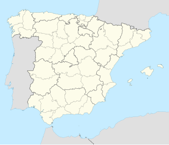
Citadel of Melilla is located in Spain
Citadel of Melilla
Citadel of Melilla
Melilla
Coordinates35°17′38″N 2°56′02″W / 35.294°N 2.934°W / 35.294; -2.934
Area35 ha
Site history
Built16th and 17th centuries
Built byCatholic Monarchs of Spain
MaterialsRammed earth
Battles/warsConquest of Melilla
Siege of Melilla (1774–1775)
Battle of Melilla (1860)
Garrison information
Past
commanders
Pedro de Estopiñán (1497–1505)
Juan Sherlock (1774–1775)
TypeNon-movable
CriteriaMonument
Designated11 August 1953

Melilla la Vieja ("Old Melilla") is a walled citadel located in the Spanish city of Melilla one of Spain's Plazas de soberanía on the north African coast. With an approximate length of 2,000 meters, it is one of the largest fortifications of its kind in Spain. Its structure is built upon an ancient fortification of Phoenician-Punic origin, which bears witness to its long history of occupation.[1]

Considered one of the main monuments of the city, this site combines heritage and scenic elements that make it a popular destination for both residents and visitors interested in its historical and architectural value.[2][3]

History

[edit]

Foundation of the City and Origins

[edit]

The origins of Melilla date back to the 8th century BCE, when the Phoenicians founded the settlement of Rusadir as a strategic trading post on the North African coast. Taking advantage of its privileged location facing the Alboran Sea, Rusadir became a key point within the maritime routes of the western Mediterranean.[4]

From the 6th century BCE onward, the city came under the control of the Carthaginians, who inherited many Phoenician colonies in the region. During this period, Rusadir maintained its commercial and naval character, participating in the exchange system that connected Carthage with the Iberian Peninsula and other parts of North Africa.[5]

With the fall of Carthage and the expansion of Rome, Rusadir was incorporated into the Roman Empire in the 2nd century BCE, within the province of Mauretania Tingitana. It was recognized as a municipium and received certain administrative privileges. Classical authors such as Pliny the Elder and Ptolemy I mention the city in their writings, confirming its importance during Roman times. During this period, a defensive wall is documented as early as the 1st century BCE.[6]

After the disintegration of the Roman Empire, Rusadir was sacked by the Vandals and later briefly reoccupied by the Byzantines during their attempt to regain control of North Africa. The presence of the Visigoths, although possible in the south of the Iberian Peninsula, is not clearly documented in Melilla. By the 7th century, the city was in decline until it was incorporated into the Islamic world.[7]

During the Muslim period (7th to 15th centuries), Rusadir was integrated into various Muslim kingdoms. Under the Umayyad Caliphate of Córdoba, it experienced a brief revival: in 927, Caliph Abd al-Rahman III ordered the construction of a powerful stone wall, establishing the city as an important naval base for controlling the Strait. Later, Melilla passed through the hands of the Almoravids, Almohads, Marinids, and finally the Sultanate of Fez, although during these centuries it progressively lost relevance due to internal conflicts, pressure from local tribes, and the decline of trade.[8]

By the mid-15th century, Melilla was almost depopulated and its defenses in ruins. It was then, on September 17, 1497, that Pedro de Estopiñán, in the service of the Duke of Medina Sidonia and with the approval of the Catholic Monarchs, took the city for the Crown of Castile. The following year, in 1498, the Asiento of Alcalá de Henares was signed, authorizing the reconstruction of the city and the restoration of its fortifications in response to the constant threat of North African raids.[9]

Fortification System (15th–16th c.)

[edit]

The first defense model adopted by royal engineers was the “Cava y Barrera” system, consisting of quickly assembled wooden structures to provide initial protection.[10]

Between 1497 and 1556, the First Enclosure, also known as Villa Nueva, was built atop the promontory. This complex was reinforced by notable military engineers such as Gabriel Tadino de Martinengo, Miguel de Perea, Francisco de Medina, and Juan de Zurita, who adapted the medieval layout to accommodate gunpowder artillery. Cylindrical and elliptical towers were built, similar to those illustrated by Albrecht Dürer in his treatises on Renaissance fortification.[11]

Architectural highlights include the Gate and Chapel of Santiago (the only Gothic temple in Africa), the Royal Hospital, the Peñuelas Cisterns, the Conventico Caves, and the military storehouses.[12][13]

Expansions and Consolidation

[edit]
17th century

The defensive system was expanded in the 17th and 18th centuries with the construction of new enclosures (Second, Third, and Fourth), adapted to strategic needs. These added structures like the San José Bastions, San Pedro, San Fernando, the Bastion of the Five Words, and the San Fernando Tunnel.

Of particular importance is the Hornabeque Ditch, an example of Baroque military architecture, which connects different defensive levels via bridges and tunnels.

In the 17th century, Melilla suffered prolonged sieges by Sultan Mohammed III. Despite limited resources, major repairs were undertaken, such as the consolidation of the Alafía wall and interior walkways. However, most of the outer forts built in the 16th century were lost.[14][15][16][17][18]

19th century

Siege of 1774–1775

[edit]

During the 18th century, Melilla endured the prolonged Siege of Melilla (1774–1775) by Sultan Mohammed III, one of the most significant attacks in its history. Since the 17th century, the city had faced military pressure, prompting repairs such as the consolidation of the Alafía wall and the inner ramparts. During the siege, which lasted over 100 days, Melilla held out thanks to its defenses and maritime support, but the need to strengthen its fortification system became evident. After the conflict, major renovations were carried out on bastions, walls, and tunnels, reinforcing the military and strategic character of Melilla la Vieja. [19] [20] [21] [22] [23]

19th and 20th Centuries

[edit]

In the 19th century, outer forts such as Camel Fort, High Cabrerizas Fort, and Rostrogordo Fort were built to protect the city from the growing Moroccan nationalism. In 1918, the Melilla Lighthouse was inaugurated, a symbol of the city's maritime-industrial heritage.

During the 20th century, Old Melilla suffered some degradation, although it was never entirely abandoned. Various restoration and rehabilitation efforts were undertaken in recent decades, many of them funded by the European Union.

Present Day

[edit]

Today, Old Melilla has become a cultural and tourist landmark. Many of its original spaces have been restored, such as the Royal Hospital, now a gallery and exhibition center, and the Conventico Caves, now open to the public as a museum and interpretation center.

From its walls, visitors can enjoy views of the Mediterranean, the Land Front, and the Galápagos Cove Beach, completing an immersive historical experience. The route, which begins at the Fourth Enclosure and ends at the First, offers a true lesson in urban history and defensive architecture.[24]

In recognition of its heritage value, the entire walled complex of Old Melilla was declared a Historic-Artistic Ensemble by decree on August 11, 1953, a Site of Tourist Interest in 1958, and a Cultural Heritage Site in 1986. Today, it forms part of the Historic-Artistic Ensemble of the City of Melilla.[25][26]

First Fortified Enclosure

[edit]

The First Fortified Enclosure is the foundational core of Melilla. Built following the conquest of Melilla in 1497 by Pedro de Estopiñán, envoy of the Catholic Monarchs, this enclosure stands on the ancient promontory of Rusadir, of Punic and Roman origin. Its strategic location, on a rocky outcrop jutting into the Mediterranean, and its construction adapted to the rugged topography, give the enclosure historical, military, and symbolic value, making it a key piece of Spain's fortified heritage in North Africa. Over the centuries, the First Enclosure has undergone various transformations, yet it remains the nerve center of the citadel.[27][28]

Location and Strategic Function

[edit]

The First Enclosure is located at the highest point of the promontory, allowing it to dominate the surrounding land and sea. At its peak in the 16th century, it housed the main military, religious, and administrative institutions of the city. This strategic position ensured control over maritime approaches and land routes, functioning as the principal fortress and political and social heart of Melilla for centuries.

Its layered defense design, with thick walls, circular towers, and underground structures, ensured the population’s protection during sieges. In the early years after the conquest, this enclosure was the only inhabited area, as the city had not yet expanded inland. Its defensive importance was essential in consolidating the city.[29]

Defensive Walls

[edit]

The First Fortified Enclosure is surrounded by several defensive fronts that are integral to the fortress. These fronts were designed to protect the citadel from potential attacks by land and sea.

Levante Front

[edit]
Melilla Lighthouse

The Levante Front is located to the east of the First Fortified Enclosure and was constructed in the 16th century. This front features a series of towers and defensive structures that have been modified and restored over the centuries. Highlights include:

  • Torreón del Bonete, atop which the Melilla Lighthouse stands.
  • Puerta del Socorro, one of the main entrances to the citadel.
  • Torreón del Bonete Chico, hemispherical in shape.
  • Cuevas del General: Rock-cut galleries used as shelters and storage during sieges.
  • Torreón de los Bolaños: A square tower with protruding elements.
  • Torreón del Bernal Francés, also hemispherical.
  • Cuevas de la Florentina: A network of underground galleries used for storage.
  • Torreón de las Cabras, circular in shape.

These towers were initially built in 1515 and modified in 1527 and 1533 by engineers such as Gabriel Tadino de Martinengo and Sancho Escalante.[30][31]

Marina Front

[edit]
Puerta de la Marina

The Marina Front, located to the south of the First Fortified Enclosure, was key in protecting the city from sea attacks. Notable elements include:

  • Torreón de Florentina and the Muralla de Florentina.
  • Torreón de San Juan and the Cuartel de Santa Ana.
  • Cuartel de la Maestranza and the Batería de San Felipe.
  • The Puerta de la Marina, a key access point to the citadel from the sea.

The Marina Front was rebuilt between 1677 and 1678 and underwent several renovations during the 19th and 20th centuries, including parapet installations and the construction of the Puerta de la Marina.[32]

Land Front

[edit]
Puerta de Santa Ana

The Land Front is located to the west of the First Fortified Enclosure and is divided into two distinct areas: lower and upper.

  • Lower area: Includes the Puerta de Santa Ana, the Puerta de Santiago, and the Capilla de Santiago, built in the 16th century, as well as the Foso de Santiago, dug in 1515. This moat was filled in the early 21st century, facilitating the transformation of the Ensenada de los Galápagos into a beach.
  • Upper area: Features the Torre de la Vela, above the Batería de las Puertas, home to the Andrés García Ibáñez Museum of Modern and Contemporary Art. The Royal Wall Battery includes the Vigía de Tierra and Ampolleta Vieja towers.

Also found here are the Concepción Bastions, the Historical Military Museum of Melilla, and several artillery platforms.[33]

Trápana Front

[edit]
Trápana Front

The Trápana Front lies to the north of the First Fortified Enclosure and consists of historically and defensively valuable architectural elements. Highlights include:

  • Muralla de las Cruces, built in the 16th century and restored in the 18th.
  • Conventico Caves, used as shelters and storage during sieges.
  • The Church of the Immaculate Conception, which houses the revered image of Our Lady of Victory, patron saint of the city, and the former Franciscan Convent.[34]

Interior Elements of the First Fortified Enclosure

[edit]
Monument to Pedro de Estopiñán y Virués

Within the First Fortified Enclosure are several historic buildings reflecting the administrative, health, and religious functions of the citadel throughout the centuries. These buildings are primarily located in the lower and middle areas of the enclosure and are fundamental for understanding Melilla’s development:

  • Buildings of the former Military Government: This area contains various historical buildings, including the Monument to Pedro de Estopiñán y Virués and the Punic-Roman archaeological site located in the nearby gardens.
  • Almacén de las Peñuelas: This 16th-century warehouse is one of the few surviving examples of early food storage structures within the fortress.
  • San Francisco Hospital and Pharmacy: Built in the 17th century on San Miguel Street, this hospital and pharmacy served as the city’s medical center during the fortified era.
  • King’s Hospital: This 18th-century hospital, located in Plaza de la Parada, is one of the most significant architectural features and today houses an exhibition center.
  • Conventico Caves: A system of rock-cut galleries that served as an air-raid shelter and storage during sieges. Its interior layout adapts to the natural topography of the promontory and is a remarkable example of military survival architecture.
  • Royal and Pontifical Church of the Immaculate Conception: This 18th-century church was built over an earlier temple and features a single nave and side chapels. It houses the image of Our Lady of the Rosary, patroness of the city. It is located in the highest part of the enclosure and stands out for its baroque altarpiece and historical significance.
  • Old Franciscan Convent: Originally adjacent to the Church of the Immaculate Conception, this convent was home to the Order of Friars Minor Capuchin. It was a religious center of great importance until its secularization in the 19th century.

These historical elements form a complex heritage site that bears witness to the urban, military, and religious development of Melilla from the late 15th century to the present day.

Notable Architectural Elements

[edit]

Baluarte de la Concepción Alta

[edit]
Baluarte de la Concepción Alta

Initially built in 1669 over a 16th-century tower, it has undergone several restorations, with notable renovations in the 18th and 20th centuries. Its original function was defensive, adapting to the fortification innovations of its time. Today, it houses the Historical Military Museum, which exhibits a collection of historical objects related to the city and its military heritage. Additionally, the bastion offers panoramic views of the Mediterranean Sea and the city.[35][36][37][38]

Almacén de las Peñuelas

Peñuelas Warehouses

[edit]

Built in 1781 during the reign of Charles III, they were originally intended for the storage of supplies and materials for the fortified city. Restoration began in 2007, and in 2011 the Melilla Museum of History, Archaeology, and Ethnography was inaugurated inside. It houses a collection of archaeological artifacts, historical cartography, and items related to the evolution of the city.[39]

Peñuelas Cisterns

[edit]
Peñuelas Cisterns

Constructed in 1571 to ensure a water supply for the fortified city. Designed with sand and gravel filters, they consist of two settling tanks and two large interconnected reservoirs, each capable of holding up to 572 m³ of water. Carved into the rock and covered with brick vaults, they formed part of the city’s defensive and hydraulic system. After being sealed in 1947, they were partially restored and opened to the public in 1997. Today, they are part of the city’s visitable heritage.[40]

Santiago Gate

[edit]
Santiago Gate

Built in 1549 by engineer Miguel de Perea and renovated several times. It features a bent entrance flanked by towers and is crowned by an imperial coat of arms of Charles V. In 2025, it became the starting point of the Vía Rusadir, the first official Camino de Santiago route originating in Africa. A milestone, marked with Jacobean symbols such as the yellow arrow and the scallop shell, installed in front of the gate, indicates the 972.09 km that separate Melilla from Santiago de Compostela.[41]

Conventico Caves

Conventico Caves

[edit]

A system of galleries carved into the rock, used as an air raid shelter and storage during sieges. Its inner layout adapts to the natural relief of the promontory and represents a notable example of military survival architecture.[42][43][44][45][46][47][45]

Royal and Pontifical Church of the Immaculate Conception

[edit]
Royal and Pontifical Church of the Immaculate Conception

Built in the mid-16th century on the remains of an old hermitage and has borne witness to centuries of religious, social, and military history in the city. Initially dedicated to Saint Michael the Archangel, it was consecrated to the Immaculate Conception in 1663.

Of a sober Renaissance style, the church has a rectangular floor plan with three naves separated by Tuscan columns, a stone ashlar façade, and a bell gable with bells. Inside, it houses valuable artistic heritage, including the main altarpiece featuring the image of the Virgin of Victory, patroness of Melilla, as well as other chapels dedicated to the Rosary and to Saint Francis. Historic pieces such as a 16th-century baptismal font and a 15th-century Christ of the Vera Cruz are also preserved.

The church has undergone numerous restorations, particularly after the 1755 Lisbon earthquake and the 2016 Alboran Sea earthquake, which have helped preserve both its liturgical function and heritage value. Since its last restoration, completed in 2017, the building has combined religious worship with cultural and museum uses, becoming an integral part of the monumental route of Melilla la Vieja.[48][49][50][51][52]

Hospital del Rey

Hospital del Rey

[edit]

An old healthcare center for soldiers and civilians. Now restored as an Exhibition Center, it retains part of its original structure and highlights the healthcare role of the fortified site.[53][54][55][56]

Historical Transformations

[edit]

Since its construction in the late 15th century, the First Enclosure has undergone numerous interventions. Royal engineers Gabriel Tadino de Martinengo, Juan Vallejo, Miguel de Perea, and Francisco de Medina introduced modern fortification solutions, reinforcing the walls with embankments, opening gun embrasures, and improving access.

Between 1515 and 1556, its current form was consolidated, with white ashlar walls, semicircular towers, and reinforced gates. In the 17th century, significant repairs were made due to repeated attacks by Sultan Mohammed III. Although it lost its defensive value with the advent of modern artillery, the enclosure remained the symbolic and institutional core of Melilla.

Second Fortified Enclosure

[edit]

The Second Fortified Enclosure of Melilla la Vieja, also known as the Plaza de Armas, represents a key phase in the city’s defensive evolution. Located immediately after the First Enclosure from the mainland entrance, this area expanded and strengthened the defensive capacity of the site after its initial consolidation in the 16th century. Unlike the foundational core, this second belt of walls reflects a more rational and functional plan, developed according to Renaissance military principles and adapted to the new demands of gunpowder warfare.[57]

Location and Strategic Function

[edit]

The Second Enclosure spreads across a natural terrace lower than the First Enclosure, connected to it by moats, tunnels, and bastions. Its mid-level elevation and intermediate position between the rock and the isthmus made it a key resistance area, as well as a zone for transit, supply, and tactical redistribution.

This enclosure was essential to protect the city's landward flank, the most vulnerable to attacks by enemy tribes or armies from the Rif. It was therefore reinforced with architecture clearly adapted to gunpowder artillery, including angled bastions, parapets, casemates, and ramped accesses.[58][59][60]

Notable Architectural Elements

[edit]
Baluarte de San Pedro Alto

Bastions of San Pedro and San José

[edit]

Bastion of San José: Located on the northern flank, construction began in 1694 and was remodeled in 1714. It features a square plan with parapets and embrasures, following the Italian style of fortification.

Bastion of San Pedro: Situated at the northwestern end, it was built in the late 17th century. Its design includes a sentry box on one corner and eleven embrasures set between merlons.[61][62]

Foso del Hornabeque

Hornabeque Ditch

[edit]

Built around 1690, this trench carved into the rock separates the second fortified enclosure from the third. Originally a defensive trench designed to impede enemy access, it was later converted into an underground communication route known as the San Fernando Tunnel, allowing the passage of carriages and troops between the enclosures.[63][64]

[edit]

This underground gallery, excavated in the 17th century, connects all the fortified enclosures of Melilla la Vieja. Its purpose was to allow safe communication between different sections of the citadel, even during sieges, enabling the movement of troops and supplies without exposure to enemy fire.[65][66][67]

Puerta de la Victoria

Puerta de la Victoria

[edit]

This fortified gate was built between 1690 and 1719. It consists of a lowered solid brick arch and is preceded by a wooden drawbridge that spans the Hornabeque Ditch. Its design allowed for effective control of access to the citadel.[68][69][70]

Dientes de Sierra

[edit]
Dientes de Sierra

These are fortifications shaped like saw teeth, built in the 17th century and renovated between 1707 and 1711. These defensive elements provided additional protection against potential attacks from the outside.[21][71][72][70]

Historical transformations

[edit]

During the 17th and 18th centuries, this enclosure underwent several renovations to adapt to the new bastioned fortification models. The system of tunnels and gun galleries was expanded, and the walls were reinforced with new materials such as ashlar stone and hydraulic masonry. Consolidation work was also carried out after the sieges suffered by Melilla during the attacks by the sultans of Morocco.

Over time, the enclosure acquired a more logistical than combative function. It housed food, ammunition, and water warehouses, in addition to serving as a strategic link between the first and third enclosures.

Third Fortified Enclosure

[edit]

The Third Fortified Enclosure of Melilla la Vieja represents the maturity of the citadel’s defensive system and constitutes one of the most significant phases of the military development of the stronghold. Built between the 16th and 18th centuries, this enclosure was designed as a natural and reinforced extension of the first two defensive belts, covering a broader and more open area, no longer conceived solely to withstand sieges, but also to accommodate a growing population, complementary infrastructure, and logistical spaces. It reflects the consolidation of the modern bastioned model influenced by the principles of Italian Renaissance military engineering.[73][74][75]

Location and strategic function

[edit]

The Third Enclosure extends over a stepped platform that overlooks the Foso de los Carneros, connecting vertically and horizontally with the previous enclosures. Its intermediate position between the upper enclosures and the coastal area made it a crucial point of defense against landings or naval attacks.

This space also had a clear military and urban interconnection function, allowing the safe passage of troops, the transport of supplies, and the movement of artillery. The irregular topography was used to place defensive structures at different levels, improving firing angles and crossfire coverage over potential points of attack.

Notable architectural elements

[edit]

Bastioned front over the Foso de los Carneros

[edit]
Foso de los Carneros

One of the most visually striking elements of the enclosure. It consists of a wall with parapets and towers that overlooks the moat and establishes a staggered defensive line. From this height, both the interior and exterior of the stronghold were controlled, allowing for effective defense.

Baluarte de las Cinco Palabras

[edit]
Baluarte de las cinco palabras

A defensive and surveillance element, it offers an excellent view of the Ensenada de los Galápagos and the land entrance. It was originally an isolated tower integrated into the modern defenses.[76]

Cuartel de San Fernando

[edit]

One of the most representative structures of the Second Enclosure, this building housed the garrison stationed at the stronghold. It features a sober and functional architecture, with interior courtyards and military warehouses.[70][77]

San Fernando Tunnel and Underground Communication Systems

[edit]

The tunnel, carved into the rock, allowed communication between different levels of the enclosure without being exposed to enemy fire. These galleries were essential for movement during sieges and for the transportation of supplies or ammunition.[78]

Historical Transformations

[edit]

The Third Enclosure was mainly developed during the 17th and 18th centuries, in a context of strengthening defenses against repeated attacks from the Moroccan Sultanate. During the reign of Charles II and later under the Bourbons, funds were allocated for the consolidation of walls, improvement of underground galleries, and renovation of bastions.

The modernization of artillery required walls to be widened, more casemates to be added, and parapets to be reinforced. The reforms were carried out in several phases, some of which adapted pre-existing structures from the medieval or Andalusi periods, resulting in a hybrid and evolving architecture.

In the 19th century, the Third Enclosure began to lose tactical relevance due to the city's urban expansion outside the walls, but it continued to serve administrative and logistical functions well into the 20th century.

Fourth Fortified Enclosure

[edit]

The Fourth Fortified Enclosure of Melilla la Vieja constitutes the last major expansion of the defensive system of the historic citadel. Unlike the previous three enclosures, which were built on the rocky promontory and in contact with the sea, the fourth enclosure extends over solid ground, marking the beginning of urban expansion beyond the walls. Built mainly in the 18th and 19th centuries, this enclosure reflects a more modern conception of perimeter defense, in line with Enlightenment fortification principles and adapted to the gradual advance of enemy troops and artillery from inland Africa.[79][21][61]

Location and Strategic Function

[edit]

Located on the continental area that connects the rocky outcrop with the isthmus linking Melilla to the mainland, the Fourth Enclosure was conceived as an advanced barrier and physical frontier between the fortified city and the outer territory. Its design responded both to the need for defense and to the control of land access to the city, at a time when the earlier enclosures were becoming insufficient in the face of advancing siege techniques.

This fourth defensive belt marked a new phase in Melilla’s urban organization, serving as a link between the walled city and the modern 19th-century neighborhoods, and protecting military infrastructures such as powder magazines, warehouses, and drill grounds.[80][81]

Notable Architectural Elements

[edit]

Fort of Victoria Grande

[edit]
Fort of Victoria Grande

Built in the 18th century, it was one of the main bastions on the landward front. The famous “El Caminante” cannon was fired from this location, helping define Melilla’s current geographical boundaries. Its design follows an irregular ground plan adapted to the terrain.[82][83]

Fort of Rosario

[edit]
Fort of Rosario

Strategically located on elevated ground, the Fort of Rosario forms a defensive pair with Victoria’s Forts. Together, they create a crossfire defense system over the access routes from the Rif. It is built with masonry, reinforced walls to withstand artillery, and a polygonal layout typical of 18th-century forts.[19][84] [85] [86][87][88][89]

Fort of Victoria Chica

[edit]
Fort of Victoria Chica

This rectangular fort is built using local stone for its walls and solid brick for its arches and vaults. It consists of a battery accessible via a ramp and underground vaults.[90][91][92][93][94][95][96]

Gates and Military Roads

[edit]

The Fourth Enclosure included several fortified gates, drawbridges, and military roads that connected it with the inner enclosures. These access points were designed to facilitate the movement of troops and artillery while also slowing the advance of a potential enemy.

Garrison and Artillery Areas

[edit]

In addition to the forts, the enclosure featured firing platforms, earthen parapets, and ammunition depots. These structures were integrated into the landscape, taking advantage of higher ground to ensure better visibility and protection.

Historical Transformations

[edit]

The Fourth Enclosure was developed in the context of ongoing attacks during the 17th century and the military campaigns of the 18th century, as well as in response to the increasing pressure on Melilla’s frontier. During the reign of Charles III and especially under the Bourbons, a policy of territorial consolidation in North Africa was promoted, reflected in the construction of this new defensive perimeter.

In the 19th century, with the progressive pacification of the surrounding area and the emergence of new urban concepts, the Fourth Enclosure became increasingly integrated into the urban landscape. Its military use gradually diminished, and many of its structures were adapted or repurposed within the newly developed neighborhoods built around it.

Archaeological Excavations

[edit]

Archaeological excavations in Melilla la Vieja have provided valuable information about the different historical periods of the city, from the Phoenician era to contemporary times. These interventions have uncovered architectural elements, defensive structures, and everyday objects that illustrate the evolution of this strategic enclave in North Africa.

Governor's House

[edit]

The Excavations of the Governor's House, between 2000 and 2006, have provided a wealth of discoveries that have deepened the understanding of the history of Melilla la Vieja, spanning from the Phoenician period to Roman times. These findings include architectural remains, ceramic materials, and evidence of continuous settlement in the area from the 7th century BC to the 1st century AD. [97]

Architectural Remains

[edit]
  • Dwellings: Two areas of occupation have been identified. In the eastern sector, a dwelling dated to the 1st century BC was found, while in the western sector, another dwelling from the 2nd century BC was uncovered, consisting of three rooms, with lower levels dating back to the 7th century BC.
  • Pre-Hispanic Walls: Remains of houses from the pre-Roman period, which are currently in danger of collapse due to inadequate conservation efforts, leading to the fall of some of their walls.

Archaeological Materials

[edit]
  • Ceramic Fragments: Over 200,000 ceramic fragments have been recovered, primarily amphorae used for transporting products like garum (fish sauce), a common commodity in Roman trade.
  • Stratigraphy: Excavations have reached a depth of up to 4.5 meters, revealing several layers of occupation over time. These layers show the cultural and economic transition from Phoenician to Punic and Roman influences.

Pre-Roman Necropolis

[edit]
  • In the early 20th century, a pre-Roman necropolis was discovered on the Cerro de San Lorenzo, which is linked to the urban settlement of Rusaddir. The remains of this necropolis provide insight into the lifestyle and funerary customs of the local population during that period.

Chronology and Cultural Context

[edit]
  • Period of Occupation: The findings primarily span the period of greatest prosperity for the city of Rusaddir during the 2nd century BC to the 1st century AD, when it was one of the most important cities in the Kingdom of Mauretania. During this time, there was an intense process of Roman cultural assimilation by the local population, who had Phoenician-Punic roots, with the gradual incorporation of Berber elements. This phenomenon of cultural and economic hybridization is key to understanding the development of the region.

Church of La Purísima Concepción

[edit]

In 2022, excavations and restoration works in its vicinity have revealed significant archaeological findings, shedding light on the transformation of the church and the area over the centuries.[98]

Archaeological Findings

[edit]
  • Crypts: During excavations carried out in 2022, several crypts used for burials since the 17th century were discovered beneath the church. These crypts provide valuable insight into the burial practices and funerary customs of the time.
  • Medieval Silo: A silo dating back to the medieval period was also identified, contributing to the understanding of agricultural practices and food storage methods in Melilla during the Middle Ages.
  • Architectural Elements: The excavations uncovered elements from different phases of the church’s construction, including remains of the original Church of San Miguel, which may date back to the Islamic period. These findings show the church's evolution over time, with structural modifications and additions from various historical periods.

Chronology and Cultural Context

[edit]
  • Period of Occupation: The archaeological materials found span a chronological period from the mid-16th century to the mid-17th century, with evidence suggesting a continuous process of construction, modification, and reuse of the church’s space. Furthermore, the discovery of remnants of the earlier Church of San Miguel highlights the church's significance during the Islamic period in Melilla, before its Christian transformation in the 16th century.

Fort of Victoria Grande

[edit]

The Fort of Victoria Grande has been the focus of various archaeological excavations, particularly during its restoration and rehabilitation processes. These excavations have provided important insights into the fort’s history and its role as part of Melilla's defensive system.[99]

Archaeological Findings

[edit]
  • Archaeological Remains from the 9th and 18th Centuries: Excavations in and around the fort have uncovered remains from the 9th century (Islamic period) and the 18th century (Spanish colonial period). These include silos, hearths, stakes, and a parade ground, which were integral to the fort’s defensive structure.
  • Defensive Structures: Elements that form part of the fort's defense system, including a plaza de armas (parade ground) and other military structures, have been uncovered, illustrating the fort’s importance in the defense of the city during various periods.
  • Islamic and Spanish Layers: Excavations have revealed layers of occupation from both the Islamic period and the Spanish colonial period, highlighting the fort's long and varied use in Melilla's history.

Chronology and Cultural Context

[edit]
  • Period of Occupation: The fort's archaeological findings span two major periods: the Islamic period, when it was part of the region's fortifications under the control of various North African dynasties, and the 18th century, when the Spanish constructed and expanded the fort as part of Melilla’s defense system. The combination of Islamic and Spanish materials and structures reveals the fort's continuous strategic importance for the city.

Cultural events

[edit]

Melilla la Vieja hosts various cultural events that celebrate its history, diversity, and heritage.

Melilla Day

[edit]
Melilla Day

Every September 17, Melilla Day is celebrated, commemorating the city's incorporation into the Crown of Castile in 1497. Some of the official ceremonies take place in the Plaza de Armas, within the walled enclosure, including award presentations and tributes. Although many cultural activities are held in adjacent areas, such as the Plaza de las Culturas, Melilla la Vieja retains a prominent symbolic and historical role during the celebration.[100]

Charles V Renaissance Market

[edit]
Charles V Renaissance Market

This annual event, usually held in June, transports visitors to the 16th century, recreating the era of Charles V. It takes place in locations such as the Plaza de Armas, Plaza de los Aljibes, and the Foso del Hornabeque, featuring more than 60 stalls of crafts, gastronomy, and performances that recreate local history.[101]

Música a la Luna

[edit]

During summer nights, Melilla la Vieja hosts the open-air concert series “Música a la Luna.” It features performances of various music genres in iconic spaces of the historic quarter, blending heritage and culture in a unique nighttime atmosphere.[102]

Jazz Days

[edit]

Some of the performances during the Melilla Jazz Days, an annual event dedicated to this genre, take place within Melilla la Vieja, offering a historic and exceptional setting for live music.[103]

[edit]

Film set

[edit]

Melilla la Vieja has served as a setting for various film and television productions. Some of the most notable include:[104]

  • Death Comes Easy to Ghentar (1967), directed by León Klimovsky. The film features scenes shot in Melilla, including Melilla la Vieja and the port. Although not widely recognized, it offers a historical glimpse of the city in the 1960s.
  • You Shall Die in Chafarinas (1995), directed by Pedro Olea. This thriller is set in a military environment in Melilla. While most scenes were filmed elsewhere, parts of Melilla la Vieja were used to recreate the exotic atmosphere of the story.
  • The Man Who Knew Infinity (2015), directed by Matthew Brown, is a biographical drama about Indian mathematician Srinivasa Ramanujan, starring Dev Patel and Jeremy Irons. Parts were filmed in Melilla, particularly at the Baluarte de la Concepción Alta, which was used to portray colonial India and Cambridge. The city provided a visually authentic backdrop for international cinema.
  • Chavela (2017), directed by Catherine Gund and Daresha Kyi. The documentary includes interviews with people close to the artist and was partially filmed in Melilla, notably at the Real y Pontificia Iglesia de la Purísima Concepción.
  • Alegría (2021), directed by Violeta Salama. This film tells the story of a Jewish woman returning to Melilla to confront her past. Scenes were shot throughout the city, including Melilla la Vieja.

Tourist attraction

[edit]

Melilla la Vieja is considered the city's main tourist attraction. On August 11, 1953, it was declared a Historic-Artistic Site, recognized as a site of Tourist Interest in 1958, and later designated as a Cultural Heritage Site in 1986, under Law 16/1985 on Spanish Historical Heritage.[105][106]

The museums and spaces within the walled complex are open daily, except Mondays, December 25, and January 1. Admission is free for both residents and tourists. In recent years, the number of visitors has grown significantly. In 2015, 74,000 visits were recorded, increasing to 126,000 in 2016—an increase of 90%. This growth is attributed to initiatives such as the opening of the Interpretation Center of Melilla la Vieja (CIMLaV), the installation of an access elevator, and the organization of cultural events. The Charles V Renaissance Market, in particular, attracts over 45,000 attendees annually.[107][108][109][110][111]

Protection and conservation

[edit]

The Citadel of Melilla, protected for its exceptional heritage value, is part of the Historic-Artistic Ensemble of Melilla. Its location offers panoramic views of the city and bay, visible from up to 55 kilometers away on clear days. Fortunately, the protected area has not been affected by urban development, which has allowed the preservation of its original structures and the study of the city's earliest settlements.

See also

[edit]

References

[edit]
  1. ^ Moreno Peralta, Salvador; Bravo Nieto, Antonio; Saéz Cazorla, Jesús Miguel (1990). Melilla la Vieja Plan Especial de los Cuatro Recintos Fortificados (PDF). EDICIONES SEYER. p. 252–253. ISBN 84-87291-95-3.
  2. ^ "MARRUECOS. LONELY PLANET | PAULA; VORHEES, MARA; EDSALL, HEIDI HARDY | No especificada | Casa del Libro". casadellibro (in Spanish). 2018-06-02. Retrieved 2024-10-17.
  3. ^ "- Melilla "La Vieja"". 2018-06-20. Archived from the original on 2018-06-20. Retrieved 2024-10-17.
  4. ^ "Inforegio - Bringing history back to life in the Citadel of Melilla la Vieja". ec.europa.eu. Retrieved 2025-05-01.
  5. ^ "Museos". museomelilla.es. Retrieved 2025-05-04.
  6. ^ Soldado, Alberto (2021-05-25). "Ceuta, Melilla y el Imperio Romano". Levante-EMV (in Spanish). Retrieved 2025-05-04.
  7. ^ "Historia de Melilla". En español (in Italian). Retrieved 2025-05-04.
  8. ^ Proyectos, HI Iberia Ingeniería y. "Historia Hispánica". historia-hispanica.rah.es (in Spanish). Retrieved 2025-05-02.
  9. ^ Barceló, José Luis Gómez (1995-09-01). "Melilla, origin and destiny in the Archive of the Holy and Royal House of Mercy of Ceuta". Aldaba (26): 177–194. doi:10.5944/aldaba.26.1995.20354. ISSN 2603-9265. Retrieved 2025-05-02.
  10. ^ Monumental, Melilla (2020-06-02). "Conociendo nuestro patrimonio Murallas de Melilla la Vieja". Melilla Monumental (in Spanish). Retrieved 2025-05-02.
  11. ^ Marta (2025-02-26). "'MELILLA LA VIEJA' JOINS THE SPANISH HISTORICAL HERITAGE NETWORK". Turismo en la Red (in Spanish). Retrieved 2025-05-02.
  12. ^ "Melilla "La Vieja"". Turismo Melilla (in Spanish). Retrieved 2024-10-17.
  13. ^ Villalba, Miguel. "Colección cartográfica de Mapas, planos y dibujos de Melilla en el Archivo General de Simancas". Academia.
  14. ^ Bravo Nieto, Antonio (1997). Cartografía histórica de Melilla.
  15. ^ Villalba González, Miguel (2012). Colección cartográfica de mapas, planos y dibujos de Melilla, en el Archivo General de Simancas (1564–1797). Imagraf.
  16. ^ Lechado Granados, Mª del Carmen; Melero Pascual, Julia; Cabanillas Gutiérrez, Gustavo; Amar Salat, Karima; Atencia Andreu, Ana; Mimón Bouzbib, Dunia (2015). MELILLA TOURIST GUIDE. Galland Books. p. 75. ISBN 978-84-16200-16-0.
  17. ^ Bravo Nieto, Antonio (2002). Melilla Guide (pdf) (in Spanish). León: EDITORIAL EVERGRÁFICAS S.L. p. 69. ISBN 84-241-9300-8.
  18. ^ Historia de Melilla a través de sus calles y barrios. Asociación de Estudios Melillenses. 1997.
  19. ^ a b Bravo Nieto, Antonio (1997). Historical Cartography of Melilla. ISBN 9788486022853.
  20. ^ Villaba González, Miguel (2012). Colección cartográfica de mapas, planos y dibujos de Melilla, en el Archivo General de Simancas (1564–1797). Imagraf. Retrieved January 19, 2018.
  21. ^ a b c Lechado Granados, Mª del Carmen; Melero Pascual, Julia; Cabanillas Gutiérrez, Gustavo; Amar Salat, Karima; Atencia Andreu, Ana; Mimón Bouzbib, Dunia (2015). MELILLA GUÍA TURÍSTICA. Galland Books. p. 75. ISBN 978-84-16200-16-0.
  22. ^ Bravo Nieto, Antonio (2002). Guía de Melilla (pdf) (in Spanish). León: Editorial Evergráficas S.L. p. 69. ISBN 84-241-9300-8.
  23. ^ Historia de Melilla a través de sus calles y barrios. Asociación de Estudios Melillenses. 1997.
  24. ^ Vellés Montoya, Javier (1997). Melilla la bien guardada – Notes and Drawings for the Restoration of its Walls (1988–1997). UNED Melilla. ISBN 84-87291-93-7.
  25. ^ "Melilla "La Vieja" – Turismo Melilla". melillaturismo.com (in European Spanish). Retrieved June 20, 2018.
  26. ^ "Melilla "La Vieja"". melillamedioambiente. Archived from the original on June 20, 2018. Retrieved June 20, 2018.
  27. ^ Moreno Peralta, Salvador; Bravo Nieto, Antonio; Saéz Cazorla, Jesús Miguel (1990). Melilla la Vieja Plan Especial de los Cuatro Recintos Fortificados (PDF). EDICIONES SEYER. ISBN 84-87291-95-3.
  28. ^ "First Enclosure" (PDF). melilla.es. Retrieved August 2, 2017.
  29. ^ Vellés Montoya, Javier (1997). Melilla la bien guardada: notes and drawings for the restoration of its walls (1988–1997). UNED Melilla. ISBN 84-87291-93-7.
  30. ^ Vellés Montoya, Javier (1997). Melilla la bien guardada: notes and drawings for the restoration of its walls (1988–1997). UNED Melilla. ISBN 84-87291-93-7.
  31. ^ "First Enclosure" (PDF). melilla.es. Retrieved August 2, 2017.
  32. ^ Vellés Montoya, Javier (1997). Melilla la bien guardada: notes and drawings for the restoration of its walls (1988–1997). UNED Melilla. ISBN 84-87291-93-7.
  33. ^ "Beach Catalog - Ensenada de los Galápagos". sig.mapama.gob.es. Retrieved October 17, 2017.
  34. ^ Vellés Montoya, Javier (1997). Melilla la bien guardada: Notes and drawings for the restoration of its walls (1988–1997). UNED Melilla. ISBN 84-87291-93-7.
  35. ^ Moreno Peralta, Salvador; Bravo Nieto, Antonio; Saéz Cazorla, Jesús Miguel (1990). Melilla la Vieja. Plan Especial de los Cuatro Recintos Fortificados (PDF). EDICIONES SEYER. pp. 210–218. ISBN 84-87291-95-3.
  36. ^ Vellés Montoya, Javier (1997). Melilla la bien guardada. Notes and drawings for the restoration of its walls (1988–1997). UNED Melilla. ISBN 84-87291-93-7.
  37. ^ Bravo Nieto, Antonio (1997). Cartografía histórica de Melilla. ISBN 9788486022853.
  38. ^ Villalba González, Miguel (2012). Cartographic collection of maps, plans, and drawings of Melilla in the General Archive of Simancas (1564–1797). Imagraf.
  39. ^ Moreno Peralta, Salvador; Bravo Nieto, Antonio; Saéz Cazorla, Jesús Miguel (1990). Melilla la Vieja Plan Especial de los Cuatro Recintos Fortificados (PDF). EDICIONES SEYER. pp. 292–297. ISBN 84-87291-95-3.
  40. ^ Moreno Peralta, Salvador; Bravo Nieto, Antonio; Saéz Cazorla, Jesús Miguel (1990). Melilla la Vieja Plan Especial de los Cuatro Recintos Fortificados (PDF). EDICIONES SEYER. pp. 298–300. ISBN 84-87291-95-3.
  41. ^ Debate, El (2025-03-19). "Melilla already has its first milestone of the African Way of St. James". El Debate (in Spanish). Retrieved 2025-05-02.
  42. ^ Moreno Peralta, Salvador; Bravo Nieto, Antonio; Saéz Cazorla, Jesús Miguel (1990). Melilla la Vieja Plan Especial de los Cuatro Recintos Fortificados (PDF). EDICIONES SEYER. pp. 220–225. ISBN 84-87291-95-3.
  43. ^ Santacana Mestre, Joan; Martínez Gil, Tània; García Barat, Rafael (2011). "Melilla, ciudad patrimonial. La visibilidad del patrimonio intangible. El ejemplo de las cuevas del Conventico" (PDF). Revista Akros (10): 60–65. ISSN 1579-0959. Retrieved 3 August 2017.
  44. ^ "Cuevas del Conventico". melillaturismo.com. Archived from the original on 13 October 2017. Retrieved 12 October 2017.
  45. ^ a b Historia de Melilla a través de sus calles y barrios. Asociación de Estudios Melillenses. 1997.
  46. ^ Lechado Granados, Mª del Carmen; Melero Pascual, Julia; Cabanillas Gutiérrez, Gustavo; Amar Salat, Karima; Atencia Andreu, Ana; Mimón Bouzbib, Dunia (2015). MELILLA GUÍA TURÍSTICA. Galland Books. p. 75. ISBN 978-84-16200-16-0.
  47. ^ Bravo Nieto, Antonio (2002). Guía de Melilla. León: EDITORIAL EVERGRAFICAS S.L. p. 69. ISBN 84-241-9300-8.
  48. ^ Rosa Soto (18 April 2017). "The Church of the Immaculate Conception opens its doors and presents the results of its restoration". elFAROMelilla. Retrieved 9 October 2017.
  49. ^ Rosa Soto (2 May 2017). "This is how the Church of the Immaculate looks after its rehabilitation". elFAROMelilla. Archived from the original on 12 June 2018. Retrieved 9 October 2017.
  50. ^ "Culture considers restoring the altarpieces and floor of La Purísima - El Faro de Melilla". El Faro de Melilla (in European Spanish). 31 October 2016. Retrieved 20 June 2018.
  51. ^ "This is how the Church of the Immaculate looks after its rehabilitation". www.melillamedia.es. Archived from the original on 12 June 2018. Retrieved 19 July 2018.
  52. ^ "The crypts of the church in El Pueblo will be unveiled and a garden and auditorium will be created". El Faro de Melilla (in European Spanish). 21 March 2019. Retrieved 23 March 2019.
  53. ^ Gómez Martín, Rafael (1991). "THREE ARCHITECTURAL INTERVENTIONS IN THE FIRST FORTIFIED ENCLOSURE OF MELILLA". MELILLA IN HISTORY ITS FORTIFICATIONS. Artes Gráficas Iris: 111–122. ISBN 84-7483-724-3.
  54. ^ "V-BEAU - Spain - Awarded - Restoration of the Hospital del Rey". bienalesdearquitectura.es. BEAU. Retrieved 19 January 2017.
  55. ^ Linazasoro Rodríguez, José Ignacio (1993). "The restoration of the Hospital de Rey in Melilla". Architecture and City II and III: seminars held in Melilla on 14, 25 and 26 September 1990 and on 24, 25 and 26 September 1991: 411–414. ISBN 84-8181-000-2.
  56. ^ Fundación Mellilla Ciudad Monumental. "International Day for Monuments and Sites Shared Cultures, Shared Heritage, Shared Responsibility". Melilla Hoy (in Spanish). Retrieved 18 April 2020.
  57. ^ Lechado Granados, Mª del Carmen; Melero Pascual, Julia; Cabanillas Gutiérrez, Gustavo; Amar Salat, Karima; Atencia Andreu, Ana; Mimón Bouzbib, Dunia (2015). MELILLA GUÍA TURÍSTICA. Galland Books. p. 75. ISBN 978-84-16200-16-0.
  58. ^ Bravo Nieto, Antonio (2002). Guía de Melilla. León: EDITORIAL EVERGRAFICAS S.L. p. 69. ISBN 84-241-9300-8.
  59. ^ Historia de Melilla a través de sus calles y barrios. Asociación de Estudios Melillenses. 1997.
  60. ^ "Second enclosure". Melilla. Archived from the original on 8 April 2016. Retrieved 2 August 2017.
  61. ^ a b Bravo Nieto, Antonio (2002). Guía de Melilla. León: EDITORIAL EVERGRAFICAS S.L. p. 69. ISBN 84-241-9300-8.
  62. ^ "Segundo recinto". Melilla. Archived from the original on 8 April 2016. Retrieved 2 August 2017.
  63. ^ "El Foso de Hornabeque recupera su aspecto original del siglo XVII". Diario Sur. 19 August 2009. Retrieved 15 July 2018.
  64. ^ Moreno Peralta, Salvador; Bravo Nieto, Antonio; Saéz Cazorla, Jesús Miguel (1990). Melilla la Vieja Plan Especial de los Cuatro Recintos Fortificados (PDF). EDICIONES SEYER. p. 320-322.
  65. ^ Moreno Peralta, Salvador; Bravo Nieto, Antonio; Saéz Cazorla, Jesús Miguel (1990). Melilla la Vieja Plan Especial de los Cuatro Recintos Fortificados (PDF). EDICIONES SEYER. pp. 177–181.
  66. ^ España en comunidad: España en comunidad - 27/02/16 | RTVE Play (in Spanish). 2016-07-26. Retrieved 2025-05-04 – via www.rtve.es.
  67. ^ Comando Actualidad - Ceuta y Melilla (in Spanish). 2013-12-12. Retrieved 2025-05-04 – via www.rtve.es.
  68. ^ Bravo Nieto, Antonio (2002). Guía de Melilla. León: EDITORIAL EVERGRAFICAS S.L. p. 69. ISBN 84-241-9300-8.
  69. ^ Historia de Melilla a través de sus calles y barrios. Asociación de Estudios Melillenses. 1997.
  70. ^ a b c "Segundo recinto". Melilla. Archived from the original on 8 April 2016. Retrieved 2 August 2017.
  71. ^ Bravo Nieto, Antonio (2002). Guía de Melilla. León: EDITORIAL EVERGRAFICAS S.L. p. 69. ISBN 84-241-9300-8.
  72. ^ Historia de Melilla a través de sus calles y barrios. Asociación de Estudios Melillenses. 1997.
  73. ^ Bravo Nieto, Antonio (2002). Guía de Melilla. León: EDITORIAL EVERGRAFICAS S.L. p. 69.
  74. ^ Historia de Melilla a través de sus calles y barrios. Asociación de Estudios Melillenses. 1997.
  75. ^ "Tercer recinto". Melilla. Retrieved 2 August 2017.
  76. ^ Bravo Nieto, Antonio (2002). Guía de Melilla. León: EDITORIAL EVERGRAFICAS S.L. p. 69.
  77. ^ Historia de Melilla a través de sus calles y barrios. Asociación de Estudios Melillenses. 1997.
  78. ^ Comentó, Juan Carlos (2019-01-20). "The tunnels that saved the city of Melilla" (in Spanish). Retrieved 2025-05-02.
  79. ^ "Remains of the old Fort of Santiago found on the Alcazaba road". El Faro de Melilla (in European Spanish). 19 June 2019. Retrieved 20 June 2019.
  80. ^ Historia de Melilla a través de sus calles y barrios. Asociación de Estudios Melillenses. 1997.
  81. ^ "Fourth Enclosure". Archived from the original on 7 April 2016. Retrieved 2 August 2017.
  82. ^ "CENTRE FOR THE HISTORY AND MILITARY CULTURE OF MELILLA – FORT OF VICTORIA GRANDE" (PDF). ejercito.mde.es.
  83. ^ "COMGEMEL commemorates the 156th anniversary of the Caminante cannon shot". El Faro de Melilla (in European Spanish). 14 June 2018. Retrieved 15 June 2018.
  84. ^ Villalba González, Miguel (2012). Cartographic Collection of Maps, Plans and Drawings of Melilla in the General Archive of Simancas (1564–1797). Imagraf.
  85. ^ "Restoration works of the Rosario Bastion start Monday | Melillamedia". 4 March 2018. Retrieved 18 January 2019.
  86. ^ "Melilla recovers an important part of its history with Fort Rosario". El Faro de Melilla. 28 October 2013. Retrieved 18 January 2019.
  87. ^ "Imbroda visits Fort Rosario, restored after 5 months of work". El Faro de Melilla. 27 October 2013. Retrieved 23 February 2019.
  88. ^ "The City allocates €430,000 to recover Fort Rosario". El Faro de Melilla. 5 March 2018. Retrieved 18 January 2019.
  89. ^ "Restoration of Fort Rosario will cost €425,000 and will be ready in six months". Popular TV Melilla. 5 March 2018. Retrieved 18 January 2019.
  90. ^ "Restoration works begin at Fort Victoria Chica". Popular TV Melilla. 28 June 2019. Retrieved 28 June 2019.
  91. ^ "Restoration works begin at Fort Victoria Chica – MelillaMedia". Retrieved 28 June 2019.
  92. ^ "President visits restoration works at Fort Victoria Chica". El Faro de Melilla. 28 June 2019. Retrieved 28 June 2019.
  93. ^ Japón. "Restoration works at Fort Victoria Chica begin, with over two million euros and a 13-month timeline". Melilla Hoy. Retrieved 17 July 2019.
  94. ^ "Ábalos inaugurates the restoration of Fort Victoria Chica in Melilla". Retrieved 2021-02-06.
  95. ^ Sánchez T., Melilla. "Melilla recovers Fort Victoria Chica from ruins after nearly €3 million investment". Melilla Hoy. Retrieved 2021-02-06.
  96. ^ "Melilla prevents the disappearance of Fort Victoria Chica through its restoration". El Faro de Melilla. 2021-02-05. Retrieved 2021-02-06.
  97. ^ "Excavaciones de la Casa del Gobernador - Hispanopedia". es.hispanopedia.com (in Spanish). Retrieved 2025-05-04.
  98. ^ "Restos arqueológicos hallados en La Purísima Concepción alargan las excavaciones durante un mes más" (in Spanish). 2022-08-11. Retrieved 2025-05-04.
  99. ^ Redacción (2014-11-10). "Hallan restos arqueológicos de los siglos IX y XVIII en las obras del Fuerte de Victoria Grande - MelillaHoy" (in Spanish). Retrieved 2025-05-04.
  100. ^ Ruiz, Tamara Terán (2022-08-17). "Melilla Day: When is it and what is celebrated. History and flag". Banderas Puerta de Hierro (in Spanish). Retrieved 2025-05-03.
  101. ^ "Chronicle of the Carlos V Renaissance Market in Melilla 2024 - El Faro de Melilla" (in Spanish). 2024-07-03. Retrieved 2025-05-03.
  102. ^ M.R (2024-08-30). "'JavyPablo' bring Melilla la Vieja to life with an outstanding concert in Plaza Pedro de Estopiñán - MelillaHoy" (in Spanish). Retrieved 2025-05-03.
  103. ^ "Melilla la Vieja floods with jazz" (in Spanish). 2024-02-18. Retrieved 2025-05-03.
  104. ^ "Melilla, a city of cinema - El Faro de Melilla" (in Spanish). 2025-01-19. Retrieved 2025-05-03.
  105. ^ "Melilla "La Vieja"". Turismo Melilla (in Spanish). Retrieved 2025-05-03.
  106. ^ "Melilla "La Vieja"". web.archive.org. 2018-06-20. Retrieved 2025-05-03.
  107. ^ "These are the museums you can visit in Melilla" (in Spanish). 2022-05-19. Retrieved 2025-05-03.
  108. ^ "In one year, visits to the old town rose from 60,000 to 74,000". melillahoy.es. Retrieved 2025-05-03.
  109. ^ "Visitor numbers to the old town nearly doubled year-over-year". melillahoy.es. Retrieved 2025-05-03.
  110. ^ "Over 59,600 people visit the museums of Fundación Melilla - El Faro de Melilla" (in Spanish). 2013-01-15. Retrieved 2025-05-03.
  111. ^ "Vallés highlights the increase in visits to Melilla La Vieja this term - El Faro de Melilla" (in Spanish). 2013-07-25. Retrieved 2025-05-03.

35°17′38″N 2°56′02″W / 35.294°N 2.934°W / 35.294; -2.934