
 Français
 Italiano
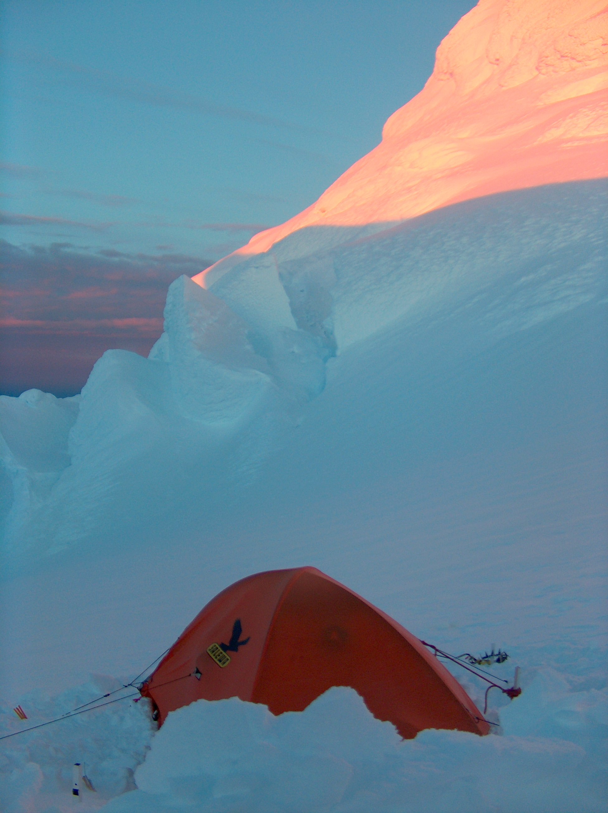
本预览的尺寸:449 × 600像素。 其他分辨率:180 × 240像素 | 359 × 480像素 | 575 × 768像素 | 766 × 1,024像素 | 1,952 × 2,608像素。
原始文件 (1,952 × 2,608像素,文件大小:532 KB,MIME类型:image/jpeg)
摘要
| 描述 | English: The bivouac of Tangra 2004/05 Expedition at Catalunyan Saddle on the crest of Tangra Mountains on Livingston Island in the South Shetland Islands, Antarctica with the west slopes of Lyaskovets Peak in the background.
|
| 日期 | |
| 来源 | 自己的作品 |
| 作者 | Lyubomir Ivanov |
| 相机位置 | | 在以下服务上查看本图像和附近其他图像: OpenStreetMap |
|---|
许可协议
 | 本作品为自由软件,您可以依据自由软件基金会发行的GNU通用公共许可证第2版或任意后续版本的条款,传播和/或修改本作品。本作品发表时预期有用,但对此无任何保证,亦无隐含的可以销售或适合特定目的的保证。详情请见GNU通用公共许可证第2版和第3版。 |
文件历史
点击某个日期/时间查看对应时刻的文件。
| 日期/时间 | 缩略图 | 大小 | 用户 | 备注 | |
|---|---|---|---|---|---|
| 当前 | 2006年4月26日 (三) 07:26 | | 1,952 × 2,608(532 KB) | Apcbg | {{ConfirmationOTRS|otrs=2006013010000528|source=Lyubomir Ivanov}} |
文件用途
以下页面使用本文件:
全域文件用途
以下其他wiki使用此文件:
- bg.wikipedia.org上的用途
- ca.wikipedia.org上的用途
- en.wikipedia.org上的用途
- en.wikivoyage.org上的用途
- fr.wikipedia.org上的用途
- gl.wikipedia.org上的用途
- it.wikipedia.org上的用途
- it.wikivoyage.org上的用途
- ja.wikipedia.org上的用途
- pt.wikipedia.org上的用途
- ru.wikipedia.org上的用途
- uk.wikipedia.org上的用途
元数据
Explore the world

United states
New York

Japan
Tokyo

Singapore
Singapore
