
 Français
 Italiano
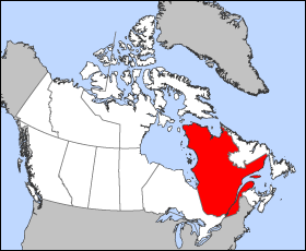
Det finns ingen version med högre upplösning.
Quebec-map.png (280 × 230 pixlar, filstorlek: 15 kbyte, MIME-typ: image/png)
Map of Quebec (Canada)
Projection: Lambert azimuthal equal-area
Geospatial data from: The Atlas of Canada, The National Atlas of the United States and U.S. Geological Survey
Cartographer: John Fowler
 | Det finns en vektorversion av denna rasterbild (SVG). När vektorbilden är lämpligare ska den användas istället för rasterbilden. File:Quebec-map.png → File:Québec, Canada.svg För mer information om vektorgrafik, se artikeln Commons transition to SVG (på engelska). |  |
| Jag, upphovsrättsinnehavaren till detta verk, släpper detta verk i public domain. Detta gäller globalt. I vissa länder kan detta inte vara juridiskt möjligt; i så fall: Jag ger härmed envar rätten att använda detta verk för alla ändamål, utan några villkor, förutom villkor som lagen ställer. |
Filhistorik
Klicka på ett datum/klockslag för att se filen som den såg ut då.
| Datum/Tid | Miniatyrbild | Dimensioner | Användare | Kommentar | |
|---|---|---|---|---|---|
| nuvarande | 24 mars 2005 kl. 14.18 | | 280 × 230 (15 kbyte) | Voyager | Map of Québec Projection: Lambert azimuthal equal-area Geospatial data from: [http://atlas.gc.ca/ The Atlas of Canada], [http://www.nationalatlas.gov/ The National Atlas of the United States] and [http://www.usgs.gov U.S. Geological Survey] Cartograph |
Filanvändning
Följande sidor länkar till den här bilden:
Global filanvändning
Följande andra wikier använder denna fil:
- Användande på en.wikinews.org
- Liberal minority government elected in Quebec
- Overcrowded Montreal hospital asks public to stay away
- Accused killer of Canadian police officer released on bail
- Gilles Duceppe drops out of Parti Québécois leadership race
- 14 people injured after bus overturns in heavy rain near Quebec City
- Quebec man found not guilty in shooting death of Laval officer
- Användande på en.wiktionary.org
- Användande på es.wikipedia.org
- Användande på fr.wikinews.org
- Användande på he.wikivoyage.org
- Användande på pl.wikivoyage.org
- Användande på su.wikipedia.org
- Användande på test2.wikipedia.org
- Användande på uk.wikivoyage.org
- Användande på www.wikidata.org
Explore the world

United states
New York

Japan
Tokyo

Singapore
Singapore
