
 Français
 Italiano
Размер этого предпросмотра: 608 × 600 пкс. Другие разрешения: 243 × 240 пкс | 487 × 480 пкс | 779 × 768 пкс | 1038 × 1024 пкс | 1695 × 1672 пкс.
Исходный файл (1695 × 1672 пкс, размер файла: 1,14 МБ, MIME-тип: image/jpeg)
Краткое описание
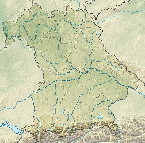
| Описание | Deutsch: Physische Positionskarte Bayern, Deutschland. Geographische Begrenzung der Karte: English: Physical Location map Bavaria, Germany. Geographic limits of the map:
|
| Дата | |
| Источник | Собственная работа |
| Автор | Grundkarte TUBS, Relief Alexrk2 |
| Другие версии |
|

Лицензирование
Я, владелец авторских прав на это произведение, добровольно публикую его на условиях следующих лицензий:
 | Разрешается копировать, распространять и/или изменять этот документ в соответствии с условиями GNU Free Documentation License версии 1.2 или более поздней, опубликованной Фондом свободного программного обеспечения, без неизменяемых разделов, без текстов, помещаемых на первой и последней обложке. Копия лицензии включена в раздел, озаглавленный GNU Free Documentation License. |
Этот файл доступен на условиях лицензий Creative Commons Attribution-Share Alike 3.0 Unported, 2.5 Generic, 2.0 Generic и 1.0 Generic.
- Вы можете свободно:
- делиться произведением – копировать, распространять и передавать данное произведение
- создавать производные – переделывать данное произведение
- При соблюдении следующих условий:
- атрибуция – Вы должны указать авторство, предоставить ссылку на лицензию и указать, внёс ли автор какие-либо изменения. Это можно сделать любым разумным способом, но не создавая впечатление, что лицензиат поддерживает вас или использование вами данного произведения.
- распространение на тех же условиях – Если вы изменяете, преобразуете или создаёте иное произведение на основе данного, то обязаны использовать лицензию исходного произведения или лицензию, совместимую с исходной.
Вы можете выбрать любую из этих лицензий.
История файла
Нажмите на дату/время, чтобы увидеть версию файла от того времени.
| Дата/время | Миниатюра | Размеры | Участник | Примечание | |
|---|---|---|---|---|---|
| текущий | 15:17, 19 ноября 2009 | | 1695 × 1672 (1,14 МБ) | Alexrk2 | == {{int:filedesc}} == {{Information |Description= {{de|Physische Positionskarte Bayern, Deutschland. Geographische Begrenzung der Karte:}} {{en|Physical Location map Bavaria, Germany. Geographic limits of the map:}} * N: |
Использование файла
Нет страниц, использующих этот файл.
Глобальное использование файла
Данный файл используется в следующих вики:
- Использование в als.wikipedia.org
- Использование в an.wikipedia.org
- Chiemsee
- Tüttensee
- Río Traun (Bavera)
- Rote Traun
- Hochfelln
- Hochgern
- Achental (Bavera)
- Watzmann
- Waginger See
- Río Itz
- Königssee
- Ammersee
- Río Ammer
- Laco de Starnberg
- Eibsee
- Tegernsee (laco)
- Pilsensee
- Wörthsee (laco)
- Weßlinger See
- Feringasee
- Walchensee
- Egglburger See
- Lacos de Seeon
- Unterschleißheimer See
- Unterföhringer See
- Zugspitze
- Kochelsee
- Hoher Peißenberg
- Sylvensteinspeicher
- Río Würm
- Großer Brombachsee
- Schliersee (laco)
- Spitzingsee
- Wendelstein
- Altmühlsee
- Glaciar de Blaueis
- Río Lech
- Использование в ar.wikipedia.org
- Использование в ast.wikipedia.org
Просмотреть глобальное использование этого файла.
Метаданные
Explore the world

United states
New York

Japan
Tokyo

Singapore
Singapore
