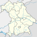
Размер этого PNG-превью для исходного SVG-файла: 608 × 600 пкс. Другие разрешения: 243 × 240 пкс | 487 × 480 пкс | 779 × 768 пкс | 1038 × 1024 пкс | 2077 × 2048 пкс | 867 × 855 пкс.
Исходный файл (SVG-файл, номинально 867 × 855 пкс, размер файла: 738 КБ)
История файла
Нажмите на дату/время, чтобы увидеть версию файла от того времени.
| Дата/время | Миниатюра | Размеры | Участник | Примечание | |
|---|---|---|---|---|---|
| текущий | 20:22, 19 ноября 2009 |  | 867 × 855 (738 КБ) | Alexrk2 | fixed boundaries, rivers; adjusted map projection; colors for internal divisions |
| 23:01, 28 марта 2009 |  | 867 × 855 (1,05 МБ) | TUBS | #corrected 4 mistakes (lake margins (pasted to foreground), RegBez and counties around TIR (splited area in two counties and corrected RegBez border), County of Munich (merged), Merged an (to me right know unknown) county north of Nuremberg. #moved all gr | |
| 12:32, 28 января 2009 |  | 867 × 855 (1,45 МБ) | TUBS | {{Information |Description= |Source= |Date= |Author= |Permission= |other_versions= }} | |
| 03:20, 28 января 2009 |  | 867 × 855 (1,45 МБ) | TUBS | {{Information |Description= |Source= |Date= |Author= |Permission= |other_versions= }} | |
| 03:11, 27 января 2009 |  | 867 × 855 (1,46 МБ) | TUBS | {{Information |Description= |Source= |Date= |Author= |Permission= |other_versions= }} | |
| 02:20, 27 января 2009 |  | 867 × 855 (1,5 МБ) | TUBS | {{Information |Description= |Source= |Date= |Author= |Permission= |other_versions= }} | |
| 14:38, 26 января 2009 |  | 867 × 855 (1,51 МБ) | TUBS | == Summary == {{Information |Description= {{de|Positionskarte Hessen, Deutschland. Geographische Begrenzung der Karte:}} {{en|Location map Bavaria, Germany. Geographic limits of the map:}} * N: 50.6303000° N * S: 47.26618 | |
| 14:24, 26 января 2009 |  | 867 × 855 (1,52 МБ) | TUBS | == Summary == {{Information |Description= {{de|Positionskarte Hessen, Deutschland. Geographische Begrenzung der Karte:}} {{en|Location map Bavaria, Germany. Geographic limits of the map:}} * N: 50.6303000° N * S: 47.26618 |
Использование файла
Нет страниц, использующих этот файл.
Глобальное использование файла
Данный файл используется в следующих вики:
- Использование в af.wikipedia.org
- Использование в als.wikipedia.org
- Использование в ar.wikipedia.org
- Использование в ast.wikipedia.org
- Использование в azb.wikipedia.org
Просмотреть глобальное использование этого файла.


 Français
 Italiano


