
 Français
 Italiano
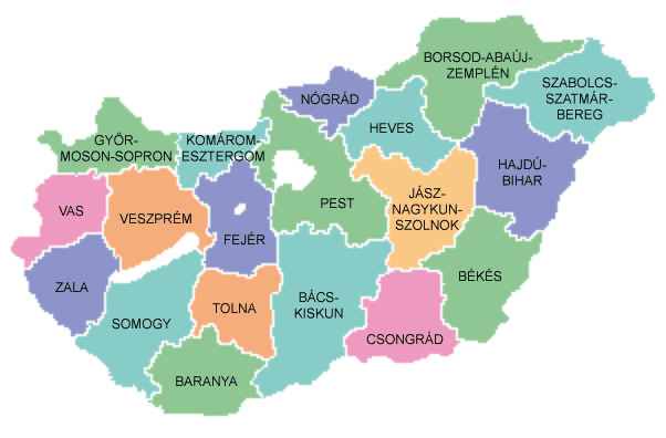
Geen hogere resolutie beschikbaar.
Map_of_counties_of_Hungary_2004.png (602 × 396 pixels, bestandsgrootte: 34 kB, MIME-type: image/png)
Dit is een bestand van Wikimedia Commons. Onderstaande beschrijving komt van de beschrijving van het bestand daar. Commons is een vrij-gelicenceerde database voor afbeeldingen, geluid, video en andere bestanden. |
 | Bestand:Map of counties of Hungary 2004.svg is een vectorversie van dit bestand. Indien niet van slechtere kwaliteit dient deze gebruikt te worden in plaats van deze rasterafbeelding. File:Map of counties of Hungary 2004.png → File:Map of counties of Hungary 2004.svg Zie Help:SVG voor meer informatie. |  |
Beschrijving
Español: Provincias de Hungría
Counties of Hungary
Uploaded to hu: on August 26, 2004 by hu:User:Szajd and licensed under GFDL
 | Toestemming wordt verleend voor het kopiëren, verspreiden en/of wijzigen van dit document onder de voorwaarden van de GNU-licentie voor vrije documentatie, versie 1.2 of enige latere versie als gepubliceerd door de Free Software Foundation; zonder Invariant Sections, zonder Front-Cover Texts, en zonder Back-Cover Texts. Een kopie van de licentie is opgenomen in de sectie GNU-licentie voor vrije documentatie. |
| Dit bestand is gelicenseerd onder de Creative Commons-licentie Naamsvermelding-Gelijk delen 3.0 Unported | ||
| ||
| Deze licentietag is toegevoegd aan dit bestand in verband met de GFDL licentie-update. |
Bestandsgeschiedenis
Klik op een datum/tijd om het bestand te zien zoals het destijds was.
| Datum/tijd | Miniatuur | Afmetingen | Gebruiker | Opmerking | |
|---|---|---|---|---|---|
| huidige versie | 26 nov 2016 12:36 | | 602 × 396 (34 kB) | Tacsipacsi | transparent background |
| 2 mrt 2007 15:03 |  | 602 × 396 (14 kB) | Tene~commonswiki | Optimised (0) | |
| 6 jun 2005 06:03 |  | 602 × 396 (15 kB) | Thuresson | Counties of Hungary Uploaded to hu: on August 26, 2004 by hu:User:Szajd and licensed under GFDL {{GFDL}} Category:Maps of Hungary hu:Kép:Magyarorszag-megyek.png |
Bestandsgebruik
Geen enkele pagina gebruikt dit bestand.
Globaal bestandsgebruik
Dit bestand wordt op de volgende andere wiki’s gebruikt:
- Gebruikt op als.wikipedia.org
- Gebruikt op be-tarask.wikipedia.org
- Gebruikt op cs.wikipedia.org
- Gebruikt op da.wikipedia.org
- Gebruikt op de.wikipedia.org
- Gebruikt op en.wikipedia.org
- Gebruikt op eo.wikipedia.org
- Gebruikt op fiu-vro.wikipedia.org
- Gebruikt op frr.wikipedia.org
- Gebruikt op fr.wikipedia.org
- Gebruikt op gl.wikipedia.org
- Gebruikt op hu.wikipedia.org
- Gebruikt op is.wikipedia.org
- Gebruikt op it.wikipedia.org
- Gebruikt op nrm.wikipedia.org
- Gebruikt op oc.wikipedia.org
- Gebruikt op pl.wikipedia.org
- Gebruikt op ro.wikipedia.org
- Gebruikt op rue.wikipedia.org
- Gebruikt op sh.wikipedia.org
- Gebruikt op sk.wikipedia.org
- Gebruikt op tr.wikipedia.org
- Gebruikt op vi.wikipedia.org
Metadata
Explore the world

United states
New York

Japan
Tokyo

Singapore
Singapore
