
 Français
 Italiano
Dimensioni di questa anteprima: 485 × 600 pixel. Altre risoluzioni: 194 × 240 pixel | 388 × 480 pixel | 621 × 768 pixel | 828 × 1 024 pixel | 1 672 × 2 068 pixel.
File originale (1 672 × 2 068 pixel, dimensione del file: 932 KB, tipo MIME: image/png)
| Questo file e la sua pagina di descrizione (discussione · modifica) si trovano su Wikimedia Commons (?) |
 | Questo file è stato trasferito su Wikimedia Commons da wts.oldwikivoyage utilizzando uno script per bot. Tutte le informazioni riguardanti la fonte del file sono ancora presenti. Tuttavia, necessitano di un controllo umano. Inoltre, potrebbero esserci degli errori nella visualizzazione di tutte le informazioni del file, dovuti alle differenze esistenti fra i template dei progetti Wikimedia. Di conseguenza, le informazioni su questo file non dovrebbero essere considerate attendibili e il file non dovrebbe essere riutilizzato finché non è stato controllato e finché tutte le correzioni necessarie non sono state fatte. Una volta eseguito il controllo, per favore rimuovi questo avviso. Per maggiori dettagli, vedi sotto. Controlla adesso! |
Dettagli
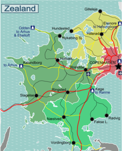
| Descrizione | Regional map of Zealand. Regional Map of Zealand with Roads and Railways
|
| Data | |
| Fonte | http://da.wikipedia.org/wiki/Skabelon:Kortpositioner_Sj%C3%A6lland |
| Autore | Stefan Ertmann & Eric Frohne |
Licenza
Questo file è disponibile in base alla licenza Creative Commons Attribuzione-Condividi allo stesso modo 2.0 Generico
- Tu sei libero:
- di condividere – di copiare, distribuire e trasmettere quest'opera
- di modificare – di adattare l'opera
- Alle seguenti condizioni:
- attribuzione – Devi fornire i crediti appropriati, un collegamento alla licenza e indicare se sono state apportate modifiche. Puoi farlo in qualsiasi modo ragionevole, ma non in alcun modo che suggerisca che il licenziante approvi te o il tuo uso.
- condividi allo stesso modo – Se remixi, trasformi o sviluppi il materiale, devi distribuire i tuoi contributi in base alla stessa licenza o compatibile all'originale.
Registro originale del caricamento
| This file was imported from Wikivoyage WTS. |
La pagina di descrizione originale era qui. Tutti i nomi utente che seguono sono riferiti a wts.wikivoyage-old.
- 2009-09-14 19:34 (WT-shared) Sertmann[collegamento interrotto] 604×1002 (293602 bytes) == Summary == {{Imagecredit|credit=Stefan Ertmann & Eric Frohne|captureDate=September 2009|location=Zealand|source=http://da.wikipedia.org/w (Import from wikitravel.org/shared)
- 2009-09-14 20:15 (WT-shared) Sertmann[collegamento interrotto] 451×750 (202129 bytes) (Import from wikitravel.org/shared)
- 2010-02-28 16:59 (WT-shared) ClausHansen[collegamento interrotto] 2227×3707 (1320514 bytes) (Import from wikitravel.org/shared)
- 2010-08-21 15:30 (WT-shared) ClausHansen[collegamento interrotto] 1337×1654 (589937 bytes) (Import from wikitravel.org/shared)
- 2010-08-24 11:56 (WT-shared) ClausHansen[collegamento interrotto] 1672×2068 (954580 bytes) Changed border between south and west to follow municipalities (Import from wikitravel.org/shared)
Cronologia del file
Fare clic su un gruppo data/ora per vedere il file come si presentava nel momento indicato.
| Data/Ora | Miniatura | Dimensioni | Utente | Commento | |
|---|---|---|---|---|---|
| attuale | 06:02, 18 dic 2012 | | 1 672 × 2 068 (932 KB) | OgreBot | (BOT): Reverting to most recent version before archival |
| 06:02, 18 dic 2012 |  | 1 337 × 1 654 (576 KB) | OgreBot | (BOT): Uploading old version of file from wts.wikivoyage; originally uploaded on 2010-08-21 15:30:41 by (WT-shared) ClausHansen | |
| 06:02, 18 dic 2012 |  | 2 227 × 3 707 (1,26 MB) | OgreBot | (BOT): Uploading old version of file from wts.wikivoyage; originally uploaded on 2010-02-28 16:59:53 by (WT-shared) ClausHansen | |
| 06:02, 18 dic 2012 |  | 451 × 750 (197 KB) | OgreBot | (BOT): Uploading old version of file from wts.wikivoyage; originally uploaded on 2009-09-14 20:15:08 by (WT-shared) Sertmann | |
| 06:02, 18 dic 2012 |  | 604 × 1 002 (287 KB) | OgreBot | (BOT): Uploading old version of file from wts.wikivoyage; originally uploaded on 2009-09-14 19:34:33 by (WT-shared) Sertmann | |
| 05:32, 18 nov 2012 |  | 1 672 × 2 068 (932 KB) | MGA73bot2 | {{BotMoveToCommons|wts.oldwikivoyage|year={{subst:CURRENTYEAR}}|month={{subst:CURRENTMONTHNAME}}|day={{subst:CURRENTDAY}}}} == {{int:filedesc}} == {{Information |description=Regional map of Zealand. Regional Map of Zealand with Roads and Railways<br>SV... |
Utilizzo del file
La seguente pagina usa questo file:
Utilizzo globale del file
Anche i seguenti wiki usano questo file:
Metadati
Explore the world

United states
New York

Japan
Tokyo

Singapore
Singapore
