
 Français
 Italiano
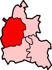
Non sono disponibili versioni a risoluzione più elevata.
OxfordshireWest.png (200 × 267 pixel, dimensione del file: 11 KB, tipo MIME: image/png)
| Questo file e la sua pagina di descrizione (discussione · modifica) si trovano su Wikimedia Commons (?) |
West Oxfordshire in Oxfordshire
Created by en:User:Morwen
 | È permesso copiare, distribuire e/o modificare questo documento in base ai termini della GNU Free Documentation License, Versione 1.2 o successive pubblicata dalla Free Software Foundation; senza alcuna sezione non modificabile, senza testo di copertina e senza testo di quarta di copertina. Una copia della licenza è inclusa nella sezione intitolata Testo della GNU Free Documentation License. |
| Questo file è disponibile in base alla licenza Creative Commons Attribuzione-Condividi allo stesso modo 3.0 Unported | ||
| ||
| Questo tag di copyright è stato aggiunto nell'ambito dell'aggiornamento della licenza dei progetti Wikimedia. |
Cronologia del file
Fare clic su un gruppo data/ora per vedere il file come si presentava nel momento indicato.
| Data/Ora | Miniatura | Dimensioni | Utente | Commento | |
|---|---|---|---|---|---|
| attuale | 15:11, 29 ott 2011 | | 200 × 267 (11 KB) | Mahahahaneapneap | Transparent background |
| 19:42, 30 lug 2005 |  | 200 × 267 (17 KB) | Cnyborg | West Oxfordshire in Oxfordshire, England. From en:Image:OxfordshireWest.png by en:User:Morwen {{GFDL-en}} Category:Maps of English districts |
Utilizzo del file
Nessuna pagina utilizza questo file.
Utilizzo globale del file
Anche i seguenti wiki usano questo file:
- Usato nelle seguenti pagine di de.wikipedia.org:
- Usato nelle seguenti pagine di en.wikipedia.org:
- Blenheim Palace
- Witney
- Burford
- West Oxfordshire
- Spelsbury
- Charlbury
- Taston
- Carterton, Oxfordshire
- Chipping Norton
- Woodstock, Oxfordshire
- Chadlington
- Eynsham
- Kelmscott
- Combe, Oxfordshire
- Stonesfield
- Churchill, Oxfordshire
- Kingham
- Henley (UK Parliament constituency)
- Banbury (UK Parliament constituency)
- Witney (UK Parliament constituency)
- Wychwood
- Radford, Oxfordshire
- Tackley
- Brize Norton
- Curbridge, Oxfordshire
- Ducklington
- Shilton, Oxfordshire
- Alvescot
- Ascott-under-Wychwood
- Asthall
- Aston, Cote, Shifford and Chimney
- Bampton, Oxfordshire
- Long Hanborough
- Black Bourton
- Bladon
- Blenheim, Oxfordshire
- Broadwell, Oxfordshire
- Bruern
- Standlake
- Milton-under-Wychwood
- Shipton-under-Wychwood
- Swinbrook
- Enstone
- Cogges
- Leafield
- Salford, Oxfordshire
- Minster Lovell
- Chastleton
- Yelford
Visualizza l'utilizzo globale di questo file.
Metadati
Explore the world

United states
New York

Japan
Tokyo

Singapore
Singapore
