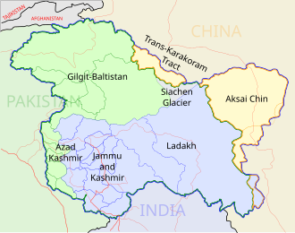
पूर्वावलोकन PNG का आकार SVG फ़ाइल: ५३० × ५९९ पिक्सेल दूसरे रेसोल्यूशन्स: २१२ × २४० पिक्सेल | ४२५ × ४८० पिक्सेल | ६८० × ७६८ पिक्सेल | ९०६ × १,०२४ पिक्सेल | १,८१२ × २,०४८ पिक्सेल | १,६३९ × १,८५२ पिक्सेल।
मूल चित्र (SVG फ़ाइल, साधारणतः १,६३९ × १,८५२ पिक्सेल, फ़ाइल का आकार: १.११ MB)
चित्र का इतिहास
चित्र पुराने समय में कैसी दिखती थी यह जानने के लिए दिनांक/समय पर क्लिक करें।
| दिनांक/समय | थंबनेल | आकार | सदस्य | टिप्पणी | |
|---|---|---|---|---|---|
| वर्तमान | १५:२८, २ अप्रैल २०२१ |  | १,६३९ × १,८५२ (१.११ MB) | JoKalliauer | 1) corrected font-family="'Arial-BoldItalicMT'" and similar to fonts available; 2) put switch at the beginning phab:T279133 3)removed useless clipPaths |
| १८:४१, २७ दिसम्बर २०१९ |  | १,६३९ × १,८५२ (१,००२ KB) | नीलम | File uploaded using svgtranslate tool (https://tools.wmflabs.org/svgtranslate/). Added translation for hi. | |
| ०३:३४, १९ अगस्त २०१८ |  | १,६३९ × १,८५२ (९०९ KB) | Cbyneorne | Fixed the spelling of the capital of Mizoram. | |
| ११:४४, २ अप्रैल २००७ |  | १,६३९ × १,८५२ (९०९ KB) | Gmaxwell | Please do not include copyrighted fonts in your SVGs. | |
| ११:४३, २ अप्रैल २००७ |  | १,६३९ × १,८५२ (९०९ KB) | Gmaxwell | Please do not include copyrighted fonts in your SVGs. | |
| १३:०३, ९ जनवरी २००७ |  | १,६३९ × १,८५२ (१,००१ KB) | Planemad | uttaranchal>uttarkhand, minor color corrections and numbering correction | |
| २२:३४, १३ नवम्बर २००६ |  | १,६३९ × १,८५२ (१,०१८ KB) | Planemad | designation for all highways | |
| १६:२९, ९ नवम्बर २००६ |  | १,६३९ × १,८५२ (८६५ KB) | Planemad | updated karnataka city spellings, added nh 110 112 113 114 116 117 119 121 123 153 154 155 224 225 226 227, corrections in north east states | |
| ०१:०१, ७ नवम्बर २००६ |  | १,६३९ × १,८५२ (८४४ KB) | Planemad | nh designation markers on nhdp highways, rivers enabled, lightened state names, 3d locators for capitals and major cities, minor corrections north east areas | |
| २३:३१, १५ अक्टूबर २००६ |  | १,६३९ × १,८५२ (७१८ KB) | Planemad | Included Nhdp phase IIIA, Changed stroke styles for highways, changed marker locators, added state names, included road legend, added more cities and towns, corrections |
चित्र का उपयोग
कोई भी ऐसा पृष्ठ नहीं है जो इस चित्र का प्रयोग कर रहा हो।
चित्र का वैश्विक उपयोग
इस चित्र का उपयोग इन दूसरे विकियों में किया जाता है:
- af.wikipedia.org पर उपयोग
- as.wikipedia.org पर उपयोग
- ba.wikipedia.org पर उपयोग
- be-tarask.wikipedia.org पर उपयोग
- bh.wikipedia.org पर उपयोग
- bn.wikipedia.org पर उपयोग
- ce.wikipedia.org पर उपयोग
- crh.wikipedia.org पर उपयोग
- cv.wikipedia.org पर उपयोग
- de.wikipedia.org पर उपयोग
- en.wikipedia.org पर उपयोग
- National Highways Authority of India
- Roads in India
- Portal:India/Picture of the week, 2006
- Wikipedia:Featured pictures thumbs/06
- National Highways Development Project
- Portal:India/Selected picture candidates/Archived nominations
- Portal:Maps/Selected picture
- Wikipedia:Featured picture candidates/October-2006
- Wikipedia:Wikipedia Signpost/2006-10-30/Features and admins
- Wikipedia:Featured picture candidates/India roadway map
- Portal:India/Selected picture candidates/India roadway map
- Portal:India/Picture of the week 45, 2006
- Portal:India/SC Summary/SP India roadway map
- Wikipedia:Picture of the day/February 2007
- Wikipedia:Wikipedia Signpost/2006-10-30/SPV
- Template:POTD/2007-02-01
- Wikipedia talk:WikiProject Indian maps/Archive 1
- User talk:Planemad/Archive 1
- Portal:Maps/Selected picture/17
- User talk:Planemad/Archive 3
- Wikipedia:Featured pictures/Diagrams, drawings, and maps/Maps
- Portal:India/Selected picture
- User talk:Naveenpf/Archive 2
- Wikipedia:WikiProject India/Recognized content
- Wikipedia:WikiProject India/Main page featured content
- Wikipedia:Graphics Lab/Map workshop/Archive/Apr 2010
- Portal:India/Selected picture/23
- Bibliography of India
- Wikipedia talk:WikiProject Indian roads/Archive 1
- Wikipedia:WikiProject Indian roads/Recognized content
- National Highways and Infrastructure Development Corporation Limited
इस चित्र के वैश्विक उपयोग की अधिक जानकारी देखें।


 Français
 Italiano


