
 Français
 Italiano
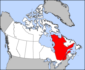
אין גרסה ברזולוציה גבוהה יותר.
Quebec-map.png (280 × 230 פיקסלים, גודל הקובץ: 15 ק"ב, סוג MIME: image/png)
זהו קובץ שמקורו במיזם ויקישיתוף. תיאורו בדף תיאור הקובץ המקורי (בעברית) מוצג למטה ויקישיתוף הוא מאגר תמונות וקובצי מדיה חופשיים. אתם יכולים לעזור. |
Map of Quebec (Canada)
Projection: Lambert azimuthal equal-area
Geospatial data from: The Atlas of Canada, The National Atlas of the United States and U.S. Geological Survey
Cartographer: John Fowler
 | File:Québec, Canada.svg הוא גרסה וקטורית של קובץ זה. יש להשתמש בו במקום קובץ ה־PNG הזה כאשר הוא איננו נחות. File:Quebec-map.png → File:Québec, Canada.svg למידע נוסף, אנא ראו Help:SVG. |  |
| ברצוני, בעלי זכויות היוצרים על יצירה זו, לשחרר יצירה זו לנחלת הכלל. זה תקף בכל העולם. יש מדינות שבהן הדבר אינו אפשרי על פי חוק, אם כך: אני מעניק לכל אחד את הזכות להשתמש בעבודה זו לכל מטרה שהיא, ללא תנאים כלשהם, אלא אם כן תנאים כאלה נדרשים על פי חוק. |
היסטוריית הקובץ
ניתן ללחוץ על תאריך/שעה כדי לראות את הקובץ כפי שנראה באותו זמן.
| תאריך/שעה | תמונה ממוזערת | ממדים | משתמש | הערה | |
|---|---|---|---|---|---|
| נוכחית | 15:18, 24 במרץ 2005 | | 230 × 280 (15 ק"ב) | Voyager | Map of Québec Projection: Lambert azimuthal equal-area Geospatial data from: [http://atlas.gc.ca/ The Atlas of Canada], [http://www.nationalatlas.gov/ The National Atlas of the United States] and [http://www.usgs.gov U.S. Geological Survey] Cartograph |
שימוש בקובץ
הדף הבא משתמש בקובץ הזה:
שימוש גלובלי בקובץ
אתרי הוויקי האחרים הבאים משתמשים בקובץ הזה:
- שימוש באתר en.wikinews.org
- Liberal minority government elected in Quebec
- Overcrowded Montreal hospital asks public to stay away
- Accused killer of Canadian police officer released on bail
- Gilles Duceppe drops out of Parti Québécois leadership race
- 14 people injured after bus overturns in heavy rain near Quebec City
- Quebec man found not guilty in shooting death of Laval officer
- שימוש באתר en.wiktionary.org
- שימוש באתר es.wikipedia.org
- שימוש באתר fr.wikinews.org
- שימוש באתר pl.wikivoyage.org
- שימוש באתר su.wikipedia.org
- שימוש באתר sv.wikivoyage.org
- שימוש באתר test2.wikipedia.org
- שימוש באתר uk.wikivoyage.org
- שימוש באתר www.wikidata.org
Explore the world

United states
New York

Japan
Tokyo

Singapore
Singapore
