
 Français
 Italiano
גודל התצוגה המקדימה הזאת: 800 × 600 פיקסלים. רזולוציות אחרות: 320 × 240 פיקסלים | 640 × 480 פיקסלים | 1,024 × 768 פיקסלים | 1,280 × 960 פיקסלים | 2,592 × 1,944 פיקסלים.
לקובץ המקורי (2,592 × 1,944 פיקסלים, גודל הקובץ: 959 ק"ב, סוג MIME: image/jpeg)
זהו קובץ שמקורו במיזם ויקישיתוף. תיאורו בדף תיאור הקובץ המקורי (בעברית) מוצג למטה ויקישיתוף הוא מאגר תמונות וקובצי מדיה חופשיים. אתם יכולים לעזור. |
| This is an image of a place or building that is listed on the National Register of Historic Places in the United States of America. Its reference number is 12000515. |
תקציר
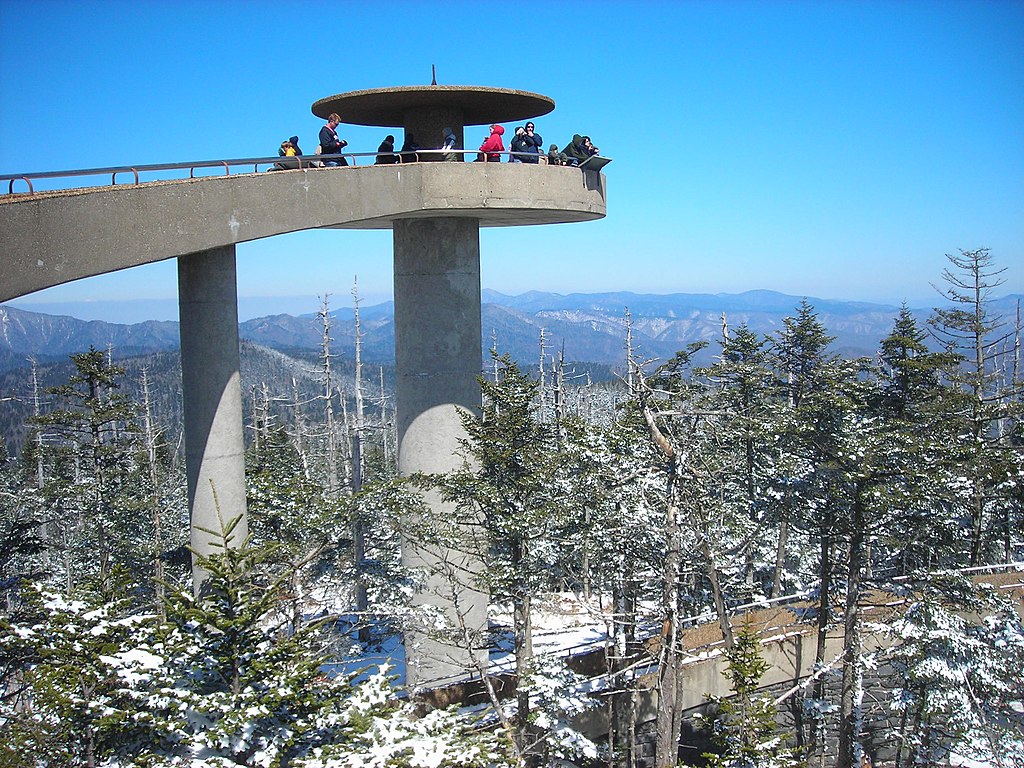
| תיאור | English: The Clingman's Dome Observation Tower rises 50 feet (15 m) from the summit of Clingman's Dome, the highest point both in the state of Tennessee and along the Appalachian Trail, in Great Smoky Mountains National Park. |
| תאריך יצירה | |
| מקור | נוצר על־ידי מעלה היצירה |
| יוצר | Scott Basford |
| מיקום האובייקט | | תמונה זו ותמונות נוספות במיקום: OpenStreetMap |
|---|
רישיון
| היצירה הזאת שוחררה לנחלת הכלל על־ידי היוצר שלה, Blinutne. זה תקף בכל העולם. יש מדינות שבהן הדבר אינו אפשרי על פי חוק, אם כך: Blinutne מעניק לכל אחד את הזכות להשתמש ביצירה הזאת לכל מטרה, ללא שום תנאי, אלא אם כן תנאים כאלה נדרשים לפי החוק. |
היסטוריית הקובץ
ניתן ללחוץ על תאריך/שעה כדי לראות את הקובץ כפי שנראה באותו זמן.
| תאריך/שעה | תמונה ממוזערת | ממדים | משתמש | הערה | |
|---|---|---|---|---|---|
| נוכחית | 02:37, 24 ביולי 2007 | | 1,944 × 2,592 (959 ק"ב) | Blinutne | {{Information |Description= The Clingman's Dome Observation Tower rises fifty feet from the pinnacle of Clingman's Dome, the highest point both in the state of Tennessee and along the Appalachian Trail, in the Great Smoky Mountains National Park. |Source= |
שימוש בקובץ
הדף הבא משתמש בקובץ הזה:
שימוש גלובלי בקובץ
אתרי הוויקי האחרים הבאים משתמשים בקובץ הזה:
- שימוש באתר ar.wikipedia.org
- שימוש באתר ca.wikipedia.org
- שימוש באתר da.wikipedia.org
- שימוש באתר de.wikipedia.org
- שימוש באתר en.wikipedia.org
- Continental climate
- Great Smoky Mountains National Park
- Kuwohi
- Mountains-to-Sea Trail
- Mission 66
- National Register of Historic Places listings in Sevier County, Tennessee
- National Register of Historic Places listings in Swain County, North Carolina
- National Register of Historic Places listings in Great Smoky Mountains National Park
- List of federal lands in Tennessee
- Protected areas of North Carolina
- שימוש באתר fr.wikipedia.org
- שימוש באתר he.wikipedia.org
- שימוש באתר hy.wikipedia.org
- שימוש באתר it.wikipedia.org
- שימוש באתר ja.wikipedia.org
- שימוש באתר kk.wikipedia.org
- שימוש באתר la.wikipedia.org
- שימוש באתר mt.wikipedia.org
- שימוש באתר nl.wikipedia.org
- שימוש באתר no.wikipedia.org
- שימוש באתר pl.wikipedia.org
- שימוש באתר pt.wikipedia.org
- שימוש באתר ru.wikipedia.org
- שימוש באתר sk.wikipedia.org
- שימוש באתר tr.wikipedia.org
- שימוש באתר uk.wikipedia.org
- שימוש באתר ur.wikipedia.org
מטא־נתונים
Explore the world

United states
New York

Japan
Tokyo

Singapore
Singapore
