
 Français
 Italiano
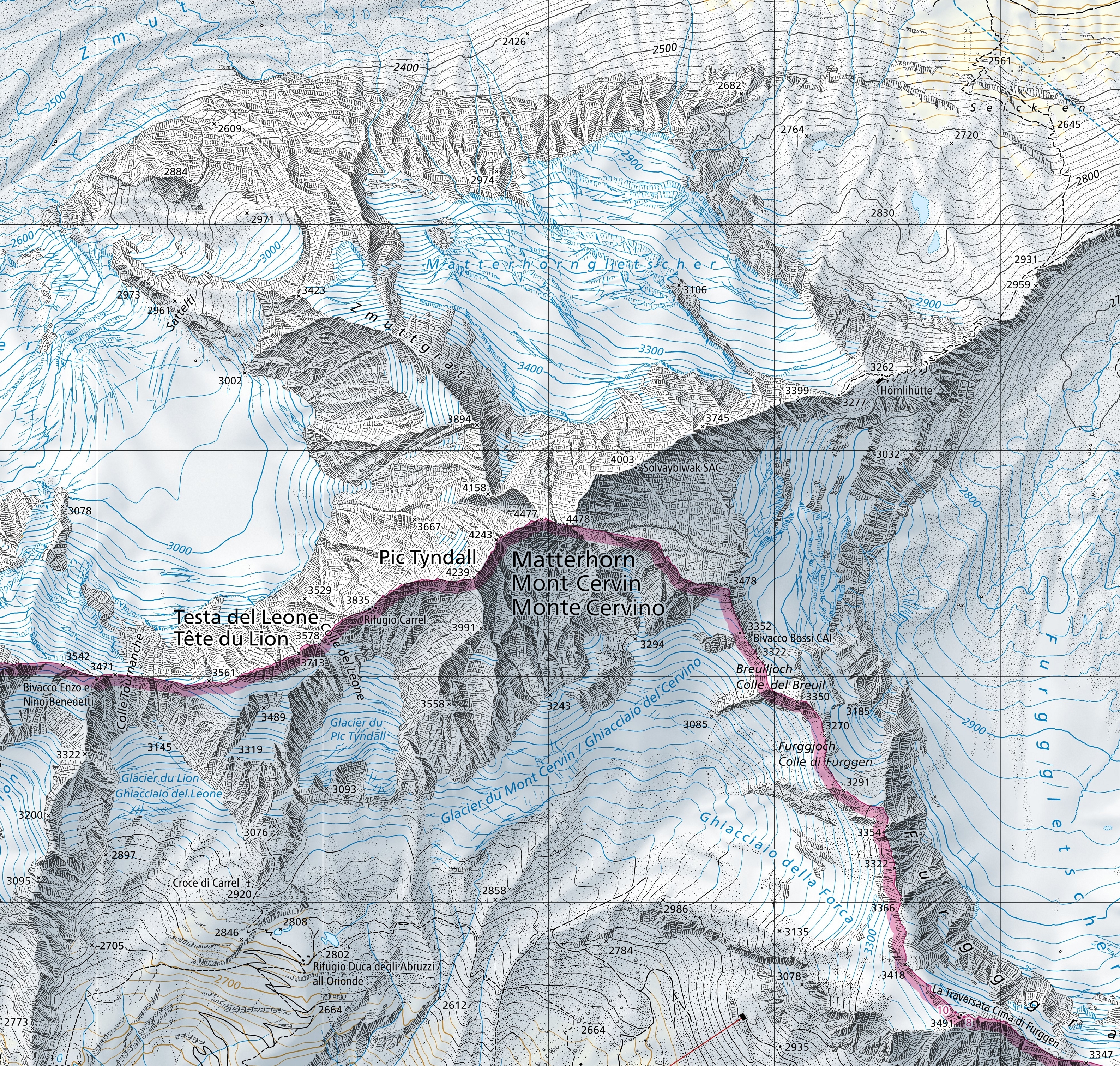
גודל התצוגה המקדימה הזאת: 630 × 600 פיקסלים. רזולוציות אחרות: 252 × 240 פיקסלים | 504 × 480 פיקסלים | 807 × 768 פיקסלים | 1,076 × 1,024 פיקסלים | 2,152 × 2,048 פיקסלים | 3,174 × 3,021 פיקסלים.
לקובץ המקורי (3,174 × 3,021 פיקסלים, גודל הקובץ: 9.49 מ"ב, סוג MIME: image/jpeg)
זהו קובץ שמקורו במיזם ויקישיתוף. תיאורו בדף תיאור הקובץ המקורי (בעברית) מוצג למטה ויקישיתוף הוא מאגר תמונות וקובצי מדיה חופשיים. אתם יכולים לעזור. |
תקציר
| תיאור | English: Extract of the 1:25'000 national map (1347 Matterhorn). The map is centered on the Matterhorn and shows the international border between Switzerland and Italy (in magenta). Full version can be consulted on the geographical portal. | |||||||||||||||||||||||
| תאריך יצירה | ||||||||||||||||||||||||
| מקור |
| |||||||||||||||||||||||
| יוצר |
| |||||||||||||||||||||||

רישיון
The data made publicly available by swisstopo may be used, distributed and made accessible. Furthermore, they may be enriched and processed and also used commercially. A reference to the source is mandatory. In the case of digital or analogue representations and publications, as well as in the case of dissemination, one of the following source references must be attached in any case:
Terms of use for free geodata and geoservices (OGD) from swisstopo
| .svg) |
היסטוריית הקובץ
ניתן ללחוץ על תאריך/שעה כדי לראות את הקובץ כפי שנראה באותו זמן.
| תאריך/שעה | תמונה ממוזערת | ממדים | משתמש | הערה | |
|---|---|---|---|---|---|
| נוכחית | 14:58, 20 במרץ 2021 | | 3,021 × 3,174 (9.49 מ"ב) | Zacharie Grossen | Uploaded a work by Bundesamt für Landestopografie swisstopo from [https://www.swisstopo.admin.ch/en/geodata/maps/smr/smr25.html swisstopo] with UploadWizard |
שימוש בקובץ
אין דפים המשתמשים בקובץ זה.
שימוש גלובלי בקובץ
אתרי הוויקי האחרים הבאים משתמשים בקובץ הזה:
- שימוש באתר en.wikipedia.org
- שימוש באתר it.wikipedia.org
- שימוש באתר ro.wikipedia.org
- שימוש באתר uz.wikipedia.org
Explore the world

United states
New York

Japan
Tokyo

Singapore
Singapore
