
 Français
 Italiano
גודל התצוגה המקדימה הזאת מסוג PNG של קובץ ה־SVG הזה: 442 × 600 פיקסלים. רזולוציות אחרות: 177 × 240 פיקסלים | 353 × 480 פיקסלים | 566 × 768 פיקסלים | 754 × 1,024 פיקסלים | 1,509 × 2,048 פיקסלים | 512 × 695 פיקסלים.
לקובץ המקורי (קובץ SVG, הגודל המקורי: 512 × 695 פיקסלים, גודל הקובץ: 538 ק"ב)
זהו קובץ שמקורו במיזם ויקישיתוף. תיאורו בדף תיאור הקובץ המקורי (בעברית) מוצג למטה ויקישיתוף הוא מאגר תמונות וקובצי מדיה חופשיים. אתם יכולים לעזור. |
תקציר
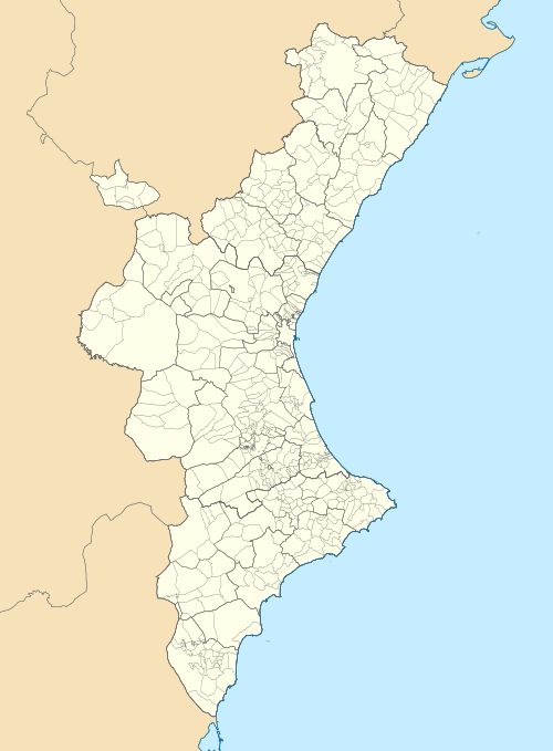
| תיאור | Català: Mapa de localització del País Valencià Projecció equirrectangular, N/S estirada 130 %. Extrems geogràfics al mapa:
English: Location map of the Land of Valencia Equirectangular projection, N/S stretching 130 %. Geographic limits of the map:
Español: Mapa de localización de la Comunidad Valenciana Proyección equirrectangular, N/S estirada 130 %. Límites geográficos del mapa:
| |
| תאריך יצירה | ||
| מקור | נוצר על ידי מעלה היצירה בהתבסס על: EspañaLoc.svg by HansenBCN, and נוצר על ידי מעלה היצירה בהתבסס על: Mapa de localització a les comarques valencianes.svg by Martorell | |
| יוצר | Miguillen and Martorell | |
| SVGהתפתחות | . Inkscape עם נוצרה ה גרפיקה וקטורית
|
רישיון
Miguillen, בעל זכויות היוצרים על היצירה הזאת, מפרסם אותה בזאת תחת הרישיון הבא:
הקובץ הזה מתפרסם לפי תנאי רישיון קריאייטיב קומונז ייחוס-שיתוף זהה 3.0 לא מותאם.
ייחוס: Miguillen
- יש לך חופש:
- לשתף – להעתיק, להפיץ ולהעביר את העבודה
- לערבב בין עבודות – להתאים את העבודה
- תחת התנאים הבאים:
- ייחוס – יש לתת ייחוס הולם, לתת קישור לרישיון, ולציין אם נעשו שינויים. אפשר לעשות את זה בכל צורה סבירה, אבל לא בשום צורה שמשתמע ממנה שמעניק הרישיון תומך בך או בשימוש שלך.
- שיתוף זהה – יצירת רמיקס, שינוי או בנייה על סמך החומר הזה, תטיל עליך חובה להפיץ את התרומות שלך לפי תנאי רישיון זהה או תואם למקור.
היסטוריית הקובץ
ניתן ללחוץ על תאריך/שעה כדי לראות את הקובץ כפי שנראה באותו זמן.
| תאריך/שעה | תמונה ממוזערת | ממדים | משתמש | הערה | |
|---|---|---|---|---|---|
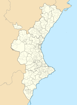
| נוכחית | 10:29, 9 בספטמבר 2022 | | 695 × 512 (538 ק"ב) | Martorell | Added borders of comarques. |
| 17:39, 25 במאי 2010 |  | 695 × 512 (494 ק"ב) | Miguillen | == {{int:filedesc}} == {{Information |Description={{en|Location map of Valencian Community}} Equirectangular projection, N/S stretching 130 %. Geographic limits of the map: * N: 40.885909° N * S: 37.698098° N * W: 1.95368 |
שימוש בקובץ
אין דפים המשתמשים בקובץ זה.
שימוש גלובלי בקובץ
אתרי הוויקי האחרים הבאים משתמשים בקובץ הזה:
- שימוש באתר ar.wikipedia.org
- שימוש באתר ast.wikipedia.org
- שימוש באתר azb.wikipedia.org
- שימוש באתר ba.wikipedia.org
- שימוש באתר bg.wikipedia.org
- שימוש באתר bn.wikipedia.org
- שימוש באתר ca.wikipedia.org
- Usuari:PereBot/cobertura/País Valencià 2/ranking
- Usuari:PereBot/cobertura/País Valencià 2/an
- Usuari:PereBot/cobertura/País Valencià 2/ca
- Usuari:PereBot/cobertura/País Valencià 2/de
- Usuari:PereBot/cobertura/País Valencià 2/en
- Usuari:PereBot/cobertura/País Valencià 2/es
- Usuari:PereBot/cobertura/País Valencià 2/eu
- Usuari:PereBot/cobertura/País Valencià 2/fr
צפייה בשימושים גלובליים נוספים של הקובץ הזה.
מטא־נתונים
Explore the world

United states
New York

Japan
Tokyo

Singapore
Singapore
