
 Français
 Italiano
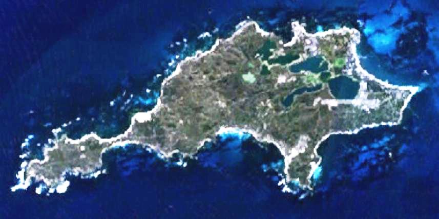
גודל התצוגה המקדימה הזאת: 800 × 399 פיקסלים. רזולוציות אחרות: 320 × 159 פיקסלים | 857 × 427 פיקסלים.
לקובץ המקורי (857 × 427 פיקסלים, גודל הקובץ: 47 ק"ב, סוג MIME: image/jpeg)
זהו קובץ שמקורו במיזם ויקישיתוף. תיאורו בדף תיאור הקובץ המקורי (בעברית) מוצג למטה ויקישיתוף הוא מאגר תמונות וקובצי מדיה חופשיים. אתם יכולים לעזור. |
| תיאור | This is a map of the Rottnest Island, Western Australia. | |||
| מקור | It was made by the uploader using NASA World Wind using Landsat 7 data. | |||
| יוצר | Created by the uploader. Any IP involved in the creation of this image is released into the public domain. | |||
| אישורים והיתרים (שימוש חוזר בקובץ זה) |
|

היסטוריית הקובץ
ניתן ללחוץ על תאריך/שעה כדי לראות את הקובץ כפי שנראה באותו זמן.
| תאריך/שעה | תמונה ממוזערת | ממדים | משתמש | הערה | |
|---|---|---|---|---|---|
| נוכחית | 02:28, 24 ביוני 2008 | | 427 × 857 (47 ק"ב) | Hesperian | Reverted to version as of 01:37, 1 May 2007 |
| 04:37, 1 במאי 2007 |  | 427 × 857 (47 ק"ב) | Moondyne | {{Information |Description=This is a map of the Rottnest Island, Western Australia, made with World Wind using Landsat 7 data. (Adjusted for contrast) |Source= |Date= |Author=Created by the uploader. Any IP involved in the creation of this image is relea | |
| 06:16, 16 בנובמבר 2006 |  | 427 × 857 (38 ק"ב) | Hesperian | {{Information |Description=This is a map of the Rottnest Island, Western Australia, made with World Wind using Landsat 7 data. |Source= |Date= |Author=Created by the uploader. Any IP involved in the creation of this image is released into the public domai |
שימוש בקובץ
אין דפים המשתמשים בקובץ זה.
שימוש גלובלי בקובץ
אתרי הוויקי האחרים הבאים משתמשים בקובץ הזה:
- שימוש באתר ar.wikipedia.org
- שימוש באתר cs.wikipedia.org
- שימוש באתר en.wikipedia.org
- שימוש באתר fa.wikipedia.org
- שימוש באתר fi.wikipedia.org
- שימוש באתר fr.wikipedia.org
- שימוש באתר he.wikipedia.org
- שימוש באתר id.wikipedia.org
- שימוש באתר ja.wikipedia.org
- שימוש באתר ru.wikipedia.org
- שימוש באתר ur.wikipedia.org
- שימוש באתר www.wikidata.org
- שימוש באתר zh-yue.wikipedia.org
- שימוש באתר zh.wikipedia.org
מטא־נתונים
Explore the world

United states
New York

Japan
Tokyo

Singapore
Singapore
