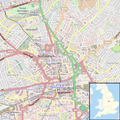
Location_map_United_Kingdom_Nottingham_Central.png (543 × 545 פיקסלים, גודל הקובץ: 645 ק"ב, סוג MIME: image/png)
היסטוריית הקובץ
ניתן ללחוץ על תאריך/שעה כדי לראות את הקובץ כפי שנראה באותו זמן.
| תאריך/שעה | תמונה ממוזערת | ממדים | משתמש | הערה | |
|---|---|---|---|---|---|
| נוכחית | 20:42, 12 באוגוסט 2013 |  | 545 × 543 (645 ק"ב) | Rushton2010 | Added England locator map to the corner, adapted from File:Nottingham UK locator map.svg |
| 01:53, 12 באוגוסט 2013 |  | 545 × 543 (685 ק"ב) | Rushton2010 | User created page with UploadWizard |
שימוש בקובץ
אין דפים המשתמשים בקובץ זה.
שימוש גלובלי בקובץ
אתרי הוויקי האחרים הבאים משתמשים בקובץ הזה:
- שימוש באתר ar.wikipedia.org
- שימוש באתר ceb.wikipedia.org
- שימוש באתר en.wikipedia.org
- Nottingham Cathedral
- Forest Recreation Ground
- Ye Olde Trip to Jerusalem
- Bridlesmith Gate
- Albert Hall, Nottingham
- St Alban's Church, Sneinton
- The Bell Inn, Nottingham
- Ye Olde Salutation Inn
- St Mary's Church, Nottingham
- Nottingham Guildhall
- High Pavement
- Plumptre Hospital
- Greyfriars, Nottingham
- User talk:Cardofk
- Nottingham Whitefriars
- Module:Location map/data/United Kingdom Nottingham Central/doc
- Black Boy Hotel
- Long Row
- Walter Fountain
- Watson Fothergill's offices
- Severn's Building
- County House, Nottingham
- Cock and Hoop, Nottingham
- Royal Children, Nottingham
- Old Angel Inn
- Castle Gate, Nottingham
- St Mary's Gate, Nottingham
- Carrington Street, Nottingham
- Pelham Street, Nottingham
- Plumptre House, Nottingham
- Pierrepont House, Nottingham
- Stoney Street, Nottingham
- Newdigate House
- Module:Location map/data/United Kingdom Nottingham Central
- South Parade, Nottingham
- Poultry, Nottingham
- Wheeler Gate, Nottingham
- Beastmarket Hill
- Hounds Gate
- Byard Lane
- Oldknows Factory, Nottingham
- 10, Low Pavement
- Willoughby House, Nottingham
- Queen's Chambers, Nottingham
- Sherwin House
- Sheriff House
- 19, Castle Gate
- 24-26, Low Pavement
צפייה בשימושים גלובליים נוספים של הקובץ הזה.


 Français
 Italiano


