
 Français
 Italiano
לקובץ המקורי (קובץ SVG, הגודל המקורי: 1,500 × 1,615 פיקסלים, גודל הקובץ: 1.23 מ"ב)
זהו קובץ שמקורו במיזם ויקישיתוף. תיאורו בדף תיאור הקובץ המקורי (בעברית) מוצג למטה ויקישיתוף הוא מאגר תמונות וקובצי מדיה חופשיים. אתם יכולים לעזור. |
תקציר
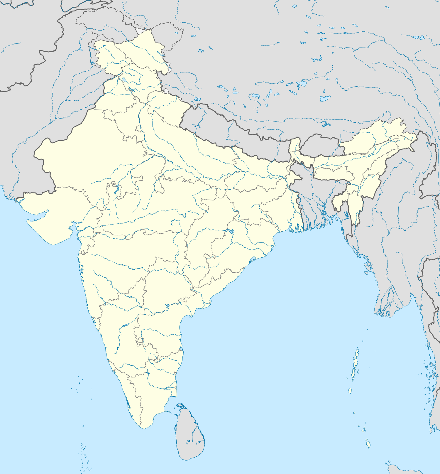
| תיאור | English: Location map of India. Equirectangular projection. Strechted by 106.0%. Geographic limits of the map:
|
| תאריך יצירה | |
| מקור | נוצר על־ידי מעלה היצירה |
| יוצר | Uwe Dedering מוויקיפדיה הגרמנית |
| גרסאות אחרות | Derivative works of this file: []
|


רישיון
 | מוענקת בכך הרשות להעתיק, להפיץ או לשנות את המסמך הזה, לפי תנאי הרישיון לשימוש חופשי במסמכים של גנו, גרסה 1.2 או כל גרסה מאוחרת יותר שתפורסם על־ידי המוסד לתוכנה חופשית; ללא פרקים קבועים, ללא טקסט עטיפה קדמית וללא טקסט עטיפה אחורית. עותק של הרישיון כלול בפרק שכותרתו הרישיון לשימוש חופשי במסמכים של גנו. |
- יש לך חופש:
- לשתף – להעתיק, להפיץ ולהעביר את העבודה
- לערבב בין עבודות – להתאים את העבודה
- תחת התנאים הבאים:
- ייחוס – יש לתת ייחוס הולם, לתת קישור לרישיון, ולציין אם נעשו שינויים. אפשר לעשות את זה בכל צורה סבירה, אבל לא בשום צורה שמשתמע ממנה שמעניק הרישיון תומך בך או בשימוש שלך.
- שיתוף זהה – יצירת רמיקס, שינוי או בנייה על סמך החומר הזה, תטיל עליך חובה להפיץ את התרומות שלך לפי תנאי רישיון זהה או תואם למקור.

Depiction of India's borders
- The territorial boundaries of India are shown as per the actual ground situation in accordance with international practices followed by the United Nations and the National Geographic Society
- This map is meant to be for illustrative purpose only and is not authenticated by official government sources. Please check the list of sources and references used to create the map for a measure of accuracy and verifiability.
- The usage of these maps in India, Pakistan and China are governed by different laws that restrict depictions of boundaries other than what is officially recognized by the state. Please check local laws and modify the map accordingly before use.
Explanation of disputed boundaries


- Boundary of Indian claim : The territory India claims is legally theirs, but the claim is disputed by China and Pakistan.
- Line of Control/Line of Conflict : The de facto administrative boundary recognised by the international community. This UN ceasefire line is considered as a temporary solution to an ongoing conflict since the departure of the British Raj.
Borders of disputed regions
The extent of the former territory of the British Indian Empire, seceeded by Republic of India depicted on this map may not be accepted by most countries as legal due to ongoing border disputes:
- The northern Himalayan region of the disputed territory Indian-administered Kashmir is claimed by India including (Pakistan-administered Kashmir) and the Chinese Occupied territory of (Ladakh plateau). It is currently divided between all three countries since 1972. See also Line of Control and Line of Actual Control.
- Siachen glacier (shown white) is an actively contested region between India and Pakistan. At present the region is in control of India since 1984.
- The northeastern territory of Arunachal Pradesh is almost entirely claimed by China as part of its Tibetan territory.
- Minor areas of eastern Ladakh, Himachal Pradesh and Uttarakhand on the Chinese frontier are claimed by China. These areas are under Indian control.
- A small area of Uttarakhand adjoining the Nepal border along the Sarda river is disputed between the two countries.
For a detailed map of all disputed regions in South Asia, see Image:India disputed areas map.svg
Internal borders
The borders of the state of Meghalaya, Assam and Arunachal Pradesh are shown as interpreted from the North-Eastern Areas (Reorganisation) Act, 1971, but has yet to be verified.
Territorial waters
The limit of the territorial waters of India extends to twelve nautical miles measured from the appropriate baseline. See this archive copy at the Wayback Machine for more information.
יומן העלאה מקורי
הועבר מ- de.wikipedia לוויקישיתוףעל ידי Uwe Dedering.
- 2010-02-21 16:39 Uwe Dedering 1500×1615× (2412750 bytes) {{Information |Beschreibung = very little borders style changes |Quelle = |Urheber = |Datum = |Genehmigung = |Andere Versionen = |Anmerkungen = }}
- 2010-02-21 14:16 Uwe Dedering 1500×1615× (2411518 bytes) {{Information |Beschreibung = North now 37.5, changed disputed areas |Quelle = |Urheber = |Datum = |Genehmigung = |Andere Versionen = |Anmerkungen = }}
- 2010-02-20 16:44 Uwe Dedering 1500×1540× (2246850 bytes) {{Information |Beschreibung = Location map of India. Equirectangular projection. Strechted by 106.0%. Geographic limits of the map: * N: 36.0° N * S: 5.0° N * W: 67.0° E * E: 99.0° E Made with Natural Earth. Free vector and raster map data @ nat
היסטוריית הקובץ
ניתן ללחוץ על תאריך/שעה כדי לראות את הקובץ כפי שנראה באותו זמן.
| תאריך/שעה | תמונה ממוזערת | ממדים | משתמש | הערה | |
|---|---|---|---|---|---|
| נוכחית | 12:24, 4 באפריל 2021 | | 1,615 × 1,500 (1.23 מ"ב) | TKsdik8900 | Fulfilling the edit request (File talk:India location map.svg#Upload more compact version of India location map) by C1MM |
| 19:50, 14 באוקטובר 2020 |  | 1,615 × 1,500 (1.64 מ"ב) | NordNordWest | correct Telangana/Andhra Pradesh | |
| 02:10, 4 בנובמבר 2019 |  | 1,615 × 1,500 (1.62 מ"ב) | RaviC | slight colour change for consistency | |
| 02:06, 4 בנובמבר 2019 |  | 1,615 × 1,500 (1.62 מ"ב) | RaviC | == {{int:filedesc}} == {{Information |Description={{en|Location map of India. Equirectangular projection. Strechted by 106.0%. Geographic limits of the map: * N: 37.5° N * S: 5.0° N * W: 67.0° E * E: 99.0° E Made with Natural Earth. Free vector and raster map data @ naturalearthdata.com.}} |Source={{own}} |Date=2010-02-20 |Author={{user at project|Uwe Dedering|wikipedia|de}} |Permission= |other_versions={{DerivativeVersions|India location map2.svg|India location map 3.png}} {{Other versions/I... | |
| 00:42, 20 באוגוסט 2014 |  | 1,615 × 1,500 (1.59 מ"ב) | M0tty | Update by Sémhur : add the state of Telangana | |
| 14:51, 7 ביוני 2011 |  | 1,615 × 1,500 (1.49 מ"ב) | NordNordWest | Nagaland corrected | |
| 19:10, 18 בינואר 2011 |  | 1,615 × 1,500 (2.36 מ"ב) | Uwe Dedering | Reverted to version as of 15:50, 17 January 2011 and again, layer structure destroyed, and first discuss this! | |
| 22:04, 17 בינואר 2011 |  | 1,615 × 1,500 (1.52 מ"ב) | AshwiniKalantri | The disputed land of Kashmir are shown in a different shade. | |
| 18:50, 17 בינואר 2011 |  | 1,615 × 1,500 (2.36 מ"ב) | Uwe Dedering | Reverted to version as of 11:34, 22 September 2010 vandalism | |
| 02:30, 17 בינואר 2011 |  | 1,615 × 1,500 (2.01 מ"ב) | AshwiniKalantri | {{Information |Description=Location Map of India |Source= |Date= |Author= |Permission= |other_versions= }} |
שימוש בקובץ
הדפים הבאים משתמשים בקובץ הזה:
שימוש גלובלי בקובץ
אתרי הוויקי האחרים הבאים משתמשים בקובץ הזה:
- שימוש באתר ace.wikipedia.org
- שימוש באתר af.wikipedia.org
- Leh
- Taj Mahal
- Amritsar
- Sjabloon:Liggingkaart Indië
- Indore
- Thane
- Bhopal
- Visakhapatnam
- Pimpri-Chinchwad
- Vadodara
- Ghaziabad
- Ludhiana
- Nashik
- Faridabad
- Meerut
- Rajkot
- Kalyan-Dombivali
- Vasai-Virar
- Srinagar
- Aurangabad
- Dhanbad
- Navi Mumbai
- Prayagraj
- Ranchi
- Haora
- Coimbatore
- Jabalpur
- Gwalior
- Vijayawada
- Jodhpur
- Madurai
- Raipur
- Kota
- Guwahati
- Chandigarh
- Solapur
- Hubli-Dharwad
- Indiese nasionale krieketspan
- Tiruchirappalli
- Thiruvananthapuram
- Krieketwêreldbeker 1987
- Krieketwêreldbeker 1996
- Krieketwêreldbeker 2011
- Krieketwêreldbeker 2023
- Jaynagar Majilpur
- Wes-Ghats
- Kushok Bakula Rimpochee Lughawe
צפייה בשימושים גלובליים נוספים של הקובץ הזה.
מטא־נתונים
Explore the world

United states
New York

Japan
Tokyo

Singapore
Singapore
