
 Français
 Italiano
גודל התצוגה המקדימה הזאת מסוג PNG של קובץ ה־SVG הזה: 800 × 588 פיקסלים. רזולוציות אחרות: 320 × 235 פיקסלים | 640 × 471 פיקסלים | 1,024 × 753 פיקסלים | 1,280 × 941 פיקסלים | 2,560 × 1,883 פיקסלים | 1,425 × 1,048 פיקסלים.
לקובץ המקורי (קובץ SVG, הגודל המקורי: 1,425 × 1,048 פיקסלים, גודל הקובץ: 1.66 מ"ב)
זהו קובץ שמקורו במיזם ויקישיתוף. תיאורו בדף תיאור הקובץ המקורי (בעברית) מוצג למטה ויקישיתוף הוא מאגר תמונות וקובצי מדיה חופשיים. אתם יכולים לעזור. |
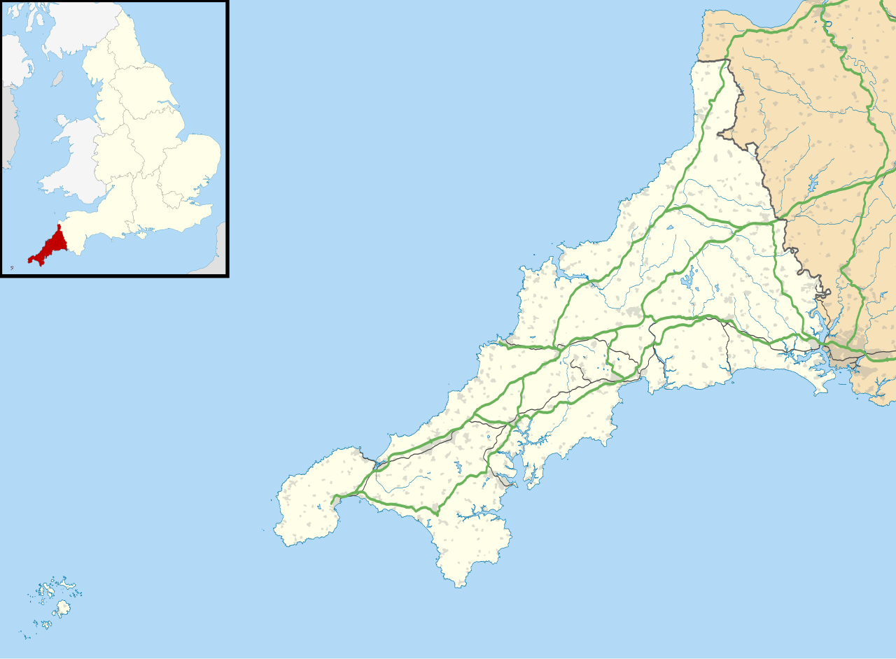
| תיאור | Map of Cornwall, UK with the following information shown:
Equirectangular map projection on WGS 84 datum, with N/S stretched 150% Geographic limits:
|
| תאריך יצירה | |
| מקור |
|
| יוצר | Nilfanion, created using Ordnance Survey data |
| אישורים והיתרים (שימוש חוזר בקובץ זה) | הקובץ הזה מתפרסם לפי תנאי רישיון קריאייטיב קומונז ייחוס-שיתוף זהה 3.0 לא מותאם. ייחוס: Contains Ordnance Survey data © Crown copyright and database right
|
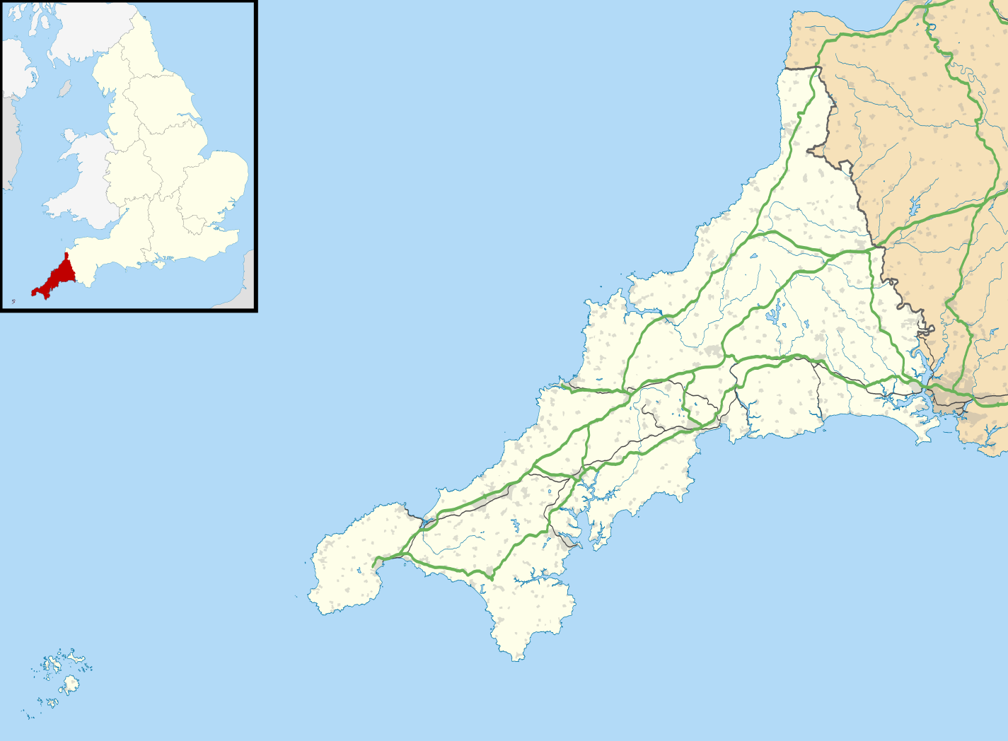
| גרסאות אחרות | File:Cornwall UK district map (blank).svg - Blank map File:Cornwall UK mainland location map.svg - Without Isles of Scilly |
.svg)
היסטוריית הקובץ
ניתן ללחוץ על תאריך/שעה כדי לראות את הקובץ כפי שנראה באותו זמן.
| תאריך/שעה | תמונה ממוזערת | ממדים | משתמש | הערה | |
|---|---|---|---|---|---|
| נוכחית | 21:43, 26 בספטמבר 2010 | | 1,048 × 1,425 (1.66 מ"ב) | Nilfanion | {{Information |Description=Map of Cornwall, UK with the following information shown: *Administrative borders *Coastline, lakes and rivers *Roads and railways *Urban areas Equirectangular map projection on WGS 84 datum, with N/S stretched 1 |
שימוש בקובץ
אין דפים המשתמשים בקובץ זה.
שימוש גלובלי בקובץ
אתרי הוויקי האחרים הבאים משתמשים בקובץ הזה:
- שימוש באתר ar.wikipedia.org
- שימוש באתר bg.wikipedia.org
- שימוש באתר ceb.wikipedia.org
- שימוש באתר en.wikipedia.org
- List of lighthouses in England
- Tintagel Castle
- Chûn Castle
- Truro Cathedral
- Port Eliot
- Lanhydrock House
- Carn Brea, Redruth
- Runnel Stone
- RAF St Mawgan
- Jamaica Inn
- List of places in Cornwall
- Penryn Campus
- St Germans Priory
- Rillaton Barrow
- Roseland Peninsula
- Pendennis Castle
- Tregenna Castle
- Tregothnan
- Picklecombe Fort
- Restormel Castle
- Redruth transmitting station
- St Bartholomew's Church, Lostwithiel
- Caradon Hill transmitting station
- Goldsithney
- Mount Wellington Tin Mine
- Brisons
- Penlee Battery
- Newquay Airport
- Geevor Tin Mine
- Botallack Mine
- Pencarrow
- Camborne School of Mines
- Prideaux Place
- Cotehele
- Trerice
- Hawker's Hut
- Land's End Airport
- The Hurlers (stone circles)
- Poldice mine
- Godolphin Estate
- Lawrence House, Launceston
- RAF Davidstow Moor
- Levant Mine and Beam Engine
- Trelissick
- Antony House
- Mount Edgcumbe House
- Trengwainton Garden
צפייה בשימושים גלובליים נוספים של הקובץ הזה.
Explore the world

United states
New York

Japan
Tokyo

Singapore
Singapore
