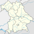
גודל התצוגה המקדימה הזאת מסוג PNG של קובץ ה־SVG הזה: 608 × 600 פיקסלים. רזולוציות אחרות: 243 × 240 פיקסלים | 487 × 480 פיקסלים | 779 × 768 פיקסלים | 1,038 × 1,024 פיקסלים | 2,077 × 2,048 פיקסלים | 867 × 855 פיקסלים.
לקובץ המקורי (קובץ SVG, הגודל המקורי: 867 × 855 פיקסלים, גודל הקובץ: 738 ק"ב)
היסטוריית הקובץ
ניתן ללחוץ על תאריך/שעה כדי לראות את הקובץ כפי שנראה באותו זמן.
| תאריך/שעה | תמונה ממוזערת | ממדים | משתמש | הערה | |
|---|---|---|---|---|---|
| נוכחית | 20:22, 19 בנובמבר 2009 |  | 855 × 867 (738 ק"ב) | Alexrk2 | fixed boundaries, rivers; adjusted map projection; colors for internal divisions |
| 23:01, 28 במרץ 2009 |  | 855 × 867 (1.05 מ"ב) | TUBS | #corrected 4 mistakes (lake margins (pasted to foreground), RegBez and counties around TIR (splited area in two counties and corrected RegBez border), County of Munich (merged), Merged an (to me right know unknown) county north of Nuremberg. #moved all gr | |
| 12:32, 28 בינואר 2009 |  | 855 × 867 (1.45 מ"ב) | TUBS | {{Information |Description= |Source= |Date= |Author= |Permission= |other_versions= }} | |
| 03:20, 28 בינואר 2009 |  | 855 × 867 (1.45 מ"ב) | TUBS | {{Information |Description= |Source= |Date= |Author= |Permission= |other_versions= }} | |
| 03:11, 27 בינואר 2009 |  | 855 × 867 (1.46 מ"ב) | TUBS | {{Information |Description= |Source= |Date= |Author= |Permission= |other_versions= }} | |
| 02:20, 27 בינואר 2009 |  | 855 × 867 (1.5 מ"ב) | TUBS | {{Information |Description= |Source= |Date= |Author= |Permission= |other_versions= }} | |
| 14:38, 26 בינואר 2009 |  | 855 × 867 (1.51 מ"ב) | TUBS | == Summary == {{Information |Description= {{de|Positionskarte Hessen, Deutschland. Geographische Begrenzung der Karte:}} {{en|Location map Bavaria, Germany. Geographic limits of the map:}} * N: 50.6303000° N * S: 47.26618 | |
| 14:24, 26 בינואר 2009 |  | 855 × 867 (1.52 מ"ב) | TUBS | == Summary == {{Information |Description= {{de|Positionskarte Hessen, Deutschland. Geographische Begrenzung der Karte:}} {{en|Location map Bavaria, Germany. Geographic limits of the map:}} * N: 50.6303000° N * S: 47.26618 |
שימוש בקובץ
אין דפים המשתמשים בקובץ זה.
שימוש גלובלי בקובץ
אתרי הוויקי האחרים הבאים משתמשים בקובץ הזה:
- שימוש באתר af.wikipedia.org
- שימוש באתר als.wikipedia.org
- שימוש באתר ar.wikipedia.org
- שימוש באתר ast.wikipedia.org
- שימוש באתר azb.wikipedia.org
צפייה בשימושים גלובליים נוספים של הקובץ הזה.


 Français
 Italiano


