
 Français
 Italiano
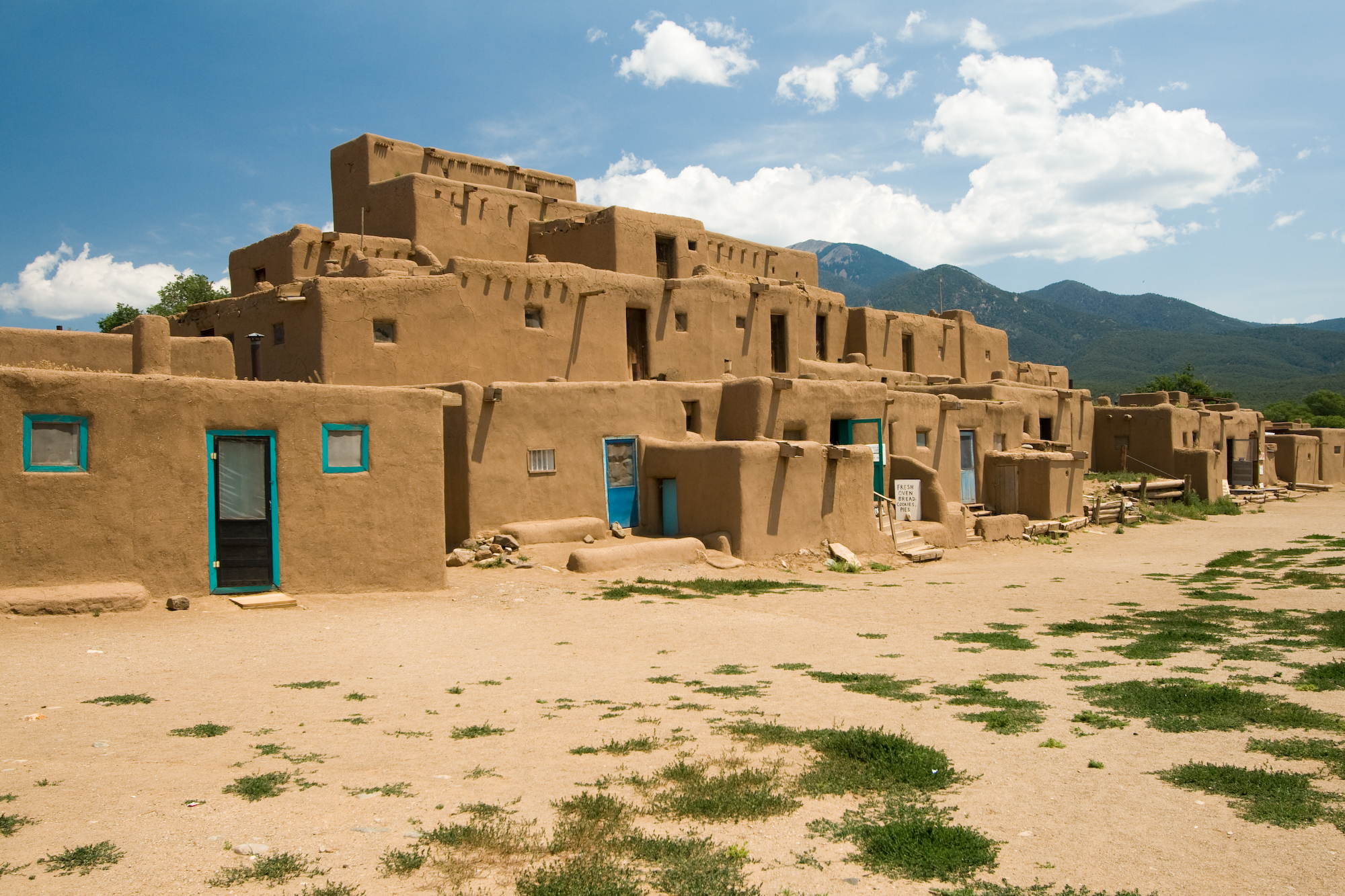
לקובץ המקורי (2,000 × 1,333 פיקסלים, גודל הקובץ: 2.37 מ"ב, סוג MIME: image/jpeg)
זהו קובץ שמקורו במיזם ויקישיתוף. תיאורו בדף תיאור הקובץ המקורי (בעברית) מוצג למטה ויקישיתוף הוא מאגר תמונות וקובצי מדיה חופשיים. אתם יכולים לעזור. |
| This is an image of a place or building that is listed on the National Register of Historic Places in the United States of America. Its reference number is 66000496. |
| תיאור | Taos Pueblo multi-storied residential complex of reddish-brown adobe. It was probably built between 1000 and 1450 A.D. Located about 1 mile (1.6 km) north of the modern city of Taos, New Mexico, USA. | ||
| תאריך יצירה | |||
| מקור | Photo taken by (Luca Galuzzi) * http://www.galuzzi.it | ||
| יוצר | Luca Galuzzi (Lucag) | ||
| אישורים והיתרים (שימוש חוזר בקובץ זה) |
I, Luca Galuzzi, בעל זכויות היוצרים על היצירה הזאת, מפרסם אותה בזאת תחת הרישיון הבא: הקובץ הזה מתפרסם לפי תנאי רישיון קריאייטיב קומונז ייחוס-שיתוף זהה 2.5 כללי. ייחוס: I, Luca Galuzzi
|

| מיקום האובייקט | | תמונה זו ותמונות נוספות במיקום: OpenStreetMap |
|---|
היסטוריית הקובץ
ניתן ללחוץ על תאריך/שעה כדי לראות את הקובץ כפי שנראה באותו זמן.
| תאריך/שעה | תמונה ממוזערת | ממדים | משתמש | הערה | |
|---|---|---|---|---|---|
| נוכחית | 00:05, 6 בספטמבר 2007 | | 1,333 × 2,000 (2.37 מ"ב) | Lucag | {{Information |Description=Taos Pueblo multi-storied residential complex of reddish-brown adobe. It was probably built between 1000 and 1450 A.D. Located about 1 mile (1.6 km) north of the modern city of Taos, New Mexico, USA. |Source=Photo taken by ([[Us |
שימוש בקובץ
אין דפים המשתמשים בקובץ זה.
שימוש גלובלי בקובץ
אתרי הוויקי האחרים הבאים משתמשים בקובץ הזה:
- שימוש באתר af.wikipedia.org
- שימוש באתר ast.wikipedia.org
- שימוש באתר bat-smg.wikipedia.org
- שימוש באתר be.wikipedia.org
- שימוש באתר bn.wikipedia.org
- שימוש באתר ca.wikipedia.org
- שימוש באתר de.wikipedia.org
- שימוש באתר de.wikibooks.org
- שימוש באתר de.wikivoyage.org
- שימוש באתר en.wikipedia.org
- Colorado Western Slope
- Pueblo Revolt
- List of National Historic Landmarks in New Mexico
- National Register of Historic Places listings in Taos County, New Mexico
- Prehistory of Colorado
- Chamuscado and Rodríguez Expedition
- Mountain states
- List of Ancestral Puebloan dwellings in Colorado
- List of Ancestral Puebloan dwellings in New Mexico
- Pueblo I Period
- Pueblo II Period
- Pueblo III Period
- Pueblo IV Period
- Basketmaker III Era
- Late Basketmaker II Era
- Early Basketmaker II Era
- Basketmaker culture
- Pueblo V Period
- Archaic–Early Basketmaker Era
- Template:Ancestral Puebloan Periods
- List of World Heritage Sites in North America
- Ancestral Puebloans
- שימוש באתר en.wikivoyage.org
- שימוש באתר es.wikipedia.org
צפייה בשימושים גלובליים נוספים של הקובץ הזה.
מטא־נתונים
Explore the world

United states
New York

Japan
Tokyo

Singapore
Singapore
