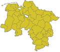
Lower_saxony_template.png (400 × 350 פיקסלים, גודל הקובץ: 14 ק"ב, סוג MIME: image/png)
היסטוריית הקובץ
ניתן ללחוץ על תאריך/שעה כדי לראות את הקובץ כפי שנראה באותו זמן.
| תאריך/שעה | תמונה ממוזערת | ממדים | משתמש | הערה | |
|---|---|---|---|---|---|
| נוכחית | 02:09, 8 באפריל 2011 |  | 350 × 400 (14 ק"ב) | Purple acid | Added the border between the exclave Fürstenhagen, which is a district of the city of Uslar belonging to the Landkreis Northeim, and the Landkreis Göttingen. Die Grenze der Exklave Fürstenhagen (Ortsteil der Stadt Uslar im Landkreis Northeim) zum Land |
| 20:33, 3 במרץ 2006 |  | 350 × 400 (11 ק"ב) | Dbenzhuser | Transparency | |
| 04:29, 9 בפברואר 2006 |  | 350 × 400 (16 ק"ב) | Ludger1961 | Map Template Lower Saxony *'''Source:''' http://en.wikipedia.org/wiki/Image:Lower_saxony_template.png {{GFDL}} |
שימוש בקובץ
אין דפים המשתמשים בקובץ זה.
שימוש גלובלי בקובץ
אתרי הוויקי האחרים הבאים משתמשים בקובץ הזה:
- שימוש באתר als.wikipedia.org
- שימוש באתר en.wikipedia.org
- שימוש באתר ha.wikipedia.org
- שימוש באתר ja.wikipedia.org


 Français
 Italiano


