
 Français
 Italiano
גודל התצוגה המקדימה הזאת מסוג PNG של קובץ ה־SVG הזה: 512 × 581 פיקסלים. רזולוציות אחרות: 211 × 240 פיקסלים | 423 × 480 פיקסלים | 677 × 768 פיקסלים | 902 × 1,024 פיקסלים | 1,805 × 2,048 פיקסלים.
לקובץ המקורי (קובץ SVG, הגודל המקורי: 512 × 581 פיקסלים, גודל הקובץ: 444 ק"ב)
זהו קובץ שמקורו במיזם ויקישיתוף. תיאורו בדף תיאור הקובץ המקורי (בעברית) מוצג למטה ויקישיתוף הוא מאגר תמונות וקובצי מדיה חופשיים. אתם יכולים לעזור. |
תקציר
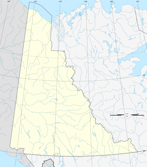
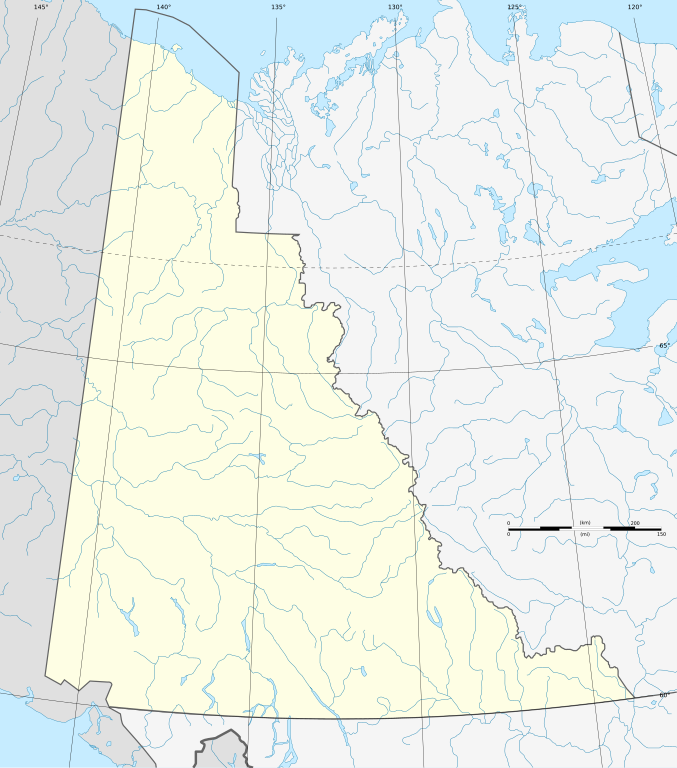
| תיאור | Albers equal-area conic projection. |
| תאריך יצירה | |
| מקור | קובץ זה הוא יצירה נגזרת של : Canada Yukon location map-albers proj.svg |
| יוצר |
|
רישיון
אני, בעל זכויות היוצרים על עבודה זו, מפרסם בזאת את העבודה תחת הרישיון הבא:
הקובץ הזה מתפרסם לפי תנאי רישיון קריאייטיב קומונז ייחוס-שיתוף זהה 3.0 לא מותאם.
- יש לך חופש:
- לשתף – להעתיק, להפיץ ולהעביר את העבודה
- לערבב בין עבודות – להתאים את העבודה
- תחת התנאים הבאים:
- ייחוס – יש לתת ייחוס הולם, לתת קישור לרישיון, ולציין אם נעשו שינויים. אפשר לעשות את זה בכל צורה סבירה, אבל לא בשום צורה שמשתמע ממנה שמעניק הרישיון תומך בך או בשימוש שלך.
- שיתוף זהה – יצירת רמיקס, שינוי או בנייה על סמך החומר הזה, תטיל עליך חובה להפיץ את התרומות שלך לפי תנאי רישיון זהה או תואם למקור.
יומן העלאה מקורי
This image is a derivative work of the following images:
- File:Canada_Yukon_location_map-albers_proj.svg licensed with Cc-by-sa-3.0
- 2012-08-06T17:20:55Z Flappiefh 512x581 (454698 Bytes)
היסטוריית הקובץ
ניתן ללחוץ על תאריך/שעה כדי לראות את הקובץ כפי שנראה באותו זמן.
| תאריך/שעה | תמונה ממוזערת | ממדים | משתמש | הערה | |
|---|---|---|---|---|---|
| נוכחית | 11:37, 19 באוגוסט 2012 | | 581 × 512 (444 ק"ב) | NordNordWest | == {{int:filedesc}} == {{Information |Description={{de|1=Positionskarte des Yukon-Territoriums, Kanada}} {{en|1=Blank administrative map of the Yukon territory, Canada, for geo-loc... |
שימוש בקובץ
אין דפים המשתמשים בקובץ זה.
שימוש גלובלי בקובץ
אתרי הוויקי האחרים הבאים משתמשים בקובץ הזה:
- שימוש באתר be.wikipedia.org
- שימוש באתר de.wikipedia.org
- Mount Logan
- Teslin Lake
- Tagish Lake
- Kluane Lake
- Shipyard Island (Yukon)
- Bennett Lake (Kanada)
- Herschel Island
- Kluane Icefield
- Keele Peak
- Tombstone Territorial Park
- Wikipedia:Kartenwerkstatt/Positionskarten/Nordamerika
- Spirit Lake (Yukon)
- Alligator Lake Volcanic Complex
- Alligator Lake (Yukon)
- Marsh Lake (Yukon)
- Lake Laberge
- Bluefish-Höhlen
- Flughafen Whitehorse
- Goldrausch in Alaska
- Kaskawulsh-Gletscher
- Vorlage:Positionskarte Kanada Yukon
- Fort Reliance (Yukon)
- Kusawa Lake
- Aishihik Lake
- Dezadeash Lake
- Kathleen Lake
- Sekulmun Lake
- Quiet Lake (Yukon)
- Little Salmon Lake
- Wolf Lake (Yukon)
- Little Atlin Lake
- Herschel Island – Qikiqtaruk Territorial Park
- Coal River Springs Territorial Park
- Ni'iinlii Njik (Fishing Branch) Territorial Park
- Benutzer:Paddelschlag/Lowell Lake
- Mount Vancouver (Nordamerika)
- Mayo Lake
- Big Kalzas Lake
- Ethel Lake (Yukon)
- Drury Lake
- Wellesley Lake
- Frances Lake
- Finlayson Lake
- Tetlʼámǟn
- Fish Lake (Whitehorse)
- Pinnacle Peak (Yukon)
- King Peak (Yukon)
- Mount Kennedy
צפייה בשימושים גלובליים נוספים של הקובץ הזה.
Explore the world

United states
New York

Japan
Tokyo

Singapore
Singapore
