
 Français
 Italiano
Taille de cet aperçu : 800 × 533 pixels. Autres résolutions : 320 × 213 pixels | 640 × 427 pixels | 1 024 × 683 pixels | 1 280 × 853 pixels | 2 560 × 1 707 pixels | 4 800 × 3 200 pixels.
Fichier d’origine (4 800 × 3 200 pixels, taille du fichier : 1,63 Mio, type MIME : image/png)
Description
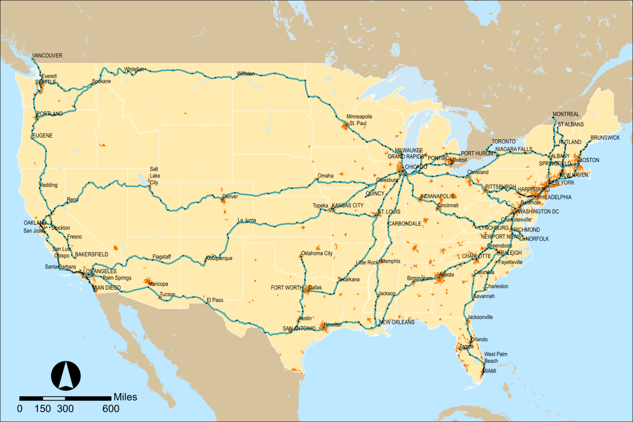
| Description | English: Map of Amtrak's rail network as of mid 2016. Updates should be uploaded as separate files rather than overwriting this one. | |||
| Date | ||||
| Source | PNG render of File:Amtrak network map 2016.svg for article use | |||
| Auteur | User:Pi.1415926535 | |||
| Autres versions |
|


Conditions d’utilisation
Moi, en tant que détenteur des droits d’auteur sur cette œuvre, je la publie sous la licence suivante :
Ce fichier est sous la licence Creative Commons Attribution – Partage dans les Mêmes Conditions 4.0 International.
- Vous êtes libre :
- de partager – de copier, distribuer et transmettre cette œuvre
- d’adapter – de modifier cette œuvre
- Sous les conditions suivantes :
- paternité – Vous devez donner les informations appropriées concernant l'auteur, fournir un lien vers la licence et indiquer si des modifications ont été faites. Vous pouvez faire cela par tout moyen raisonnable, mais en aucune façon suggérant que l’auteur vous soutient ou approuve l’utilisation que vous en faites.
- partage à l’identique – Si vous modifiez, transformez ou vous basez sur cet élément, vous devez distribuer votre contribution sous une license identique ou compatible à celle de l’original.
Historique du fichier
Cliquer sur une date et heure pour voir le fichier tel qu'il était à ce moment-là.
| Date et heure | Vignette | Dimensions | Utilisateur | Commentaire | |
|---|---|---|---|---|---|
| actuel | 18 août 2016 à 21:01 | | 4 800 × 3 200 (1,63 Mio) | Pi.1415926535 | Drop urban area threshold to match svg |
| 31 juillet 2016 à 05:37 |  | 4 800 × 3 200 (1,78 Mio) | Pi.1415926535 | == {{int:filedesc}} == {{Information |Description ={{en|1=Map of Amtrak's rail network with rail stations (black) and Thruway bus stops (grey) marked. }} |Source =PNG render of File:Amtrak network map 2016.svg for article use |Author... |
Utilisation du fichier
Aucune page n’utilise ce fichier.
Métadonnées
Explore the world

United states
New York

Japan
Tokyo

Singapore
Singapore
