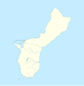
Taille de cet aperçu PNG pour ce fichier SVG : 588 × 600 pixels. Autres résolutions : 235 × 240 pixels | 470 × 480 pixels | 753 × 768 pixels | 1 004 × 1 024 pixels | 2 007 × 2 048 pixels | 1 372 × 1 400 pixels.
Fichier d’origine (Fichier SVG, nominalement de 1 372 × 1 400 pixels, taille : 66 kio)
Historique du fichier
Cliquer sur une date et heure pour voir le fichier tel qu'il était à ce moment-là.
| Date et heure | Vignette | Dimensions | Utilisateur | Commentaire | |
|---|---|---|---|---|---|
| actuel | 14 mars 2010 à 16:57 |  | 1 372 × 1 400 (66 kio) | Alexrk2 | - |
| 14 mars 2010 à 16:54 |  | 1 372 × 1 400 (66 kio) | Alexrk2 | == Beschreibung == {{Information |Description= {{de|Positionskarte von Guam, USA}} Quadratische Plattkarte, N-S-Streckung 100.0 %. Geographische Begrenzung der Karte: {{en|Location map of Guam, USA}} Equir |
Utilisation du fichier
Aucune page n’utilise ce fichier.
Usage global du fichier
Les autres wikis suivants utilisent ce fichier :
- Utilisation sur an.wikipedia.org
- Utilisation sur ar.wikipedia.org
- Utilisation sur ast.wikipedia.org
- Utilisation sur az.wikipedia.org
- Utilisation sur be.wikipedia.org
- Utilisation sur bg.wikipedia.org
- Utilisation sur ceb.wikipedia.org
- Plantilya:Location map USA Guam
- Umata
- Piti
- Santa Rita
- Cocos Lagoon
- Mushroom Rock
- Cocos Island
- Mount Santa Rosa
- Taguan Point
- Aguada River
- Liguan Point
- Perez Beach
- Namo River
- Western Shoal
- Camel Rock
- Babe Island
- Mount Schroeder
- Ladrone Islands
- Yigu
- Agat
- Matagi
- Aga Point
- Santa Rosa Reef
- Mariana Trench Marine National Monument - Vents Unit
- Polaris Point
- SW Mountain Chain
- Volcanic Outcrop through Limestone Plateau
- Talo'fo'fo
- Taogam Point
- Ugum River
- Humåtak
- Yo’ ña
- Yona
- Double Reef
- Malesso
- Inalåhan
- Agana Swamp
- Guam (pagklaro)
- Asan River
- Asan
- Hågat
Voir davantage sur l’utilisation globale de ce fichier.


 Français
 Italiano


