
 Français
 Italiano
Taille de cet aperçu PNG pour ce fichier SVG : 608 × 599 pixels. Autres résolutions : 243 × 240 pixels | 487 × 480 pixels | 779 × 768 pixels | 1 039 × 1 024 pixels | 2 077 × 2 048 pixels | 1 061 × 1 046 pixels.
Fichier d’origine (Fichier SVG, nominalement de 1 061 × 1 046 pixels, taille : 97 kio)
Description
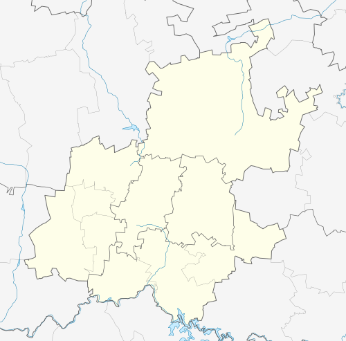
| Description | English: Location map of Gauteng Equirectangular projection, N/S stretching 111%. Geographic limits of the map:
|
| Date | |
| Source |
|
| Auteur | Htonl |
| Autorisation (Réutilisation de ce fichier) | Moi, en tant que détenteur des droits d’auteur sur cette œuvre, je la publie sous la licence suivante : Ce fichier est disponible selon les termes de la licence Creative Commons Attribution – Partage dans les Mêmes Conditions 3.0 Non Transposé.
|
| Autres versions | File:South Africa Gauteng relief location map.svg, File:Blank map of Gauteng (2011).svg |
.svg)
Historique du fichier
Cliquer sur une date et heure pour voir le fichier tel qu'il était à ce moment-là.
| Date et heure | Vignette | Dimensions | Utilisateur | Commentaire | |
|---|---|---|---|---|---|
| actuel | 5 janvier 2013 à 20:22 | | 1 061 × 1 046 (97 kio) | Htonl | == {{int:filedesc}} == {{Information |Description ={{en|Location map of en:Gauteng Equirectangular projection, N/S stretching 111%. Geographic limits of the map: * N: 25° S * S: 27° S * W: 27° E * E: 29.25° E}} |Source = * Boundari... |
Utilisation du fichier
Aucune page n’utilise ce fichier.
Usage global du fichier
Les autres wikis suivants utilisent ce fichier :
- Utilisation sur af.wikipedia.org
- Johannesburg
- Pretoria
- Heidelberg, Gauteng
- Suikerbosrand-natuurreservaat
- Roodepoort
- Sharpeville
- Centurion
- Cullinan
- Krugersdorp
- Springs
- Brakpan
- Kliptown
- Alberton
- Germiston
- Boksburg
- Benoni
- Carletonville
- Petervale, Johannesburg
- Marabastad
- Waterkloof
- Groenkloof
- Arcadia, Pretoria
- Vereeniging
- Kemptonpark
- Edenvale
- Nigel
- Meyerton
- Vanderbijlpark
- Elarduspark
- Soweto
- Wonderboomlughawe
- Irene
- Bapsfontein
- Bronkhorstspruit
- Valhalla
- Randfontein
- Randburg
- Ennerdale
- Magaliesburg
- Sophiatown
- Rosettenville
- Kleinfontein
- Linden
- Woodmead, Johannesburg
- Mabopane
- Rosebank, Johannesburg
- Atteridgeville
- Capital Park
- Hammanskraal
- Westonaria
Voir davantage sur l’utilisation globale de ce fichier.
Métadonnées
Explore the world

United states
New York

Japan
Tokyo

Singapore
Singapore
