
 Français
 Italiano
Taille de cet aperçu PNG pour ce fichier SVG : 800 × 578 pixels. Autres résolutions : 320 × 231 pixels | 640 × 462 pixels | 1 024 × 740 pixels | 1 280 × 925 pixels | 2 560 × 1 850 pixels | 1 175 × 849 pixels.
Fichier d’origine (Fichier SVG, nominalement de 1 175 × 849 pixels, taille : 145 kio)
Description
| Lieu de la prise de vue | | Voir cet endroit et d’autres images sur : OpenStreetMap |
|---|
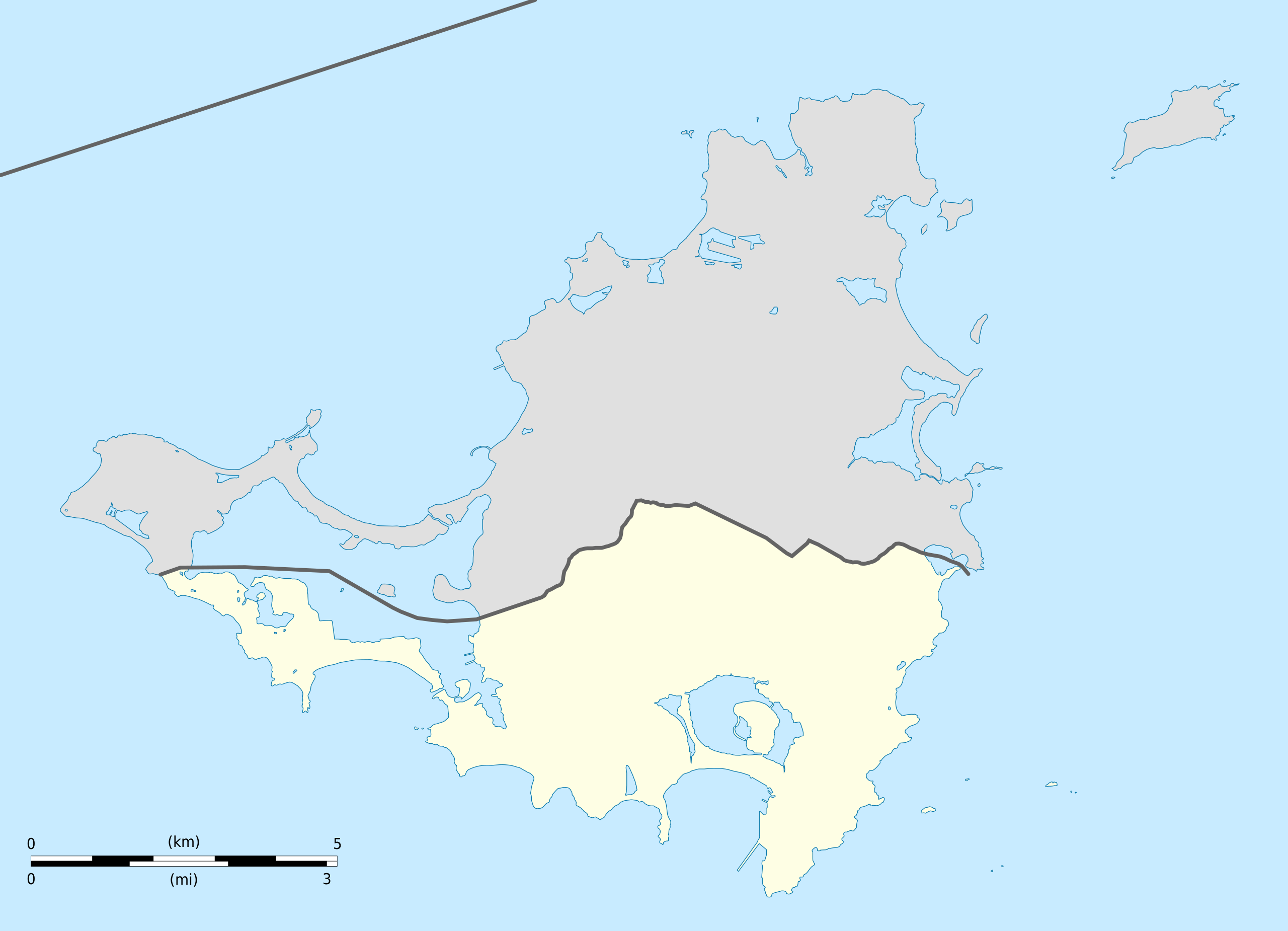
| Description | English: Blank administrative map of Sint Maarten, constituent country of the Kingdom of the Netherlands, for geo-location purpose. Français : Carte administrative vierge de Sint Maarten, État du Royaume des Pays-Bas, destinée à la géolocalisation. Estimated scale: 1:200,000 (precision: 50 m)
Geographic limits of the map:
| ||
| Date | |||
| Source | Travail personnel
| ||
| Auteur | Eric Gaba (Sting - fr:Sting) | ||
| Autorisation (Réutilisation de ce fichier) |
| ||
| Autres versions |
| ||
| SVG information |


Conditions d’utilisation
Eric Gaba, Wikimedia Commons user Sting, en tant que détenteur des droits d’auteur sur cette œuvre, la publie sous les licences suivantes :
Ce fichier est disponible selon les termes de la licence Creative Commons Attribution – Partage dans les Mêmes Conditions 3.0 Non Transposé.
Attribution: Eric Gaba, Wikimedia Commons user Sting
- Vous êtes libre :
- de partager – de copier, distribuer et transmettre cette œuvre
- d’adapter – de modifier cette œuvre
- Sous les conditions suivantes :
- paternité – Vous devez donner les informations appropriées concernant l'auteur, fournir un lien vers la licence et indiquer si des modifications ont été faites. Vous pouvez faire cela par tout moyen raisonnable, mais en aucune façon suggérant que l’auteur vous soutient ou approuve l’utilisation que vous en faites.
- partage à l’identique – Si vous modifiez, transformez ou vous basez sur cet élément, vous devez distribuer votre contribution sous une license identique ou compatible à celle de l’original.
 | Vous avez la permission de copier, distribuer et modifier ce document selon les termes de la GNU Free Documentation License version 1.2 ou toute version ultérieure publiée par la Free Software Foundation, sans sections inaltérables, sans texte de première page de couverture et sans texte de dernière page de couverture. Un exemplaire de la licence est inclus dans la section intitulée GNU Free Documentation License. |
Vous pouvez choisir l’une de ces licences.
Historique du fichier
Cliquer sur une date et heure pour voir le fichier tel qu'il était à ce moment-là.
| Date et heure | Vignette | Dimensions | Utilisateur | Commentaire | |
|---|---|---|---|---|---|
| actuel | 25 octobre 2010 à 16:41 | | 1 175 × 849 (145 kio) | Sting | == {{int:filedesc}} == {{Location|18|04|07|N|63|03|45|W|scale:100000}} <br/> {{Information |Description={{en|Blank administrative map of Sint Maarten, constituent country of the [[:en:Kingdom of the Netherl |
Utilisation du fichier
Aucune page n’utilise ce fichier.
Usage global du fichier
Les autres wikis suivants utilisent ce fichier :
- Utilisation sur af.wikipedia.org
- Utilisation sur an.wikipedia.org
- Utilisation sur ar.wikipedia.org
- Utilisation sur ast.wikipedia.org
- Utilisation sur ba.wikipedia.org
- Utilisation sur bg.wikipedia.org
- Utilisation sur bn.wikipedia.org
- Utilisation sur ceb.wikipedia.org
- Plantilya:Location map Sint Maarten
- Great Bay
- Guano Cay
- Guana Cay
- Great Salt Pond
- Beacon Hill
- Fort Hill
- Cul de Sac
- Mona Island
- Grande Bay
- Simpson Bay
- Cow and Calf
- Williams Hill
- Trial Hill
- Grande Baie
- Hen and Chicks
- Pond Island
- Ravine Rouge
- Simson Baai Lagoen
- Simson
- Pelikan
- Philipsburg
- Little Key
- Point Blanche
- Williams Hill (bungtod sa Sint Maarten)
- Trial Hill (bungtod sa Sint Maarten)
- The Devils Cupper
- Simson Bay Village
- Simpson Bay (luuk sa Sint Maarten)
- Sentry Hill (bukid sa Sint Maarten)
- Sint Peter Hill
- Saint Barthélemy Channel
- Kanaal van Rolandus
- Princess Juliana International Airport
- Philipsburg (ulohang dakbayan)
- Pelikaan Punt
- Naked Boy
- Mona Island (pulo sa Sint Maarten)
- Molly Beday
- Lower Prince's Quarter
Voir davantage sur l’utilisation globale de ce fichier.
Explore the world

United states
New York

Japan
Tokyo

Singapore
Singapore
