
 Français
 Italiano
Taille de cet aperçu : 800 × 583 pixels. Autres résolutions : 320 × 233 pixels | 640 × 467 pixels | 1 024 × 747 pixels | 1 280 × 933 pixels | 1 838 × 1 340 pixels.
Fichier d’origine (1 838 × 1 340 pixels, taille du fichier : 901 kio, type MIME : image/jpeg)
Description
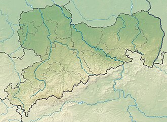
| Description | Deutsch: Physische Positionskarte Sachsen, Deutschland. Geographische Begrenzung der Karte: English: Physical Location map Saxony, Germany. Geographic limits of the map:
|
| Date | |
| Source | Travail personnel |
| Auteur | Grundkarte TUBS, Relief Alexrk2 |
| Autres versions |
|

Conditions d’utilisation
Moi, en tant que détenteur des droits d’auteur sur cette œuvre, je la publie sous les licences suivantes :
 | Vous avez la permission de copier, distribuer et modifier ce document selon les termes de la GNU Free Documentation License version 1.2 ou toute version ultérieure publiée par la Free Software Foundation, sans sections inaltérables, sans texte de première page de couverture et sans texte de dernière page de couverture. Un exemplaire de la licence est inclus dans la section intitulée GNU Free Documentation License. |
Ce fichier est sous licence Creative Commons Attribution – Partage dans les Mêmes Conditions 3.0 Non Transposé, 2.5 Générique, 2.0 Générique et 1.0 Générique.
- Vous êtes libre :
- de partager – de copier, distribuer et transmettre cette œuvre
- d’adapter – de modifier cette œuvre
- Sous les conditions suivantes :
- paternité – Vous devez donner les informations appropriées concernant l'auteur, fournir un lien vers la licence et indiquer si des modifications ont été faites. Vous pouvez faire cela par tout moyen raisonnable, mais en aucune façon suggérant que l’auteur vous soutient ou approuve l’utilisation que vous en faites.
- partage à l’identique – Si vous modifiez, transformez ou vous basez sur cet élément, vous devez distribuer votre contribution sous une license identique ou compatible à celle de l’original.
Vous pouvez choisir l’une de ces licences.
Historique du fichier
Cliquer sur une date et heure pour voir le fichier tel qu'il était à ce moment-là.
| Date et heure | Vignette | Dimensions | Utilisateur | Commentaire | |
|---|---|---|---|---|---|
| actuel | 23 octobre 2009 à 20:36 | | 1 838 × 1 340 (901 kio) | Alexrk2 | == {{int:filedesc}} == {{Information |Description= {{de|Physische Positionskarte Sachsen, Deutschland. Geographische Begrenzung der Karte:}} {{en|Physical Location map Saxony, Germany. Geographic limits of the map:}} * N: |
Utilisation du fichier
Aucune page n’utilise ce fichier.
Usage global du fichier
Les autres wikis suivants utilisent ce fichier :
- Utilisation sur ar.wikipedia.org
- Utilisation sur az.wikipedia.org
- Utilisation sur ba.wikipedia.org
- Utilisation sur be.wikipedia.org
- Utilisation sur bg.wikipedia.org
- Лайпциг
- Дрезден
- Кемниц
- Цвикау
- Шлайфе
- Бауцен
- Гросботен
- Росвайн
- Валдхайм
- Делич
- Митвайда
- Ратен
- Гьорлиц
- Майсен
- Плауен
- Шаблон:ПК Германия Саксония
- Клингентал
- Лайпцигски университет
- Бад Мускау
- Бернщат на Айген
- Еберсбах-Нойгерсдорф
- Хернхут
- Льобау
- Нойзалца-Шпремберг
- Ниски
- Остриц
- Райхенбах (Горна Лужица)
- Ротенбург (Горна Лужица)
- Зайфхенерсдорф
- Вайсвасер
- Цитау
- Бернсдорф (окръг Бауцен)
- Бишофсверда
- Елстра
- Каменц
- Гросрьорсдорф
- Хойерсверда
- Кьонигсбрюк
- Лаута
- Пулшниц
- Радеберг
- Ширгисвалде-Киршау
- Вайсенберг
- Вилтен
- Витихенау
Voir davantage sur l’utilisation globale de ce fichier.
Métadonnées
Explore the world

United states
New York

Japan
Tokyo

Singapore
Singapore
