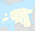
Taille de cet aperçu : 674 × 600 pixels. Autres résolutions : 270 × 240 pixels | 539 × 480 pixels | 863 × 768 pixels | 1 150 × 1 024 pixels | 2 475 × 2 203 pixels.
Fichier d’origine (2 475 × 2 203 pixels, taille du fichier : 5,84 Mio, type MIME : image/png)
Historique du fichier
Cliquer sur une date et heure pour voir le fichier tel qu'il était à ce moment-là.
| Date et heure | Vignette | Dimensions | Utilisateur | Commentaire | |
|---|---|---|---|---|---|
| actuel | 12 avril 2020 à 20:26 |  | 2 475 × 2 203 (5,84 Mio) | Tschubby | {{Information |description= |date= |source= |author= |permission= |other versions= }} |
| 20 mai 2018 à 07:55 |  | 2 588 × 2 303 (6,11 Mio) | Tschubby | {{Information |description= |source= |date= |author= |permission= |other versions= }} | |
| 15 mai 2018 à 13:46 |  | 2 588 × 2 303 (5,97 Mio) | Tschubby | {{Information |description= |source= |date= |author= |permission= |other versions= }} | |
| 15 mai 2018 à 11:30 |  | 2 588 × 2 303 (5,97 Mio) | Tschubby | == {{int:filedesc}} == {{Information |Description= {{de| Reliefkarte Estland}} Topographischer Hintergrund: [http://www2.jpl.nasa.gov/srtm NASA Shuttle Radar Topography Mission] (public domain). SRTM3 v.2. |Source={{own}} |Date= 2018-05-15 |Author= Tschubby |Permission= {{self|GFDL|Cc-by-sa-3.0-migrated|Cc-by-sa-2.5,2.0,1.0}} |other_versions= }} Category:Location maps of Estonia |
Utilisation du fichier
Aucune page n’utilise ce fichier.
Usage global du fichier
Les autres wikis suivants utilisent ce fichier :
- Utilisation sur arz.wikipedia.org
- Utilisation sur az.wikipedia.org
- Şablon:Yer xəritəsi Estoniya
- Çud gölü
- Lahemaa Milli Parkı
- Voozi boğazı
- Vyaykevyayn boğazı
- Vyəynameri boğazı
- Suurvyəyn boğazı
- Soela boğazı
- İrbe boğazı
- Kassari adası
- Hiyumaa
- Kihnu adası
- Muhu
- Ruhnu adası
- Pakri adaları
- Yulemiste gölü
- Saaremaa
- Vormsi
- Abruka adası
- Naissaar
- Vaqula gölü
- Ermistu
- Kopli yarımadası
- Yuminda yarımadası
- Karuyarv gölü
- Aeqna adası
- Vesiloo adası
- Veysyarv gölü
- Mullutu-Suurlaht gölü
- Kuremaa gölü
- Estoniya adaları
- Paunkyula su anbarı
- Viimsi yarımadası
- Sırve burnu
- Tahkuna burnu
- Baltik stansiyası (Tallin)
- Tallin körfəzi
- Pranqli adası
- Piyrisar adası
Voir davantage sur l’utilisation globale de ce fichier.


 Français
 Italiano


