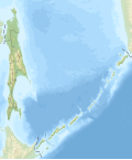
Taille de cet aperçu PNG pour ce fichier SVG : 499 × 599 pixels. Autres résolutions : 200 × 240 pixels | 400 × 480 pixels | 640 × 768 pixels | 853 × 1 024 pixels | 1 706 × 2 048 pixels | 1 127 × 1 353 pixels.
Fichier d’origine (Fichier SVG, nominalement de 1 127 × 1 353 pixels, taille : 630 kio)
Historique du fichier
Cliquer sur une date et heure pour voir le fichier tel qu'il était à ce moment-là.
| Date et heure | Vignette | Dimensions | Utilisateur | Commentaire | |
|---|---|---|---|---|---|
| actuel | 25 septembre 2010 à 07:07 |  | 1 127 × 1 353 (630 kio) | Виктор В | Reverted to version as of 04:33, 22 August 2010 |
| 25 septembre 2010 à 07:07 |  | 1 127 × 1 353 (844 kio) | Виктор В | м | |
| 22 août 2010 à 04:33 |  | 1 127 × 1 353 (630 kio) | Виктор В | == {{int:filedesc}} == {{Information |Description={{ru|1=Физическая карта Сахалинской области *Проеция — равноугольная *Стандартная параллель — 51°19′4,13″ с.ш. *Пара� |
Utilisation du fichier
Aucune page n’utilise ce fichier.
Usage global du fichier
Les autres wikis suivants utilisent ce fichier :
- Utilisation sur ab.wikipedia.org
- Utilisation sur af.wikipedia.org
- Utilisation sur als.wikipedia.org
- Utilisation sur ar.wikipedia.org
- Utilisation sur az.wikipedia.org
- Kuril adaları
- İkinci Kuril boğazı
- Bussol boğazı
- Atlasov adası
- Şumşu
- Şablon:Yer xəritəsi Saxalin vilayəti
- Onekotan
- Paramuşir
- İturup
- Zelyonı (Kuril adaları)
- Kunaşir
- Simuşir
- Urup
- Ansiferov adası
- Çirinkotan adası
- Ekarma adası
- Makanruşi
- Peskov adası
- Raykoke adası
- Rasşua adası
- Matua adası
- Ayvazovski adası
- Devyatı Val adası
- Qrinq adası
- Qneçko adası
- Farxutdinov adası
- Dalnı adası
- Srednı adası
- Şir-Daşı (Kuril adaları)
- Siqnalnı adası
- Rifovı adası
- Storojevoy adası
- Polonski adası
- Brouton adası
- Ketoy adası
- Xarimkotan
- Şiaşkotan
- Kapitsa adası
- Brat-Çirpoev adası
- Çirpoy
- Çornıye Bratya adaları
- Ruyponkitya adası
- Uşişir adaları
- Yankiç adası
- Kraternaya buxtası
Voir davantage sur l’utilisation globale de ce fichier.


 Français
 Italiano


