
 Français
 Italiano
Taille de cet aperçu : 267 × 600 pixels. Autres résolutions : 107 × 240 pixels | 213 × 480 pixels | 668 × 1 500 pixels.
Fichier d’origine (668 × 1 500 pixels, taille du fichier : 496 kio, type MIME : image/jpeg)
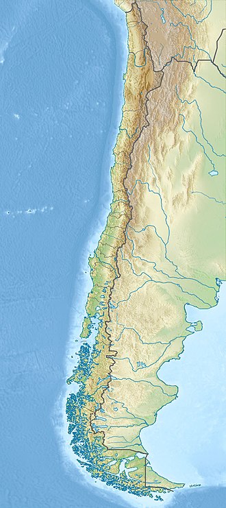
| Description | English: Location map of Chile Equirectangular projection, N/S stretching 115 %. Geographic limits of the map:
|
| Date | (UTC) |
| Source |
|
| Auteur |
|
| Cette image a été retouchée, ce qui signifie qu'elle a été modifiée par ordinateur et est différente de l'image d'origine. L'image d'origine se trouve ici : Chile location map.svg:
|
Moi, en tant que détenteur des droits d’auteur sur cette œuvre, je la publie sous les licences suivantes :
Ce fichier est disponible selon les termes de la licence Creative Commons Attribution – Partage dans les Mêmes Conditions 3.0 Non Transposé.
- Vous êtes libre :
- de partager – de copier, distribuer et transmettre cette œuvre
- d’adapter – de modifier cette œuvre
- Sous les conditions suivantes :
- paternité – Vous devez donner les informations appropriées concernant l'auteur, fournir un lien vers la licence et indiquer si des modifications ont été faites. Vous pouvez faire cela par tout moyen raisonnable, mais en aucune façon suggérant que l’auteur vous soutient ou approuve l’utilisation que vous en faites.
- partage à l’identique – Si vous modifiez, transformez ou vous basez sur cet élément, vous devez distribuer votre contribution sous une license identique ou compatible à celle de l’original.
 | Vous avez la permission de copier, distribuer et modifier ce document selon les termes de la GNU Free Documentation License version 1.2 ou toute version ultérieure publiée par la Free Software Foundation, sans sections inaltérables, sans texte de première page de couverture et sans texte de dernière page de couverture. Un exemplaire de la licence est inclus dans la section intitulée GNU Free Documentation License. |
Vous pouvez choisir l’une de ces licences.
Journal des téléversements d’origine
This image is a derivative work of the following images:
- File:Chile_location_map.svg licensed with Cc-by-sa-3.0, GFDL
- 2010-11-19T10:03:21Z NordNordWest 1183x2658 (1300094 Bytes) Reverted to version as of 18:34, 29 August 2010: see file discussion
- 2010-11-18T00:30:27Z Createaccount 1183x2658 (1306572 Bytes) antartic territories added
- 2010-08-29T18:34:57Z Createaccount 1183x2658 (1300094 Bytes) Maritime Grenze auf der Magellanstraße und Beagle-Kanal gezeichnet
- 2009-05-20T20:05:21Z NordNordWest 1183x2658 (1277602 Bytes) {{Information |Description= {{de|Positionskarte von [[:de:Chile|Chile]]}} Quadratische Plattkarte, N-S-Streckung 115 %. Geographische Begrenzung der Karte: * N: 17.4° S * S: 56.5° S * W: 81.5° W * O: 61.5° W {{en|Location
Téléversé avec derivativeFX
Historique du fichier
Cliquer sur une date et heure pour voir le fichier tel qu'il était à ce moment-là.
| Date et heure | Vignette | Dimensions | Utilisateur | Commentaire | |
|---|---|---|---|---|---|
| actuel | 5 septembre 2018 à 22:56 | | 668 × 1 500 (496 kio) | Janitoalevic | Ñuble Region |
| 18 mai 2018 à 22:42 |  | 668 × 1 500 (496 kio) | Janitoalevic | Without Ñuble Region | |
| 18 mai 2018 à 22:40 |  | 668 × 1 500 (496 kio) | Janitoalevic | Better quality | |
| 11 octobre 2017 à 17:44 |  | 668 × 1 500 (506 kio) | Janitoalevic | More precise borders | |
| 20 mars 2016 à 18:43 |  | 668 × 1 500 (515 kio) | Janitoalevic | Fixed Small issues, as the svg. | |
| 2 mars 2016 à 21:48 |  | 668 × 1 500 (529 kio) | Janitoalevic | Updated as the svg | |
| 24 mai 2015 à 18:48 |  | 668 × 1 500 (236 kio) | Janitoalevic | Added Southern Patagonian Ice Field (Campo de hielo Patagónico Sur) undefined limit, since 1998 For more information read: https://en.wikipedia.org/wiki/Southern_Patagonian_Ice_Field#Borderline | |
| 27 novembre 2010 à 18:35 |  | 668 × 1 500 (224 kio) | Виктор В | {{Information |Description={{en|Location map of Chile}} Equirectangular projection, N/S stretching 115 %. Geographic limits of the map: * N: 17.4° S * S: 56.5° S * W: 81.5° W * E: 61.5° W |Source=*File:Chile_location_map.svg *S |
Utilisation du fichier
Aucune page n’utilise ce fichier.
Usage global du fichier
Les autres wikis suivants utilisent ce fichier :
- Utilisation sur als.wikipedia.org
- Utilisation sur ar.wikipedia.org
- Utilisation sur arz.wikipedia.org
- Utilisation sur ast.wikipedia.org
- Utilisation sur az.wikipedia.org
- Kopaue
- Şablon:Yer xəritəsi Çili
- Atakama
- Çili dənizi
- Cakao boğazı
- Bransuik yarımadası
- Taytao yarımadası
- Odlu Torpaq (ada)
- Ofqui bərzəği
- Vellinqton (ada)
- Pataqoniya arxipelaqı
- Riesko
- Odlu Torpaq (arxipelaq)
- İldefonso adaları
- Dieqo-Ramires adaları
- Çiloe
- Maqdalena adası
- Tamaruqal
- Horn burnu
- Oxos-del-Salado vulkanı
- Salar de Atakama
- Yalançı Horn burnu
- Motu-Nui
- Matu-İti
- Rapanui Milli Parkı
- Utilisation sur ba.wikipedia.org
- Utilisation sur be.wikipedia.org
Voir davantage sur l’utilisation globale de ce fichier.
Métadonnées
Explore the world

United states
New York

Japan
Tokyo

Singapore
Singapore
