
 Français
 Italiano
Taille de cet aperçu PNG pour ce fichier SVG : 527 × 524 pixels. Autres résolutions : 241 × 240 pixels | 483 × 480 pixels | 772 × 768 pixels | 1 030 × 1 024 pixels | 2 060 × 2 048 pixels.
Fichier d’origine (Fichier SVG, nominalement de 527 × 524 pixels, taille : 1,22 Mio)
Description
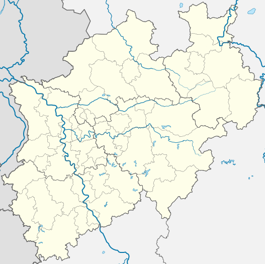
| Description | Deutsch: Positionskarte Nordrhein-Westfalen, Germany. Geographische Begrenzung der Karte: English: Location map North Rhine-Westphalia, Germany. Geographic limits of the map: Français : Carte du land Rhénanie-du-Nord-Westphalie (Allemagne) destinée à géolocalisation. Les limites géographiques sont:
| |||||||||||||
| Date | ||||||||||||||
| Source | Travail personnel, based on (not all layers may be visible or included):
Only to compare some issues: | |||||||||||||
| Auteur | TUBS | |||||||||||||
| Autres versions | []
| |||||||||||||
| SVG information | Le code de ce fichier SVG n'est pas valide en raison de 5 erreurs. Cette carte W3C-invalide a été créée avec Adobe Illustrator |


Conditions d’utilisation
TUBS
 , en tant que détenteur des droits d’auteur sur cette œuvre, la publie sous les licences suivantes :
 | Vous avez la permission de copier, distribuer et modifier ce document selon les termes de la GNU Free Documentation License version 1.2 ou toute version ultérieure publiée par la Free Software Foundation, sans sections inaltérables, sans texte de première page de couverture et sans texte de dernière page de couverture. Un exemplaire de la licence est inclus dans la section intitulée GNU Free Documentation License. |
Ce fichier est sous licence Creative Commons Attribution 3.0 Non Transposé, 2.5 Générique, 2.0 Générique et 1.0 Générique.
Attribution: TUBS
- Vous êtes libre :
- de partager – de copier, distribuer et transmettre cette œuvre
- d’adapter – de modifier cette œuvre
- Sous les conditions suivantes :
- paternité – Vous devez donner les informations appropriées concernant l'auteur, fournir un lien vers la licence et indiquer si des modifications ont été faites. Vous pouvez faire cela par tout moyen raisonnable, mais en aucune façon suggérant que l’auteur vous soutient ou approuve l’utilisation que vous en faites.
Ce fichier est sous licence Creative Commons Attribution – Partage dans les Mêmes Conditions 3.0 Non Transposé, 2.5 Générique, 2.0 Générique et 1.0 Générique.
Attribution: TUBS
- Vous êtes libre :
- de partager – de copier, distribuer et transmettre cette œuvre
- d’adapter – de modifier cette œuvre
- Sous les conditions suivantes :
- paternité – Vous devez donner les informations appropriées concernant l'auteur, fournir un lien vers la licence et indiquer si des modifications ont été faites. Vous pouvez faire cela par tout moyen raisonnable, mais en aucune façon suggérant que l’auteur vous soutient ou approuve l’utilisation que vous en faites.
- partage à l’identique – Si vous modifiez, transformez ou vous basez sur cet élément, vous devez distribuer votre contribution sous une license identique ou compatible à celle de l’original.
| Ce fichier est dans le domaine public selon les termes de la licence Creative Commons CC0 1.0 Universel. | |
| La personne qui a associé une œuvre avec cet acte l’a placée dans le domaine public en renonçant mondialement à tous ses droits sur cette œuvre en vertu des lois relatives au droit d’auteur, ainsi qu’à tous les droits juridiques connexes et voisins qu’elle possédait sur l’œuvre, sans autre limite que celles imposées par la loi. Vous pouvez copier, modifier, distribuer et utiliser cette œuvre, y compris à des fins commerciales, sans qu’il soit nécessaire d’en demander la permission.
|
| Moi, propriétaire des droits d’auteur sur cette œuvre, la place dans le domaine public. Ceci s'applique dans le monde entier. Dans certains pays, ceci peut ne pas être possible ; dans ce cas : J’accorde à toute personne le droit d’utiliser cette œuvre dans n’importe quel but, sans aucune condition, sauf celles requises par la loi. |
| Copyleft : cette œuvre d’art est libre ; vous pouvez la redistribuer ou la modifier selon les termes de la licence Art Libre. Vous trouverez un exemplaire de cette licence sur le site Copyleft Attitude ainsi que sur d’autres sites. |
 | Le détenteur des droits d’auteur de ce fichier, TUBS |
|
|
Vous pouvez choisir l’une de ces licences.
 | J'apprécierais que vous attribuiez ce média à Wikimedia Commons, s’il est utilisé en dehors de Wikipédia ou Wikimedia Commons. Pour une utilisation dans des publications (telles que livres, journaux, blogs, sites Web, etc), veuillez insérer la ligne suivante dans sa page de discussion :
|
Historique du fichier
Cliquer sur une date et heure pour voir le fichier tel qu'il était à ce moment-là.
| Date et heure | Vignette | Dimensions | Utilisateur | Commentaire | |
|---|---|---|---|---|---|
| actuel | 16 décembre 2009 à 19:35 | | 527 × 524 (1,22 Mio) | TUBS | korr crop area |
| 20 octobre 2009 à 09:05 |  | 657 × 656 (476 kio) | TUBS | -ac | |
| 26 janvier 2009 à 20:33 |  | 657 × 656 (479 kio) | TUBS | {{Information |Description= |Source= |Date= |Author= |Permission= |other_versions= }} | |
| 26 janvier 2009 à 20:26 |  | 657 × 656 (479 kio) | TUBS | {{Information |Description= |Source= |Date= |Author= |Permission= |other_versions= }} | |
| 4 novembre 2008 à 08:23 |  | 657 × 656 (429 kio) | TUBS | {{Information |Description= |Source= |Date= |Author= |Permission= |other_versions= }} | |
| 9 octobre 2008 à 08:40 |  | 657 × 656 (424 kio) | TUBS | {{Information |Description= |Source= |Date= |Author= |Permission= |other_versions= }} | |
| 9 octobre 2008 à 08:38 |  | 688 × 688 (424 kio) | TUBS | {{Information |Description= |Source= |Date= |Author= |Permission= |other_versions= }} | |
| 8 octobre 2008 à 08:44 |  | 654 × 656 (424 kio) | TUBS | *reduced stroke thickness again (rivers and districts) | |
| 8 octobre 2008 à 08:27 |  | 654 × 656 (424 kio) | TUBS | *lightened district borders | |
| 8 octobre 2008 à 08:09 |  | 654 × 656 (424 kio) | TUBS | *added transpareny to all those above-rivers-lines *moved the rivers aside the borders |
Utilisation du fichier
Aucune page n’utilise ce fichier.
Usage global du fichier
Les autres wikis suivants utilisent ce fichier :
- Utilisation sur als.wikipedia.org
- Utilisation sur ar.wikipedia.org
- Utilisation sur azb.wikipedia.org
- Utilisation sur az.wikipedia.org
- Vuppertal
- Şablon:Yer xəritəsi Almaniya Şimali Reyn-Vestfaliya
- Kosfeld
- Hagen
- Hamm
- Mönxenqladbax
- Mülhaym
- Münster
- Remşayd
- Herne (Şimali Reyn-Vestfaliya)
- Drenştaynfurt
- İsselburq
- Ştaynfurt
- Varendorf
- Zassenberq
- Zendenhorst
- Hayligenhaus
- Ratingen
- Verl
- Datteln
- Emsdetten
- Or-Erkenşvik
- Rede
- Telqte
- Teklenburq
- Velen
- Villix
- Ziqen
- UEFA Avropa Liqası 2019/2020
- Utilisation sur ba.wikipedia.org
- Utilisation sur bg.wikipedia.org
- Utilisation sur bn.wikipedia.org
- Utilisation sur ceb.wikipedia.org
- Utilisation sur cs.wikipedia.org
- Utilisation sur cv.wikipedia.org
Voir davantage sur l’utilisation globale de ce fichier.
Explore the world

United states
New York

Japan
Tokyo

Singapore
Singapore
