
 Français
 Italiano
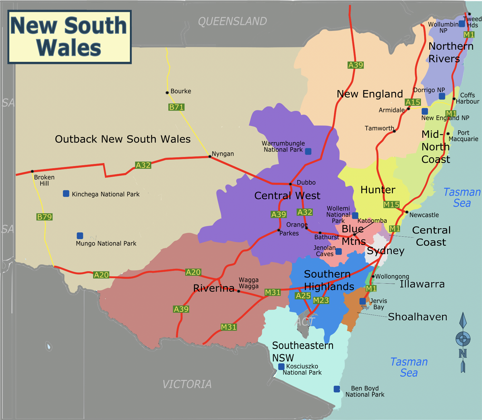
Taille de cet aperçu : 689 × 600 pixels. Autres résolutions : 276 × 240 pixels | 551 × 480 pixels | 882 × 768 pixels | 1 176 × 1 024 pixels | 1 592 × 1 386 pixels.
Fichier d’origine (1 592 × 1 386 pixels, taille du fichier : 1,26 Mio, type MIME : image/png)
Description
Cette image matricielle PNG a été créée avec Inkscape .
| Description | A static map of the regions of New South Wales, for use on voy:en:New South Wales. |
| Date | |
| Source | Travail personnel based on File:Australia New South Wales location map.svg |
| Auteur | SHB2000 |
| Autres versions | SVG version |
Conditions d’utilisation
Ce fichier est disponible selon les termes de la licence Creative Commons Attribution – Partage dans les Mêmes Conditions 3.0 Non Transposé.
- Vous êtes libre :
- de partager – de copier, distribuer et transmettre cette œuvre
- d’adapter – de modifier cette œuvre
- Sous les conditions suivantes :
- paternité – Vous devez donner les informations appropriées concernant l'auteur, fournir un lien vers la licence et indiquer si des modifications ont été faites. Vous pouvez faire cela par tout moyen raisonnable, mais en aucune façon suggérant que l’auteur vous soutient ou approuve l’utilisation que vous en faites.
- partage à l’identique – Si vous modifiez, transformez ou vous basez sur cet élément, vous devez distribuer votre contribution sous une license identique ou compatible à celle de l’original.
Historique du fichier
Cliquer sur une date et heure pour voir le fichier tel qu'il était à ce moment-là.
| Date et heure | Vignette | Dimensions | Utilisateur | Commentaire | |
|---|---|---|---|---|---|
| actuel | 28 juin 2022 à 11:49 | | 1 592 × 1 386 (1,26 Mio) | SHB2000 | Update PNG file |
| 24 juin 2022 à 12:23 |  | 1 398 × 1 208 (1 022 kio) | SHB2000 | update png file | |
| 24 juin 2022 à 07:58 |  | 744 × 1 052 (87 kio) | SHB2000 | {{Information |Description=A static map of the regions of New South Wales, for use on voy:en:New South Wales. |Source={{own}} based on File:Australia New South Wales location map.svg |Date=2022-06-24 |Author=SHB2000 |Permission= |other_versions=SVG version }} |
Utilisation du fichier
La page suivante utilise ce fichier :
Usage global du fichier
Les autres wikis suivants utilisent ce fichier :
- Utilisation sur en.wikivoyage.org
- Utilisation sur ru.wikipedia.org
- Utilisation sur ru.wikivoyage.org
- Utilisation sur to.wikipedia.org
Métadonnées
Explore the world

United states
New York

Japan
Tokyo

Singapore
Singapore
