
 Français
 Italiano
Taille de cet aperçu PNG pour ce fichier SVG : 300 × 599 pixels. Autres résolutions : 120 × 240 pixels | 240 × 480 pixels | 384 × 768 pixels | 513 × 1 024 pixels | 1 026 × 2 048 pixels | 1 102 × 2 200 pixels.
Fichier d’origine (Fichier SVG, nominalement de 1 102 × 2 200 pixels, taille : 42 kio)
_location_map.svg)
Description
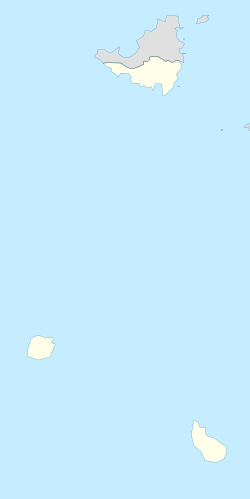
| Description | Deutsch: de|1=Positionskarte der Niederländische Antillen (Inseln über dem Winde) Quadratische Plattkarte, N-S-Streckung 107 %, Geographische Begrenzung der Karte:
English: Location map of the Netherlands Antilles (Leeward Islands) Equirectangular projection, N/S stretching 107 %, Geographic limits of the map:
|
| Date | |
| Source | Travail personnel |
| Auteur | Rosso Robot |
| SVG information |
 | Cette carte a été créée ou améliorée dans le Kartenwerkstatt (Atelier cartographique allemand). Vous pouvez également y proposer des cartes à améliorer. |
Conditions d’utilisation
Moi, en tant que détenteur des droits d’auteur sur cette œuvre, je la publie sous les licences suivantes :
Ce fichier est disponible selon les termes de la licence Creative Commons Attribution – Partage dans les Mêmes Conditions 3.0 Non Transposé.
- Vous êtes libre :
- de partager – de copier, distribuer et transmettre cette œuvre
- d’adapter – de modifier cette œuvre
- Sous les conditions suivantes :
- paternité – Vous devez donner les informations appropriées concernant l'auteur, fournir un lien vers la licence et indiquer si des modifications ont été faites. Vous pouvez faire cela par tout moyen raisonnable, mais en aucune façon suggérant que l’auteur vous soutient ou approuve l’utilisation que vous en faites.
- partage à l’identique – Si vous modifiez, transformez ou vous basez sur cet élément, vous devez distribuer votre contribution sous une license identique ou compatible à celle de l’original.
 | Vous avez la permission de copier, distribuer et modifier ce document selon les termes de la GNU Free Documentation License version 1.2 ou toute version ultérieure publiée par la Free Software Foundation, sans sections inaltérables, sans texte de première page de couverture et sans texte de dernière page de couverture. Un exemplaire de la licence est inclus dans la section intitulée GNU Free Documentation License. |
Vous pouvez choisir l’une de ces licences.
Historique du fichier
Cliquer sur une date et heure pour voir le fichier tel qu'il était à ce moment-là.
| Date et heure | Vignette | Dimensions | Utilisateur | Commentaire | |
|---|---|---|---|---|---|
| actuel | 13 juin 2009 à 14:55 | | 1 102 × 2 200 (42 kio) | Rosso Robot | (c) |
| 13 juin 2009 à 14:51 |  | 1 102 × 2 200 (42 kio) | Rosso Robot | (c) | |
| 13 juin 2009 à 14:42 |  | 1 102 × 2 200 (52 kio) | Rosso Robot | solved trace error | |
| 12 juin 2009 à 10:45 |  | 1 102 × 2 200 (122 kio) | Rosso Robot | cropped map | |
| 12 juin 2009 à 10:38 |  | 2 200 × 2 200 (122 kio) | Rosso Robot | {{Information |Description={{de|1=de|1=Positionskarte der Niederländische Antillen (Inseln über dem Winde) Quadratische Plattkarte, N-S-Streckung 107 %, Geographische Begrenzun |
Utilisation du fichier
Aucune page n’utilise ce fichier.
Usage global du fichier
Les autres wikis suivants utilisent ce fichier :
- Utilisation sur af.wikipedia.org
- Utilisation sur ar.wikipedia.org
- Utilisation sur ast.wikipedia.org
- Utilisation sur be.wikipedia.org
- Utilisation sur ceb.wikipedia.org
- Utilisation sur de.wikipedia.org
- Liste der Nationalparks im Königreich der Niederlande
- Mount Scenery
- Wikipedia:Kartenwerkstatt/Positionskarten/Nordamerika
- Juancho E. Yrausquin Airport
- Green Island (Saba)
- The Quill (Vulkan)
- Vorlage:Positionskarte Niederländische Antillen (Inseln über dem Winde)
- Wikipedia:Kartenwerkstatt/Archiv/2009-06
- Wikipedia Diskussion:WikiProjekt Georeferenzierung/Archiv/2017-I
- Saba National Marine Park
- Fort Bay
- Ladder Bay
- Utilisation sur el.wikipedia.org
- Utilisation sur en.wikipedia.org
- Utilisation sur eo.wikipedia.org
- Utilisation sur fa.wikipedia.org
- Utilisation sur fr.wikipedia.org
- Saba
- Saint-Eustache (Antilles)
- The Bottom
- Oranjestad (Saint-Eustache)
- Mont Scenery
- Quill (volcan)
- Modèle:Géolocalisation/Îles SSS
- Windwardside
- Zion's Hill
- Aéroport Juancho E. Yrausquin
- Phare d'Oranjestad
- Phare de St. John's
- Phare de Klein Curaçao
- Fort Willem I
- Fort Amsterdam (Saint-Martin)
- Musée Harry L. Johnson de Windwardside
Voir davantage sur l’utilisation globale de ce fichier.
_location_map.svg)
_location_map.svg)
Explore the world

United states
New York

Japan
Tokyo

Singapore
Singapore
