
 Français
 Italiano
Taille de cet aperçu PNG pour ce fichier SVG : 440 × 600 pixels. Autres résolutions : 176 × 240 pixels | 352 × 480 pixels | 563 × 768 pixels | 751 × 1 024 pixels | 1 503 × 2 048 pixels | 1 400 × 1 908 pixels.
Fichier d’origine (Fichier SVG, nominalement de 1 400 × 1 908 pixels, taille : 136 kio)
Description
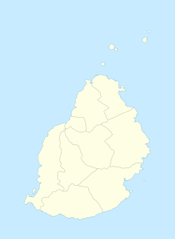
| Description | English: Location map of Mauritius Equirectangular projection. Stretched by 106.0%. Geographic limits of the map:
|
| Date | |
| Source | Travail personnel |
| Auteur | Uwe Dedering |
Conditions d’utilisation
Uwe Dedering sur Wikipédia allemand, en tant que détenteur des droits d’auteur sur cette œuvre, la publie sous les licences suivantes :
 | Vous avez la permission de copier, distribuer et modifier ce document selon les termes de la GNU Free Documentation License version 1.2 ou toute version ultérieure publiée par la Free Software Foundation, sans sections inaltérables, sans texte de première page de couverture et sans texte de dernière page de couverture. Un exemplaire de la licence est inclus dans la section intitulée GNU Free Documentation License. |
Ce fichier est disponible selon les termes de la licence Creative Commons Attribution – Partage dans les Mêmes Conditions 3.0 Non Transposé.
Attribution: Uwe Dedering sur Wikipédia allemand
- Vous êtes libre :
- de partager – de copier, distribuer et transmettre cette œuvre
- d’adapter – de modifier cette œuvre
- Sous les conditions suivantes :
- paternité – Vous devez donner les informations appropriées concernant l'auteur, fournir un lien vers la licence et indiquer si des modifications ont été faites. Vous pouvez faire cela par tout moyen raisonnable, mais en aucune façon suggérant que l’auteur vous soutient ou approuve l’utilisation que vous en faites.
- partage à l’identique – Si vous modifiez, transformez ou vous basez sur cet élément, vous devez distribuer votre contribution sous une license identique ou compatible à celle de l’original.
Ce fichier est disponible selon les termes de la licence Creative Commons Attribution – Partage dans les Mêmes Conditions 3.0 Allemagne.
Attribution: Uwe Dedering sur Wikipédia allemand
- Vous êtes libre :
- de partager – de copier, distribuer et transmettre cette œuvre
- d’adapter – de modifier cette œuvre
- Sous les conditions suivantes :
- paternité – Vous devez donner les informations appropriées concernant l'auteur, fournir un lien vers la licence et indiquer si des modifications ont été faites. Vous pouvez faire cela par tout moyen raisonnable, mais en aucune façon suggérant que l’auteur vous soutient ou approuve l’utilisation que vous en faites.
- partage à l’identique – Si vous modifiez, transformez ou vous basez sur cet élément, vous devez distribuer votre contribution sous une license identique ou compatible à celle de l’original.

Vous pouvez choisir l’une de ces licences.
Journal des téléversements d’origine
Transféré de de.wikipedia à Commons par Uwe Dedering.
La page de description originale était ici. Tous les noms d'utilisateur qui suivent se rapportent à de.wikipedia.
- 2010-02-16 15:29 Uwe Dedering 1400×1908× (52333 bytes) {{Information |Beschreibung = Location map of Mauritius Equirectangular projection. Stretched by 106.0%. Geographic limits of the map: * N: -19.7° N * S: -20.6° N * W: 57.21° E * E: 57.91° E Made with Natural Earth. Free vector and raster map data @ naturalearthdata.com. |Quelle = own work |Urheber = [[Benutzer:Uwe Dedering|Uwe Dedering]] |Datum = 20100216 |Genehmigung = |Andere Versionen = |Anmerkungen = more islands }}
- 2010-02-16 12:41 Uwe Dedering 1400×1484× (16125 bytes) {{Information |Beschreibung = Location map of Mauritius Equirectangular projection. Stretched by 106.0%. Geographic limits of the map: * N: -19.9° N * S: -20.6° N * W: 57.2° E * E: 57.9° E Made with Natural Earth. Free vector and raster map da
Historique du fichier
Cliquer sur une date et heure pour voir le fichier tel qu'il était à ce moment-là.
| Date et heure | Vignette | Dimensions | Utilisateur | Commentaire | |
|---|---|---|---|---|---|
| actuel | 5 octobre 2011 à 18:14 | | 1 400 × 1 908 (136 kio) | Yash400 | Reverted to version as of 14:15, 9 December 2010 |
| 5 octobre 2011 à 18:12 |  | 1 400 × 1 908 (136 kio) | Yash400 | Reverted to version as of 14:15, 9 December 2010 | |
| 5 octobre 2011 à 18:11 |  | 1 400 × 1 908 (136 kio) | Yash400 | Reverted to version as of 14:15, 9 December 2010 | |
| 5 octobre 2011 à 18:11 |  | 1 400 × 1 908 (41 kio) | Yash400 | Reverted to version as of 10:10, 2 October 2011 | |
| 2 octobre 2011 à 18:16 |  | 1 400 × 1 908 (39 kio) | Yash400 | change colour | |
| 2 octobre 2011 à 10:10 |  | 1 400 × 1 908 (41 kio) | Yash400 | exact size needed | |
| 2 octobre 2011 à 09:54 |  | 1 810 × 2 160 (1,3 Mio) | Yash400 | update size of map | |
| 2 octobre 2011 à 09:42 |  | 1 810 × 2 160 (1,3 Mio) | Yash400 | more islets added | |
| 9 décembre 2010 à 14:15 |  | 1 400 × 1 908 (136 kio) | Uwe Dedering | coastline completly new | |
| 16 février 2010 à 21:56 |  | 1 400 × 1 908 (51 kio) | Uwe Dedering | {{Information |Description={{de|Location map of Mauritius Equirectangular projection. Stretched by 106.0%. Geographic limits of the map: * N: -19.7° N * S: -20.6° N * W: 57.21° E * E: 57.91° E Made with Natural Earth. Free vector and raster map data @ |
Utilisation du fichier
Aucune page n’utilise ce fichier.
Usage global du fichier
Les autres wikis suivants utilisent ce fichier :
- Utilisation sur af.wikipedia.org
- Utilisation sur am.wikipedia.org
- Utilisation sur an.wikipedia.org
- Utilisation sur ar.wikipedia.org
- Utilisation sur ast.wikipedia.org
- Utilisation sur az.wikipedia.org
- Utilisation sur ba.wikipedia.org
- Utilisation sur be-tarask.wikipedia.org
- Utilisation sur be.wikipedia.org
- Utilisation sur bg.wikipedia.org
- Utilisation sur bn.wikipedia.org
- Utilisation sur bs.wikipedia.org
- Utilisation sur ca.wikipedia.org
- Utilisation sur ceb.wikipedia.org
- Plantilya:Location map Mauritius
- Sandy Island
- Sandy Islet
- The Narrows
- Bird Island
- Bird Islet
- Rocky Point
- Cat Island
- Devils Point
- Sand Point
- The Bluff
- Diamond Point
- Combo
- Nelson
- Noire
- West Peak
- Whale Rock
- Albion
- Oliva (pagklaro)
- Rodriguez
- East Peak
- Flat Island
- Saint-André (pagklaro)
- Roche Baleine
- Grande Pointe
- Ile Coco
Voir davantage sur l’utilisation globale de ce fichier.
Explore the world

United states
New York

Japan
Tokyo

Singapore
Singapore
