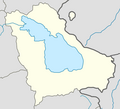
Location_map_Armenia_Gegharkunik_province.png (465 × 424 pixels, taille du fichier : 43 kio, type MIME : image/png)
Historique du fichier
Cliquer sur une date et heure pour voir le fichier tel qu'il était à ce moment-là.
| Date et heure | Vignette | Dimensions | Utilisateur | Commentaire | |
|---|---|---|---|---|---|
| actuel | 20 février 2011 à 10:07 |  | 465 × 424 (43 kio) | Pandukht | {{Information |Description ={{en|1=Location map Armenia Gegharkunik province}} {{hy|1=Տեղորոշման քարտեզ Հայաստան Գեղարքունիքի մարզ}} |Source ={{own}} |Author =Pandukht |Date |
Utilisation du fichier
Aucune page n’utilise ce fichier.
Usage global du fichier
Les autres wikis suivants utilisent ce fichier :
- Utilisation sur az.wikipedia.org
- Utilisation sur ba.wikipedia.org
- Utilisation sur ce.wikipedia.org
- Utilisation sur fr.wikipedia.org
- Artsvashen
- Noradouz
- Sevan
- Gavar
- Vardenis
- Martouni
- Tjambarak
- Berdkunk
- Gandzak
- Gegharkunik (communauté)
- Hayravank
- Karmirgyugh (Gegharkunik)
- Lanjaghbyur
- Lchap
- Sarukhan
- Tsaghkachen (Gegharkunik)
- Tsovazard
- Chkalovka
- Ddmashen
- Geghamavan
- Lchashen
- Norashen (Gegharkunik)
- Semyonovka
- Tsaghkunk (Gegharkunik)
- Tsovagyugh
- Varser
- Zovaber
- Aghberk
- Antaramej
- Artanich
- Aygut
- Dprabak
- Drakhtik
Voir davantage sur l’utilisation globale de ce fichier.


 Français
 Italiano


