
 Français
 Italiano
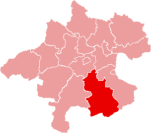
Pas de plus haute résolution disponible.
Karte_Aut_Ooe_KI.png (300 × 265 pixels, taille du fichier : 4 kio, type MIME : image/png)
Description
| Description | Location of Bezirk Kirchdorf an der Krems within the Land of Upper Austria |
| Date | |
| Source | de:Bild:Karte Aut Ooe KI.png |
| Auteur | de:Benutzer:Plp |
| Autorisation (Réutilisation de ce fichier) | GFDL-author (licence from German Wikipedia) |
| Autres versions | de:Bild:Karte Aut Ooe KI.png |
Conditions d’utilisation
 | Vous avez la permission de copier, distribuer et modifier ce document selon les termes de la GNU Free Documentation License version 1.2 ou toute version ultérieure publiée par la Free Software Foundation, sans sections inaltérables, sans texte de première page de couverture et sans texte de dernière page de couverture. Un exemplaire de la licence est inclus dans la section intitulée GNU Free Documentation License. |
| Ce fichier est disponible selon les termes de la licence Creative Commons Attribution – Partage dans les Mêmes Conditions 3.0 Non Transposé. | ||
| ||
| Ce bandeau de licence a été ajouté à ce fichier dans le cadre de la procédure de mise à jour des licences des images sous GFDL. |
Historique du fichier
Cliquer sur une date et heure pour voir le fichier tel qu'il était à ce moment-là.
| Date et heure | Vignette | Dimensions | Utilisateur | Commentaire | |
|---|---|---|---|---|---|
| actuel | 23 juin 2006 à 15:09 | | 300 × 265 (4 kio) | Physchim62 | {{Information |Description=Location of Bezirk Kirchdorf an der Krems within the Land of Upper Austria |Source=de:Bild:Karte Aut Ooe KI.png |Date=2004 |Author=[[:de:Be |
Utilisation du fichier
Aucune page n’utilise ce fichier.
Usage global du fichier
Les autres wikis suivants utilisent ce fichier :
- Utilisation sur bs.wikipedia.org
- Utilisation sur ce.wikipedia.org
- Вартберг-ан-дер-Кремс
- Виндишгарстен
- Груьнбург
- Инцерсдорф-им-Кремсталь
- Кирхдорф-ан-дер-Кремс
- Клаус-ан-дер-Пихрнбан
- Кремсмуьнстер
- Михельдорф (Лакха Австри)
- Мольн (Австри)
- Нусбах (Лакха Австри)
- Обершлирбах
- Петтенбах (Лакха Австри)
- Рид-им-Траункрайс
- Розенау-ам-Хенгстпас
- Рослайтен
- Санкт-Панкрац
- Фордерштодер
- Хинтерштодер
- Шлирбах (Лакха Австри)
- Шпиталь-ам-Пирн
- Штайнбах-ам-Циберг
- Штайнбах-ан-дер-Штайр
- Эдльбах
- Кеп:Австри:Кирхдорф гуо:ГӀаланаш
- Utilisation sur cs.wikipedia.org
- Utilisation sur de.wikipedia.org
- Utilisation sur es.wikipedia.org
- Utilisation sur fa.wikipedia.org
- Utilisation sur fr.wikipedia.org
- Hinterstoder
- Kremsmünster
- District de Kirchdorf
- Schlierbach (Haute-Autriche)
- Modèle:Palette District de Kirchdorf
- Edlbach
- Inzersdorf im Kremstal
- Kirchdorf an der Krems
- Klaus an der Pyhrnbahn
- Molln
- Oberschlierbach
- Pettenbach
- Grünburg
- Micheldorf in Oberösterreich
- Nußbach (Autriche)
- Ried im Traunkreis
- Spital am Pyhrn
- St. Pankraz (Haute-Autriche)
- Steinbach an der Steyr
- Vorderstoder
Voir davantage sur l’utilisation globale de ce fichier.
Explore the world

United states
New York

Japan
Tokyo

Singapore
Singapore
