
 Français
 Italiano
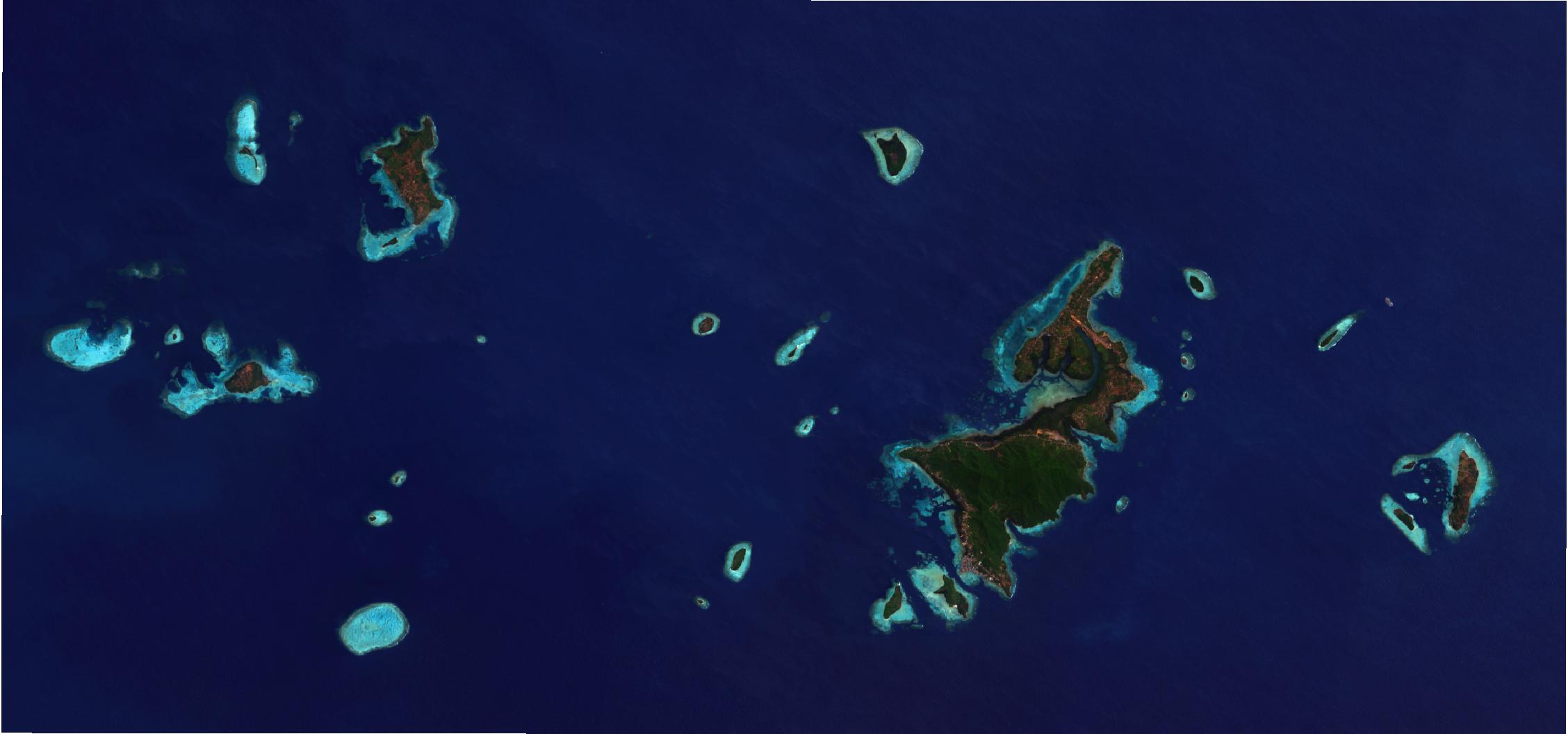
Taille de cet aperçu : 799 × 374 pixels. Autres résolutions : 320 × 150 pixels | 640 × 300 pixels | 1 024 × 479 pixels | 1 280 × 599 pixels | 2 256 × 1 056 pixels.
Fichier d’origine (2 256 × 1 056 pixels, taille du fichier : 107 kio, type MIME : image/jpeg)
Description
| Description | Bahasa Indonesia: Citra top-of-atmosphere Kepulauan Karimunjawa dari satelit Landsat 8 tanggal 2019-09-13. Kecerahan dan saturasi gambar telah diproses menggunakan QGIS. English: Landsat 8 top-of-atmosphere image of Karimunjawa Islands on 2019-09-13. Brightnes and saturation was enhanced using QGIS. | |||||||||
| Date | ||||||||||
| Source | Contains modified data from Landsat 8. | |||||||||
| Créé par | USGS/NASA Landsat Program, RXerself | |||||||||
| Données géotemporelles | ||||||||||
| Rectangle englobant |
| |||||||||
Conditions d’utilisation
Ce fichier est sous la licence Creative Commons Attribution – Partage dans les Mêmes Conditions 4.0 International.
- Vous êtes libre :
- de partager – de copier, distribuer et transmettre cette œuvre
- d’adapter – de modifier cette œuvre
- Sous les conditions suivantes :
- paternité – Vous devez donner les informations appropriées concernant l'auteur, fournir un lien vers la licence et indiquer si des modifications ont été faites. Vous pouvez faire cela par tout moyen raisonnable, mais en aucune façon suggérant que l’auteur vous soutient ou approuve l’utilisation que vous en faites.
- partage à l’identique – Si vous modifiez, transformez ou vous basez sur cet élément, vous devez distribuer votre contribution sous une license identique ou compatible à celle de l’original.
| Annotations | Cette image est annotée : Voir les annotations sur Wikimedia Commons |
Historique du fichier
Cliquer sur une date et heure pour voir le fichier tel qu'il était à ce moment-là.
| Date et heure | Vignette | Dimensions | Utilisateur | Commentaire | |
|---|---|---|---|---|---|
| actuel | 14 octobre 2019 à 19:40 | | 2 256 × 1 056 (107 kio) | RXerself | {{Information |description ={{id|1=Citra top-of-atmosphere Kepulauan Karimunjawa dari satelit Landsat 8 tanggal 2019-09-13. Kecerahan dan saturasi gambar telah diproses menggunakan QGIS.}} {{en|1=Landsat 8 top-of-atmosphere image of Karimunjawa Islands on 2019-09-13. Brightnes and saturation was enhanced using QGIS.}} |date =2019-09-13 |source =Contains modified public domain data from Landsat 8. }} Category:Karimunjawa [[Category:Satellite... |
Utilisation du fichier
La page suivante utilise ce fichier :
Usage global du fichier
Les autres wikis suivants utilisent ce fichier :
- Utilisation sur ar.wikipedia.org
- Utilisation sur ca.wikipedia.org
- Utilisation sur de.wikipedia.org
- Utilisation sur en.wikipedia.org
- Utilisation sur en.wikivoyage.org
- Utilisation sur es.wikipedia.org
- Utilisation sur id.wikipedia.org
- Utilisation sur it.wikivoyage.org
- Utilisation sur www.wikidata.org
Explore the world

United states
New York

Japan
Tokyo

Singapore
Singapore
