
 Français
 Italiano
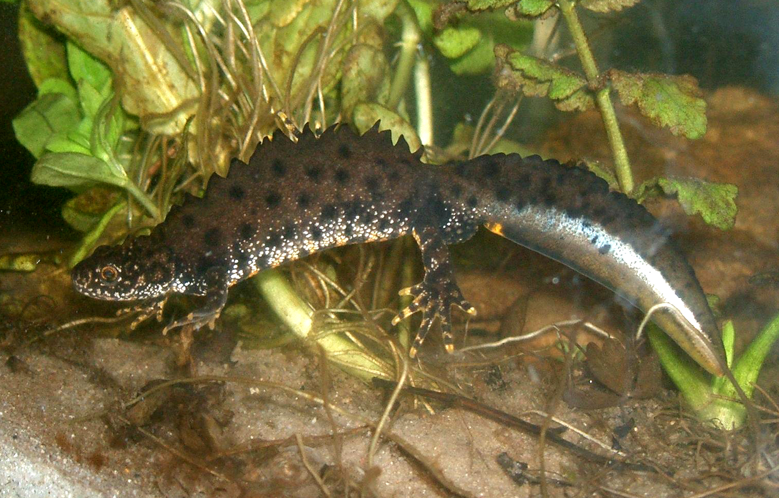
Taille de cet aperçu : 800 × 512 pixels. Autres résolutions : 320 × 205 pixels | 640 × 410 pixels | 1 024 × 655 pixels | 1 517 × 971 pixels.
Fichier d’origine (1 517 × 971 pixels, taille du fichier : 1,15 Mio, type MIME : image/jpeg)
Description
| Description | English: The Crested Newt (Triturus cristatus); male specimen in "mating dress" under water. Deutsch: Der Kammmolch (Triturus cristatus); hier ein Männchen in Wassertracht in einem Aquarium. |
| Date | |
| Source | originally uploaded on de.wikipedia.org (file: [1]). |
| Auteur | Rainer Theuer. |
![[1]](https://de.wikipedia.org/wiki/Bild:Kammolchmaennchen.JPG)
Conditions d’utilisation
| Moi, propriétaire des droits d’auteur sur cette œuvre, la place dans le domaine public. Ceci s'applique dans le monde entier. Dans certains pays, ceci peut ne pas être possible ; dans ce cas : J’accorde à toute personne le droit d’utiliser cette œuvre dans n’importe quel but, sans aucune condition, sauf celles requises par la loi. |
Historique du fichier
Cliquer sur une date et heure pour voir le fichier tel qu'il était à ce moment-là.
| Date et heure | Vignette | Dimensions | Utilisateur | Commentaire | |
|---|---|---|---|---|---|
| actuel | 23 août 2008 à 16:29 | | 1 517 × 971 (1,15 Mio) | Fice | {{Information| |Description='''''English''''': The '''Crested Newt''' (''Triturus cristatus''); male specimen in "mating dress" under water. '''''Deutsch''''': Der '''Kammmolch''' (''Triturus cristatus''); hier ein Männ |
Utilisation du fichier
Aucune page n’utilise ce fichier.
Usage global du fichier
Les autres wikis suivants utilisent ce fichier :
- Utilisation sur an.wikipedia.org
- Utilisation sur arz.wikipedia.org
- Utilisation sur az.wikipedia.org
- Utilisation sur ba.wikipedia.org
- Utilisation sur be.wikipedia.org
- Utilisation sur bg.wikipedia.org
- Utilisation sur br.wikipedia.org
- Utilisation sur ca.wikipedia.org
- Utilisation sur ceb.wikipedia.org
- Utilisation sur cs.wikipedia.org
- Utilisation sur cy.wikipedia.org
- Utilisation sur de.wikipedia.org
- Bundesautobahn 44
- Nördlicher Kammmolch
- Schwanzlurche
- Nemphe
- Fließwiese Ruhleben
- Untere Argen und Seitentäler
- Rotachtal Bodensee
- Bodenseehinterland zwischen Salem und Markdorf
- Bodensee Hinterland bei Überlingen
- Feuchtgebiete um Bad Schussenried
- Feuchtgebiete um Altshausen
- Wurzacher Ried und Rohrsee
- Riede und Gewässer bei Mengen und Pfullendorf
- Gebiete um das Laucherttal
- Naturschutzgebiet Unteres Morsbachtal mit Hölterfelder Siefen und Fürberger Bachtal
- Neckar und Seitentäler bei Rottenburg
- Umlachtal und Riß südlich Biberach
- Wälder bei Biberach
- Donau zwischen Munderkingen und Ulm und nördliche Iller
- Donau zwischen Munderkingen und Riedlingen
- Donaumoos (FFH-Gebiet)
- Großer Heuberg und Donautal
- Kuppenalb bei Laichingen und Lonetal
- Schönbuch (FFH-Gebiet)
- Argen und Feuchtgebiete bei Neukirch und Langnau
- Albtrauf zwischen Mössingen und Gönningen
- Baar, Eschach und Südostschwarzwald
- Südliche Baaralb
Voir davantage sur l’utilisation globale de ce fichier.
Métadonnées
Explore the world

United states
New York

Japan
Tokyo

Singapore
Singapore
