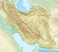
Taille de cet aperçu : 672 × 600 pixels. Autres résolutions : 269 × 240 pixels | 538 × 480 pixels | 861 × 768 pixels | 1 200 × 1 071 pixels.
Fichier d’origine (1 200 × 1 071 pixels, taille du fichier : 941 kio, type MIME : image/jpeg)
Historique du fichier
Cliquer sur une date et heure pour voir le fichier tel qu'il était à ce moment-là.
| Date et heure | Vignette | Dimensions | Utilisateur | Commentaire | |
|---|---|---|---|---|---|
| actuel | 11 juillet 2010 à 20:09 |  | 1 200 × 1 071 (941 kio) | Uwe Dedering | 31. province Alborz |
| 23 avril 2010 à 15:51 |  | 1 200 × 1 071 (941 kio) | Uwe Dedering | {{Information |Description={{en|1=Location map of Iran. Equirectangular projection. Strechted by 118.0%. Geographic limits of the map: * N: 40.0° N * S: 24.5° N * W: 43.5° E * E: 64.0° E Made with Natural Earth. Free vector and raster map data @ |
Utilisation du fichier
Aucune page n’utilise ce fichier.
Usage global du fichier
Les autres wikis suivants utilisent ce fichier :
- Utilisation sur als.wikipedia.org
- Utilisation sur ar.wikipedia.org
- Utilisation sur ary.wikipedia.org
- Utilisation sur ast.wikipedia.org
- Utilisation sur av.wikipedia.org
- Utilisation sur azb.wikipedia.org
- اورمو گؤلو
- تبریز بازاری
- تهران
- سالماس
- گؤی مسجید (تبریز)
- شابلون:Location map Iran
- سهند
- دماوند
- نیشابور
- کاشمر
- سولطانیه
- زابول
- دامغان
- کیرمانشاه زلزلهسی ۱۳۹۶
- شاه عبدالعظیم توربهسی
- بلده (مازندران)
- جیرفت
- دوز گؤلو
- چغازنبیل
- قارا کیلیسا
- جندیشاپور (تاریخی شهر)
- صاحبالامر مسجیدی
- طاقبوستان
- فاطمه معصومه توربهسی
- شوشتر
- Utilisation sur az.wikipedia.org
Voir davantage sur l’utilisation globale de ce fichier.


 Français
 Italiano


