
 Français
 Italiano
Fichier d’origine (Fichier SVG, nominalement de 1 500 × 1 615 pixels, taille : 1,23 Mio)
Description
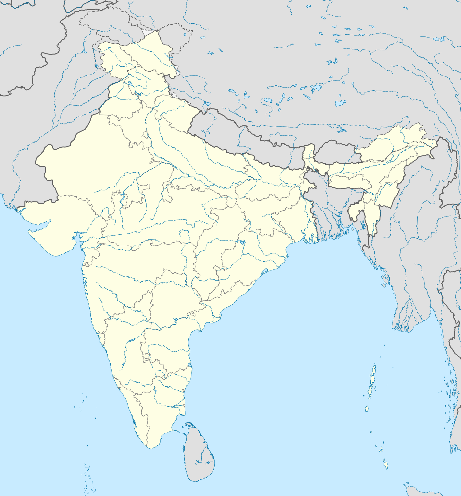
| Description | English: Location map of India. Equirectangular projection. Strechted by 106.0%. Geographic limits of the map:
|
| Date | |
| Source | Travail personnel |
| Auteur | Uwe Dedering sur Wikipédia allemand |
| Autres versions | Œuvres dérivées de ce fichier : []
|


Conditions d’utilisation
 | Vous avez la permission de copier, distribuer et modifier ce document selon les termes de la GNU Free Documentation License version 1.2 ou toute version ultérieure publiée par la Free Software Foundation, sans sections inaltérables, sans texte de première page de couverture et sans texte de dernière page de couverture. Un exemplaire de la licence est inclus dans la section intitulée GNU Free Documentation License. |
- Vous êtes libre :
- de partager – de copier, distribuer et transmettre cette œuvre
- d’adapter – de modifier cette œuvre
- Sous les conditions suivantes :
- paternité – Vous devez donner les informations appropriées concernant l'auteur, fournir un lien vers la licence et indiquer si des modifications ont été faites. Vous pouvez faire cela par tout moyen raisonnable, mais en aucune façon suggérant que l’auteur vous soutient ou approuve l’utilisation que vous en faites.
- partage à l’identique – Si vous modifiez, transformez ou vous basez sur cet élément, vous devez distribuer votre contribution sous une license identique ou compatible à celle de l’original.

Depiction of India's borders
- The territorial boundaries of India are shown as per the actual ground situation in accordance with international practices followed by the United Nations and the National Geographic Society
- This map is meant to be for illustrative purpose only and is not authenticated by official government sources. Please check the list of sources and references used to create the map for a measure of accuracy and verifiability.
- The usage of these maps in India, Pakistan and China are governed by different laws that restrict depictions of boundaries other than what is officially recognized by the state. Please check local laws and modify the map accordingly before use.
Explanation of disputed boundaries


- Boundary of Indian claim : The territory India claims is legally theirs, but the claim is disputed by China and Pakistan.
- Line of Control/Line of Conflict : The de facto administrative boundary recognised by the international community. This UN ceasefire line is considered as a temporary solution to an ongoing conflict since the departure of the British Raj.
Borders of disputed regions
The extent of the former territory of the British Indian Empire, seceeded by Republic of India depicted on this map may not be accepted by most countries as legal due to ongoing border disputes:
- The northern Himalayan region of the disputed territory Indian-administered Kashmir is claimed by India including (Pakistan-administered Kashmir) and the Chinese Occupied territory of (Ladakh plateau). It is currently divided between all three countries since 1972. See also Line of Control and Line of Actual Control.
- Siachen glacier (shown white) is an actively contested region between India and Pakistan. At present the region is in control of India since 1984.
- The northeastern territory of Arunachal Pradesh is almost entirely claimed by China as part of its Tibetan territory.
- Minor areas of eastern Ladakh, Himachal Pradesh and Uttarakhand on the Chinese frontier are claimed by China. These areas are under Indian control.
- A small area of Uttarakhand adjoining the Nepal border along the Sarda river is disputed between the two countries.
For a detailed map of all disputed regions in South Asia, see Image:India disputed areas map.svg
Internal borders
The borders of the state of Meghalaya, Assam and Arunachal Pradesh are shown as interpreted from the North-Eastern Areas (Reorganisation) Act, 1971, but has yet to be verified.
Territorial waters
The limit of the territorial waters of India extends to twelve nautical miles measured from the appropriate baseline. See this copie d'archive sur Wayback Machine for more information.
Journal des téléversements d’origine
Transféré de de.wikipedia à Commons par Uwe Dedering.
- 2010-02-21 16:39 Uwe Dedering 1500×1615× (2412750 bytes) {{Information |Beschreibung = very little borders style changes |Quelle = |Urheber = |Datum = |Genehmigung = |Andere Versionen = |Anmerkungen = }}
- 2010-02-21 14:16 Uwe Dedering 1500×1615× (2411518 bytes) {{Information |Beschreibung = North now 37.5, changed disputed areas |Quelle = |Urheber = |Datum = |Genehmigung = |Andere Versionen = |Anmerkungen = }}
- 2010-02-20 16:44 Uwe Dedering 1500×1540× (2246850 bytes) {{Information |Beschreibung = Location map of India. Equirectangular projection. Strechted by 106.0%. Geographic limits of the map: * N: 36.0° N * S: 5.0° N * W: 67.0° E * E: 99.0° E Made with Natural Earth. Free vector and raster map data @ nat
Historique du fichier
Cliquer sur une date et heure pour voir le fichier tel qu'il était à ce moment-là.
| Date et heure | Vignette | Dimensions | Utilisateur | Commentaire | |
|---|---|---|---|---|---|
| actuel | 4 avril 2021 à 09:24 | | 1 500 × 1 615 (1,23 Mio) | TKsdik8900 | Fulfilling the edit request (File talk:India location map.svg#Upload more compact version of India location map) by C1MM |
| 14 octobre 2020 à 16:50 |  | 1 500 × 1 615 (1,64 Mio) | NordNordWest | correct Telangana/Andhra Pradesh | |
| 3 novembre 2019 à 23:10 |  | 1 500 × 1 615 (1,62 Mio) | RaviC | slight colour change for consistency | |
| 3 novembre 2019 à 23:06 |  | 1 500 × 1 615 (1,62 Mio) | RaviC | == {{int:filedesc}} == {{Information |Description={{en|Location map of India. Equirectangular projection. Strechted by 106.0%. Geographic limits of the map: * N: 37.5° N * S: 5.0° N * W: 67.0° E * E: 99.0° E Made with Natural Earth. Free vector and raster map data @ naturalearthdata.com.}} |Source={{own}} |Date=2010-02-20 |Author={{user at project|Uwe Dedering|wikipedia|de}} |Permission= |other_versions={{DerivativeVersions|India location map2.svg|India location map 3.png}} {{Other versions/I... | |
| 19 août 2014 à 21:42 |  | 1 500 × 1 615 (1,59 Mio) | M0tty | Update by Sémhur : add the state of Telangana | |
| 7 juin 2011 à 11:51 |  | 1 500 × 1 615 (1,49 Mio) | NordNordWest | Nagaland corrected | |
| 18 janvier 2011 à 16:10 |  | 1 500 × 1 615 (2,36 Mio) | Uwe Dedering | Reverted to version as of 15:50, 17 January 2011 and again, layer structure destroyed, and first discuss this! | |
| 17 janvier 2011 à 19:04 |  | 1 500 × 1 615 (1,52 Mio) | AshwiniKalantri | The disputed land of Kashmir are shown in a different shade. | |
| 17 janvier 2011 à 15:50 |  | 1 500 × 1 615 (2,36 Mio) | Uwe Dedering | Reverted to version as of 11:34, 22 September 2010 vandalism | |
| 16 janvier 2011 à 23:30 |  | 1 500 × 1 615 (2,01 Mio) | AshwiniKalantri | {{Information |Description=Location Map of India |Source= |Date= |Author= |Permission= |other_versions= }} |
Utilisation du fichier
Aucune page n’utilise ce fichier.
Usage global du fichier
Les autres wikis suivants utilisent ce fichier :
- Utilisation sur ace.wikipedia.org
- Utilisation sur af.wikipedia.org
- Leh
- Taj Mahal
- Amritsar
- Sjabloon:Liggingkaart Indië
- Indore
- Thane
- Bhopal
- Visakhapatnam
- Pimpri-Chinchwad
- Vadodara
- Ghaziabad
- Ludhiana
- Nashik
- Faridabad
- Meerut
- Rajkot
- Kalyan-Dombivali
- Vasai-Virar
- Srinagar
- Aurangabad
- Dhanbad
- Navi Mumbai
- Prayagraj
- Ranchi
- Haora
- Coimbatore
- Jabalpur
- Gwalior
- Vijayawada
- Jodhpur
- Madurai
- Raipur
- Kota
- Guwahati
- Chandigarh
- Solapur
- Hubli-Dharwad
- Indiese nasionale krieketspan
- Tiruchirappalli
- Thiruvananthapuram
- Krieketwêreldbeker 1987
- Krieketwêreldbeker 1996
- Krieketwêreldbeker 2011
- Krieketwêreldbeker 2023
- Jaynagar Majilpur
- Wes-Ghats
- Kushok Bakula Rimpochee Lughawe
Voir davantage sur l’utilisation globale de ce fichier.
Métadonnées
Explore the world

United states
New York

Japan
Tokyo

Singapore
Singapore
