
 Français
 Italiano
Taille de cet aperçu PNG pour ce fichier SVG : 722 × 600 pixels. Autres résolutions : 289 × 240 pixels | 578 × 480 pixels | 925 × 768 pixels | 1 233 × 1 024 pixels | 2 465 × 2 048 pixels | 957 × 795 pixels.
Fichier d’origine (Fichier SVG, nominalement de 957 × 795 pixels, taille : 1,59 Mio)
Description
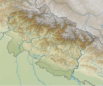
| Description | English: Relief map of Uttarakhand. Elevation data from STRM3. |
| Date | |
| Source | File:India_Uttarakhand_location_map.svg |
| Auteur | Own work based on Milenoscuro |
Conditions d’utilisation
Ce fichier est sous la licence Creative Commons Attribution – Partage dans les Mêmes Conditions 4.0 International.
- Vous êtes libre :
- de partager – de copier, distribuer et transmettre cette œuvre
- d’adapter – de modifier cette œuvre
- Sous les conditions suivantes :
- paternité – Vous devez donner les informations appropriées concernant l'auteur, fournir un lien vers la licence et indiquer si des modifications ont été faites. Vous pouvez faire cela par tout moyen raisonnable, mais en aucune façon suggérant que l’auteur vous soutient ou approuve l’utilisation que vous en faites.
- partage à l’identique – Si vous modifiez, transformez ou vous basez sur cet élément, vous devez distribuer votre contribution sous une license identique ou compatible à celle de l’original.
Historique du fichier
Cliquer sur une date et heure pour voir le fichier tel qu'il était à ce moment-là.
| Date et heure | Vignette | Dimensions | Utilisateur | Commentaire | |
|---|---|---|---|---|---|
| actuel | 23 mai 2021 à 03:03 | | 957 × 795 (1,59 Mio) | C1MM | Corrected districts and river boundaries |
| 27 janvier 2021 à 04:29 |  | 1 245 × 1 122 (1,26 Mio) | C1MM | Fixed inaccurate relief and made districts more visible | |
| 22 avril 2020 à 05:55 |  | 1 245 × 1 122 (2,71 Mio) | C1MM | Uploaded a work by Own work based on Milenoscuro from File:India_Uttarakhand_location_map.svg with UploadWizard |
Utilisation du fichier
Aucune page n’utilise ce fichier.
Usage global du fichier
Les autres wikis suivants utilisent ce fichier :
- Utilisation sur ar.wikipedia.org
- Utilisation sur as.wikipedia.org
- Utilisation sur ban.wikipedia.org
- Utilisation sur bn.wikipedia.org
- Utilisation sur de.wikipedia.org
- Nanda Devi
- Kamet
- Nanaksagar-Talsperre
- Roopkund Lake
- Trishul (Berg)
- Tehri-Talsperre
- Kishau-Talsperre
- Lakhwar-Talsperre
- Changabang
- Shivling
- Thalay Sagar
- Dunagiri
- Mana (Indien)
- Ghori Parbat
- Mukut Parbat
- Hathi Parbat
- Nanda Ghunti
- Ronti
- Nilkantha
- Nilgiri Parbat
- Barmai
- Kedarnath-Tempel
- Vorlage:Positionskarte Indien Uttarakhand
- Nanda Kot
- Chaukhamba
- Meru (Garhwal)
- Kalanka
- Rishi Pahar
- Hardeol
- Kedarnath (Berg)
- Bhagirathi (Berg)
- Nanda Khat
- Panwali Dwar
- Nanda Gond
- Panchchuli
- Satopanth
- Kalanag (Berg)
- Swargarohini
- Bandarpunchgletscher
- Bandarpunch
- Jaundhar-Bamak-Gletscher
- Nanda Pal
- Milamgletscher
- Indradhanush Parbat
Voir davantage sur l’utilisation globale de ce fichier.
Métadonnées
Explore the world

United states
New York

Japan
Tokyo

Singapore
Singapore
