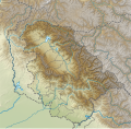
Taille de cet aperçu PNG pour ce fichier SVG : 612 × 599 pixels. Autres résolutions : 245 × 240 pixels | 490 × 480 pixels | 785 × 768 pixels | 1 046 × 1 024 pixels | 2 092 × 2 048 pixels | 757 × 741 pixels.
Fichier d’origine (Fichier SVG, nominalement de 757 × 741 pixels, taille : 1,98 Mio)
Historique du fichier
Cliquer sur une date et heure pour voir le fichier tel qu'il était à ce moment-là.
| Date et heure | Vignette | Dimensions | Utilisateur | Commentaire | |
|---|---|---|---|---|---|
| actuel | 11 juillet 2022 à 15:19 |  | 757 × 741 (1,98 Mio) | C1MM | Uploaded a work by Own work based on user:NordNordWest from Derivative of File:India Jammu and Kashmir UT adm location map.svg with UploadWizard |
Utilisation du fichier
Aucune page n’utilise ce fichier.
Usage global du fichier
Les autres wikis suivants utilisent ce fichier :
- Utilisation sur de.wikipedia.org
- Baglihar-Talsperre
- Dal-See
- Ranjit-Sagar-Talsperre
- Kolahoi
- Kolahoigletscher
- Sickle Moon
- Brammah I
- Brammah II
- Haramukh
- Kishtwar Kailash
- Kishtwar Shivling
- Hagshu
- Cerro Kishtwar
- Gadsar Lake
- Konsarnag
- Krishansar Lake
- Gangbal Lake
- Salal-Talsperre
- Dul-Hasti-Talsperre
- Uri-I-Talsperre
- Uri-II-Talsperre
- Lower-Jhelum-Staustufe
- Vorlage:Positionskarte Indien Jammu und Kashmir
- Jawahar-Tunnel
- Pir Panjal Railway Tunnel
- Dr. Syama Prasad Mookerjee Tunnel
- Banihal Qazigund Road Tunnel
- Utilisation sur en.wikipedia.org
- Udhampur
- Dal Lake
- Amarnath Temple
- Banihal Pass
- Wular Lake
- Dachigam National Park
- Hazratbal Shrine
- Jamia Masjid, Srinagar
- Bijbehara
- Baglihar Dam
- Tral
- Salal Dam
- Poonch (town)
- Brammah
- Hari Parbat
- Harmukh
- Manasbal Lake
- Mansar Lake
- Zoji La
- Gangabal Lake
- Gadsar Lake
- Kishanganga Hydroelectric Project
- Vishansar Lake
Voir davantage sur l’utilisation globale de ce fichier.


 Français
 Italiano


