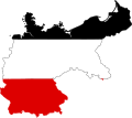
Taille de cet aperçu PNG pour ce fichier SVG : 443 × 600 pixels. Autres résolutions : 177 × 240 pixels | 354 × 480 pixels | 567 × 768 pixels | 756 × 1 024 pixels | 1 513 × 2 048 pixels | 591 × 800 pixels.
Fichier d’origine (Fichier SVG, nominalement de 591 × 800 pixels, taille : 51 kio)
Historique du fichier
Cliquer sur une date et heure pour voir le fichier tel qu'il était à ce moment-là.
| Date et heure | Vignette | Dimensions | Utilisateur | Commentaire | |
|---|---|---|---|---|---|
| actuel | 11 septembre 2012 à 14:57 |  | 591 × 800 (51 kio) | Palosirkka | Scrubbed with http://codedread.com/scour/ |
| 25 janvier 2011 à 23:14 |  | 591 × 800 (56 kio) | Fry1989 | {{Information |Description=Flag map of Germany |Source=*File:Germany_EU.svg *File:Flag_of_Germany.svg |Date=2011-01-25 23:11 (UTC) |Author=*File:Germany_EU.svg: *[[:File:ESC_2011_Potential_host_cities.svg|ESC_2011_Potential_host_cities.s |
Utilisation du fichier
Aucune page n’utilise ce fichier.
Usage global du fichier
Les autres wikis suivants utilisent ce fichier :
- Utilisation sur ar.wikipedia.org
- براندنبورغ
- راينلند بالاتينات
- مكلنبورغ فوربومرن
- هسن
- فايمار
- دارمشتات
- غلزنكيرشن
- مونشنغلادباخ
- تسيله (قضاء)
- أويلتسن
- شتاده
- لونبورغ
- حوض الرور
- الطواويس (جزيرة)
- قناة كيل
- فيتنبرغ
- نيشتيتال
- فولدا (نهر)
- بادن بادن
- فرانكونيا السفلى
- فيتن
- شفابن (منطقة إدارية)
- دوسلدورف (منطقة)
- بالاتينات العليا
- هاغن
- فورسلن
- أودر
- بريجش
- بريج
- زولت (جزيرة)
- رون (سلسلة جبال)
- رور (نهر)
- آرنسبيرغ (منطقة)
- قالب:بذرة جغرافيا ألمانيا
- مونستر (منطقة إدارية)
- هوبستن
- ماسن
- بلاد مونستر
- شاله
- إمس
- ليبه (نهر)
- خليج وستفالي
- غلوكسبورغ
- أنغلن
- فلنسبورغ
- مندن
- بادربورن
- مولهاوزن (تورينغيا)
- زولينغن
- ساربروكن
Voir davantage sur l’utilisation globale de ce fichier.


 Français
 Italiano


