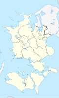
Taille de cet aperçu PNG pour ce fichier SVG : 361 × 600 pixels. Autres résolutions : 144 × 240 pixels | 289 × 480 pixels | 462 × 768 pixels | 616 × 1 024 pixels | 1 233 × 2 048 pixels | 602 × 1 000 pixels.
Fichier d’origine (Fichier SVG, nominalement de 602 × 1 000 pixels, taille : 249 kio)
Historique du fichier
Cliquer sur une date et heure pour voir le fichier tel qu'il était à ce moment-là.
| Date et heure | Vignette | Dimensions | Utilisateur | Commentaire | |
|---|---|---|---|---|---|
| actuel | 13 janvier 2010 à 13:22 |  | 602 × 1 000 (249 kio) | Erik Frohne | Reverted to version as of 16:15, 14 March 2009:Colors as agreed upon by german and french map makers. Use file Denmark Zealand location map (ca).svg instead if you need other colors |
| 29 décembre 2009 à 01:37 |  | 361 × 600 (635 kio) | Hubertus45 | Changing colour after consensus with other users. | |
| 14 décembre 2009 à 23:42 |  | 361 × 600 (635 kio) | Hubertus45 | Making the region more visible to the neighbour areas. | |
| 14 décembre 2009 à 23:35 |  | 361 × 600 (635 kio) | Hubertus45 | Making the region more visible to the neighbour areas. | |
| 14 mars 2009 à 16:15 |  | 602 × 1 000 (249 kio) | Erik Frohne | {{Information |Description={{en|1=Location map of Region Zealand in Denmark Equirectangular projection, N/S stretching 176 %. Geographic limits of the map: * N: 56.20° N * S: 54.50° N * W: 10.80° E * E: 12.60° E}} {{de|1=Positionskarte von der Regio |
Utilisation du fichier
Aucune page n’utilise ce fichier.
Usage global du fichier
Les autres wikis suivants utilisent ce fichier :
- Utilisation sur de.wikipedia.org
- Storstrømsbroen
- Farøbroerne
- Flughafen Kopenhagen-Roskilde
- Wikipedia:Kartenwerkstatt/Positionskarten/Europa
- Vorlage:Positionskarte Dänemark Sjælland
- Gedser Fyr
- Stevns Klint
- Herfølge Stadion
- Odden Færgehavn
- Guldborgsundbroen
- Kong Frederik d. IX’s Bro
- Dronning Alexandrines Bro
- Munkholmbroen
- Masnedsundbroen
- Harboe Arena Slagelse
- Fuglsang Kunstmuseum
- Wikipedia:Fragen zur Wikipedia/Archiv/2014/Woche 19
- Næstved Stadion
- Ganggrab im Lars Jensens Skov
- Trophy European Pentathlon 1989
- Halsskovbroen
- Møn Fyr
- Stevns Fyr
- Arena Næstved
- Bogø fyr
- Utilisation sur eo.wikipedia.org
- Utilisation sur es.wikipedia.org
- Utilisation sur frr.wikipedia.org
- Utilisation sur fr.wikipedia.org
Voir davantage sur l’utilisation globale de ce fichier.


 Français
 Italiano


