
 Français
 Italiano
Fichier d’origine (Fichier SVG, nominalement de 1 093 × 1 121 pixels, taille : 405 kio)
Description
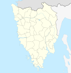
| Description | Deutsch: Positionskarte der Gespanschaft Istrien, Kroatien English: Location map of Istria County, Croatia
| ||||||||||||
| Date | |||||||||||||
| Source | Travail personnel avec: | ||||||||||||
| Auteur | NordNordWest and OpenStreetMap contributors | ||||||||||||
 | Cette carte a été créée ou améliorée dans le Kartenwerkstatt (Atelier cartographique allemand). Vous pouvez également y proposer des cartes à améliorer. |
Conditions d’utilisation
Usage de cette carte :

Pour un usage gratuit, je recommande de respecter les conditions suivantes de la licence :
1. Inclure mon nom comme indiqué ci-dessus : NordNordWest,
2. une copie ou l'adresse Internet (Identifiant Uniforme de Ressource) du contrat : https://creativecommons.org/licenses/by-sa/3.0/de/legalcode,
3. le titre de l’œuvre originale,
4. dans le cas d'une œuvre dérivée, indiquer les éléments identifiant l'utilisation de l’œuvre dite dérivée.
En cas de manquement aux conditions de la licence, les droits d'utilisation expirent automatiquement. Si vous avez des questions ou désirez des conditions différentes, merci de me contacter par courriel à l'adresse nnwest, ou sur ma page de discussion. ![]() t-online.de
t-online.de
- Vous êtes libre :
- de partager – de copier, distribuer et transmettre cette œuvre
- d’adapter – de modifier cette œuvre
- Sous les conditions suivantes :
- paternité – Vous devez donner les informations appropriées concernant l'auteur, fournir un lien vers la licence et indiquer si des modifications ont été faites. Vous pouvez faire cela par tout moyen raisonnable, mais en aucune façon suggérant que l’auteur vous soutient ou approuve l’utilisation que vous en faites.
- partage à l’identique – Si vous modifiez, transformez ou vous basez sur cet élément, vous devez distribuer votre contribution sous une license identique ou compatible à celle de l’original.

Historique du fichier
Cliquer sur une date et heure pour voir le fichier tel qu'il était à ce moment-là.
| Date et heure | Vignette | Dimensions | Utilisateur | Commentaire | |
|---|---|---|---|---|---|
| actuel | 20 décembre 2022 à 19:00 | | 1 093 × 1 121 (405 kio) | NordNordWest | == {{int:filedesc}} == {{Information |description= {{de|1=Positionskarte der Gespanschaft Istrien, Kroatien}} {{en|1=Location map of Istria County, Croatia}} {{Location map series N |stretching=–|top=45.5447|bottom=44.7474222|left=13.318975|right=14.4216249}} |Source={{Own using}} * [http://www.openstreetmap.org OpenStreetMap] |date=2022-12-20 |author={{U|NordNordWest}} and OpenStreetMap contributors |other fields= }} {{Kartenwerkstatt}} == {{int:license-header}} == {{User:NordNordWest/Licen... |
Utilisation du fichier
Aucune page n’utilise ce fichier.
Usage global du fichier
Les autres wikis suivants utilisent ce fichier :
- Utilisation sur de.wikipedia.org
- Utilisation sur fr.wikipedia.org
- Pula
- Rovinj
- Umag
- Labin
- Grožnjan
- Plomin
- Pazin
- Buje
- Buzet (Croatie)
- Poreč
- Novigrad (Istrie)
- Vodnjan
- Žminj
- Vrsar
- Vižinada
- Višnjan
- Tinjan
- Svetvinčenat
- Sveti Petar u Šumi
- Sveti Lovreč
- Sveta Nedelja (Istrie)
- Raša
- Pićan
- Bale (Istrie)
- Barban
- Oprtalj
- Medulin
- Marčana
- Lupoglav
- Ližnjan
- Lanišće (Istrie)
- Kršan
- Kaštelir-Labinci
- Karojba
- Kanfanar
- Gračišće
- Fažana
- Cerovlje
- Brtonigla
- Brest (Lanišće)
- Brgudac
- Trstenik (Lanišće)
Voir davantage sur l’utilisation globale de ce fichier.
Métadonnées
Explore the world

United states
New York

Japan
Tokyo

Singapore
Singapore
