
 Français
 Italiano
Taille de cet aperçu PNG pour ce fichier SVG : 486 × 599 pixels. Autres résolutions : 195 × 240 pixels | 389 × 480 pixels | 623 × 768 pixels | 831 × 1 024 pixels | 1 662 × 2 048 pixels | 1 512 × 1 863 pixels.
Fichier d’origine (Fichier SVG, nominalement de 1 512 × 1 863 pixels, taille : 645 kio)
Description
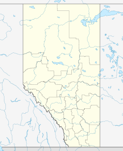
| Description | Quadratische Plattkarte, N-S-Streckung 170 %. Geographische Begrenzung der Karte:
Equirectangular projection, N/S stretching 170 %. Geographic limits of the map:
|
| Date | |
| Source | Travail personnel, using
|
| Auteur | NordNordWest |
| Autorisation (Réutilisation de ce fichier) | Moi, en tant que détenteur des droits d’auteur sur cette œuvre, je la publie sous la licence suivante : Ce fichier est disponible selon les termes de la licence Creative Commons Attribution – Partage dans les Mêmes Conditions 3.0 Non Transposé.
|
| Autres versions | Œuvres dérivées de ce fichier :
|

 | Cette carte a été créée ou améliorée dans le Kartenwerkstatt (Atelier cartographique allemand). Vous pouvez également y proposer des cartes à améliorer. |
Historique du fichier
Cliquer sur une date et heure pour voir le fichier tel qu'il était à ce moment-là.
| Date et heure | Vignette | Dimensions | Utilisateur | Commentaire | |
|---|---|---|---|---|---|
| actuel | 27 août 2009 à 19:35 | | 1 512 × 1 863 (645 kio) | NordNordWest | {{int:filedesc}} {{Information |Description= {{de|Positionskarte von Alberta, Kanada}} Quadratische Plattkarte, N-S-Streckung 170 %. Geographische Begrenzung der Karte: * N: 60.3° N * S: 48.7° N * W: 123.0° W * O: 107.0° |
Utilisation du fichier
Aucune page n’utilise ce fichier.
Usage global du fichier
Les autres wikis suivants utilisent ce fichier :
- Utilisation sur af.wikipedia.org
- Utilisation sur ba.wikipedia.org
- Utilisation sur ch.wikipedia.org
- Utilisation sur cs.wikipedia.org
- Utilisation sur da.wikipedia.org
- Utilisation sur de.wikipedia.org
- Calgary
- Edmonton
- West Edmonton Mall
- Red Deer
- Fort Chipewyan
- Fort McMurray
- Jasper (Alberta)
- Banff (Alberta)
- Lethbridge
- Drumheller
- Camrose
- Wetaskiwin
- Acme (Alberta)
- Calgary International Airport
- Redcliff (Alberta)
- Olds (Alberta)
- Scotiabank Saddledome
- Hinton (Alberta)
- Edson (Alberta)
- Athabasca (Alberta)
- Medicine Hat
- Peace River (Alberta)
- Grande Prairie
- Airdrie (Alberta)
- Vegreville
- Coalhurst
- Spruce Grove
- Vulcan (Alberta)
- Northlands Coliseum
- Okotoks
- St. Albert (Alberta)
- Fort Saskatchewan
- Donalda (Alberta)
- Commonwealth Stadium
- Hanna (Alberta)
- Barnwell (Alberta)
- Barrhead (Alberta)
Voir davantage sur l’utilisation globale de ce fichier.
Explore the world

United states
New York

Japan
Tokyo

Singapore
Singapore
