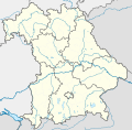
Taille de cet aperçu PNG pour ce fichier SVG : 608 × 600 pixels. Autres résolutions : 243 × 240 pixels | 487 × 480 pixels | 779 × 768 pixels | 1 038 × 1 024 pixels | 2 077 × 2 048 pixels | 867 × 855 pixels.
Fichier d’origine (Fichier SVG, nominalement de 867 × 855 pixels, taille : 738 kio)
Historique du fichier
Cliquer sur une date et heure pour voir le fichier tel qu'il était à ce moment-là.
| Date et heure | Vignette | Dimensions | Utilisateur | Commentaire | |
|---|---|---|---|---|---|
| actuel | 19 novembre 2009 à 17:22 |  | 867 × 855 (738 kio) | Alexrk2 | fixed boundaries, rivers; adjusted map projection; colors for internal divisions |
| 28 mars 2009 à 20:01 |  | 867 × 855 (1,05 Mio) | TUBS | #corrected 4 mistakes (lake margins (pasted to foreground), RegBez and counties around TIR (splited area in two counties and corrected RegBez border), County of Munich (merged), Merged an (to me right know unknown) county north of Nuremberg. #moved all gr | |
| 28 janvier 2009 à 09:32 |  | 867 × 855 (1,45 Mio) | TUBS | {{Information |Description= |Source= |Date= |Author= |Permission= |other_versions= }} | |
| 28 janvier 2009 à 00:20 |  | 867 × 855 (1,45 Mio) | TUBS | {{Information |Description= |Source= |Date= |Author= |Permission= |other_versions= }} | |
| 27 janvier 2009 à 00:11 |  | 867 × 855 (1,46 Mio) | TUBS | {{Information |Description= |Source= |Date= |Author= |Permission= |other_versions= }} | |
| 26 janvier 2009 à 23:20 |  | 867 × 855 (1,5 Mio) | TUBS | {{Information |Description= |Source= |Date= |Author= |Permission= |other_versions= }} | |
| 26 janvier 2009 à 11:38 |  | 867 × 855 (1,51 Mio) | TUBS | == Summary == {{Information |Description= {{de|Positionskarte Hessen, Deutschland. Geographische Begrenzung der Karte:}} {{en|Location map Bavaria, Germany. Geographic limits of the map:}} * N: 50.6303000° N * S: 47.26618 | |
| 26 janvier 2009 à 11:24 |  | 867 × 855 (1,52 Mio) | TUBS | == Summary == {{Information |Description= {{de|Positionskarte Hessen, Deutschland. Geographische Begrenzung der Karte:}} {{en|Location map Bavaria, Germany. Geographic limits of the map:}} * N: 50.6303000° N * S: 47.26618 |
Utilisation du fichier
Aucune page n’utilise ce fichier.
Usage global du fichier
Les autres wikis suivants utilisent ce fichier :
- Utilisation sur af.wikipedia.org
- Utilisation sur als.wikipedia.org
- Utilisation sur ar.wikipedia.org
- Utilisation sur ast.wikipedia.org
- Utilisation sur azb.wikipedia.org
Voir davantage sur l’utilisation globale de ce fichier.


 Français
 Italiano


