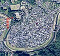
Taille de cet aperçu : 648 × 600 pixels. Autres résolutions : 259 × 240 pixels | 519 × 480 pixels | 830 × 768 pixels | 1 106 × 1 024 pixels | 2 017 × 1 867 pixels.
Fichier d’origine (2 017 × 1 867 pixels, taille du fichier : 1,33 Mio, type MIME : image/jpeg)
Historique du fichier
Cliquer sur une date et heure pour voir le fichier tel qu'il était à ce moment-là.
| Date et heure | Vignette | Dimensions | Utilisateur | Commentaire | |
|---|---|---|---|---|---|
| actuel | 22 juillet 2023 à 15:15 |  | 2 017 × 1 867 (1,33 Mio) | Naokijp | Uploaded a work by {{en|1=Geospatial Information Authority of Japan}} {{ja|1=国土地理院}} from {{en|1=Ministry of Land, Infrastructure, Transport and Tourism Geospatial Information Authority of Japan Map/aerial photo browsing service}} {{ja|1=国土交通省 国土地理院 地図・空中写真閲覧サービス}}(https://mapps.gsi.go.jp/maplibSearch.do#1) with UploadWizard |
Utilisation du fichier
Aucune page n’utilise ce fichier.
Usage global du fichier
Les autres wikis suivants utilisent ce fichier :
- Utilisation sur en.wikipedia.org
- Utilisation sur fr.wikipedia.org
- Utilisation sur ja.wikipedia.org
- Utilisation sur ko.wikipedia.org
- Utilisation sur www.wikidata.org


 Français
 Italiano


