
 Français
 Italiano
Tamaño de esta previsualización PNG del archivo SVG: 322 × 598 píxeles. Otras resoluciones: 129 × 240 píxeles | 258 × 480 píxeles | 413 × 768 píxeles | 551 × 1024 píxeles | 1102 × 2048 píxeles | 614 × 1141 píxeles.
Archivo original (archivo SVG, nominalmente 614 × 1141 píxeles, tamaño de archivo: 176 kB)
Éste es un archivo de Wikimedia Commons, un depósito de contenido libre hospedado por la Fundación Wikimedia
Más abajo se reproduce su página de descripción con la información sobre su origen y licencia.
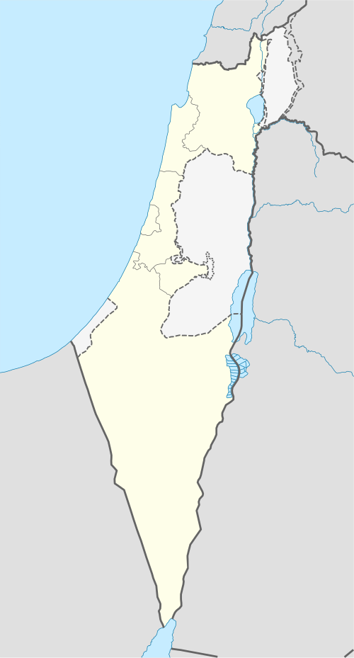
 | Las fronteras en este mapa muestran la situación de facto. Este es solo uno de los diferentes puntos de vista sobre el tema (véase COM:NPOV). |
Resumen
| Descripción | Deutsch: Positionskarte von Israel. De-facto-Situation. Quadratische Plattkarte, N-S-Streckung 115 %. Geographische Begrenzung der Karte:
English: Location map of Israel. De facto situation. Equirectangular projection, N/S stretching 115%. Geographic limits of the map:
|
| Fecha | |
| Fuente | own work, using
|
| Autor | NordNordWest |
| Otras versiones | Obras derivadas de ésta:
|


 | Este mapa se ha hecho o mejorado en el Kartenwerkstatt (taller cartográfico) alemán. También puede proponer mapas para mejorar. |
Licencia
Yo, titular de los derechos de autor de esta obra, la publico en los términos de las siguientes licencias:
 | Se autoriza la copia, distribución y modificación de este documento bajo los términos de la licencia de documentación libre GNU, versión 1.2 o cualquier otra que posteriormente publique la Fundación para el Software Libre; sin secciones invariables, textos de portada, ni textos de contraportada. Se incluye una copia de la dicha licencia en la sección titulada Licencia de Documentación Libre GNU. |
Este archivo se encuentra bajo la licencia Creative Commons Genérica de Atribución/Compartir-Igual 3.0.
- Eres libre:
- de compartir – de copiar, distribuir y transmitir el trabajo
- de remezclar – de adaptar el trabajo
- Bajo las siguientes condiciones:
- atribución – Debes otorgar el crédito correspondiente, proporcionar un enlace a la licencia e indicar si realizaste algún cambio. Puedes hacerlo de cualquier manera razonable pero no de manera que sugiera que el licenciante te respalda a ti o al uso que hagas del trabajo.
- compartir igual – En caso de mezclar, transformar o modificar este trabajo, deberás distribuir el trabajo resultante bajo la misma licencia o una compatible como el original.
Puedes usar la licencia que prefieras.
Historial del archivo
Haz clic sobre una fecha y hora para ver el archivo tal como apareció en ese momento.
| Fecha y hora | Miniatura | Dimensiones | Usuario | Comentario | |
|---|---|---|---|---|---|
| actual | 14:41 16 jun 2018 | | 614 × 1141 (176 kB) | Jdx | Reverted to version as of 09:34, 16 June 2018 (UTC) |
| 14:05 16 jun 2018 |  | 614 × 1141 (118 kB) | Beebbeebe | Reverted to version as of 00:41, 16 June 2018 (UTC) don't revert without motivating why your version is better | |
| 09:34 16 jun 2018 |  | 614 × 1141 (176 kB) | NordNordWest | Reverted to version as of 20:16, 14 May 2018 (UTC); please write your hundred articles and respect Commons:Overwriting existing files | |
| 00:41 16 jun 2018 |  | 614 × 1141 (118 kB) | Beebbeebe | Reverted to version as of 19:25, 14 May 2018 (UTC) The current map is simply incorrect. And I don't want to upload a new one, I'll have to edit more than a hundred wiki-articles. | |
| 20:16 14 may 2018 |  | 614 × 1141 (176 kB) | NordNordWest | Commons:Overwriting existing files#Controversial or contested changes even has to be respected by User:Eric's son | |
| 19:25 14 may 2018 |  | 614 × 1141 (118 kB) | Eric's son | Reverted to version as of 18:50, 10 March 2018 (UTC) | |
| 03:54 14 may 2018 |  | 614 × 1141 (176 kB) | Nableezy | Reverted to version as of 23:24, 5 March 2018 (UTC) yes you can, this map shows the occupied territories as separate make another if you want | |
| 18:50 10 mar 2018 |  | 614 × 1141 (118 kB) | Eric's son | Again, you cant compare gaza to golan. Reverted to version as of 00:44, 20 January 2018 (UTC) | |
| 23:24 5 mar 2018 |  | 614 × 1141 (176 kB) | Nableezy | Reverted to version as of 21:07, 14 April 2014 (UTC) restore convention of black lines for international borders and dashed lines for disputed boundaries | |
| 00:44 20 ene 2018 |  | 614 × 1141 (118 kB) | Eric's son | Fixing small details in the green line |
Usos del archivo
No hay páginas que enlacen a este archivo.
Uso global del archivo
Las wikis siguientes utilizan este archivo:
- Uso en af.wikipedia.org
- Uso en als.wikipedia.org
- Uso en am.wikipedia.org
- Uso en ar.wikipedia.org
- قائمة مدن إسرائيل
- بئر السبع
- تل أبيب
- باقة الغربية
- اللد
- إيلات
- كفر قرع
- إجليل
- الجية
- العمارة (بئر السبع)
- إجزم (حيفا)
- مذبحة الدوايمة
- مذبحة بيت دراس
- بيت نبالا
- قالب:خريطة مواقع إسرائيل
- أم الفرج (فلسطين)
- مجزرة عين الزيتون
- خان الدوير
- ماروس
- سعسع (فلسطين)
- الكابري (فلسطين)
- السوافير الشمالية
- السوافير الشرقية
- الحرم (يافا)
- الجماسين الغربي
- الخيرية
- الحديثة (الرملة)
- حقل سارة وميرا
- مجزرة سعسع
- الجلمة (طولكرم)
Ver más uso global de este archivo.
Metadatos
Explore the world

United states
New York

Japan
Tokyo

Singapore
Singapore
