Sarh Airport | |||||||||||
|---|---|---|---|---|---|---|---|---|---|---|---|
| Summary | |||||||||||
| Airport type | Public | ||||||||||
| Owner | Government | ||||||||||
| Location | Sarh, Chad | ||||||||||
| Elevation AMSL | 1,198 ft / 365 m | ||||||||||
| Coordinates | 9°08′46″N 18°22′33″E / 9.14611°N 18.37583°E | ||||||||||
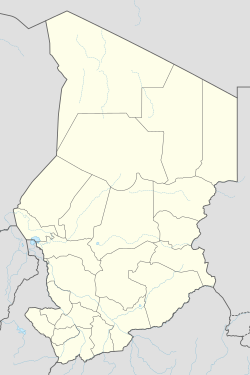
| Map | |||||||||||
 | |||||||||||
| Runways | |||||||||||
| |||||||||||
Sarh Airport (IATA: SRH, ICAO: FTTA) (Arabic: مطار ساره) is an airport serving Sarh, Chad. Originally entitled Fort-Archambault Airport during French colonial rule.[1] Sarh Airport serves the city of Sarh, located in the Moyen-Chari Region of southern Chad. Situated approximately 2 kilometers northwest of the city center, it provides vital air connectivity for the region.
History
[edit]Originally named Fort-Archambault Airport during French colonial rule, the airport's current designation reflects its service to Sarh, a city founded by the French in the early 20th century. Sarh was established as a settlement for returnees from labor camps associated with the construction of the Congo-Ocean Railway
Location and Coordinates
[edit]- City: Sarh
- Region: Moyen-Chari
- Country: Chad
- Coordinates: Latitude 9.14479° N, Longitude 18.37472° E
- Elevation: 1,198 feet (365 meters) above sea level (metar-taf.com, mapcarta.com)
Runway Information
[edit]- Runway Orientation: 04/22
- Length: 1,800 meters (5,906 feet)
- Surface: Laterite/asphalt
- Width: Approximately 40 meters (metar-taf.com, metar-taf.com, acukwik.com)
Operations
[edit]Sarh Airport is open to public use and operates during daylight hours. It is not designated as an international airport, and customs and immigration services are not available on-site. The airport does not offer fueling services. Aircraft operations are subject to prior permission, and a Notice to Airmen (NOTAM) may be required. (acukwik.com)
Airlines and Destinations
[edit]Tchadia Airlines, the national carrier of Chad, operates flights to Sarh Airport. As of 2018, destinations included N'Djamena, Moundou, and Abéché within Chad, as well as international routes to Douala (Cameroon), Bangui (Central African Republic), and Khartoum (Sudan). (en.wikipedia.org)
Nearby Airports
[edit]Other airports in the vicinity of Sarh include:(planemapper.com)
- Kyabé Airport (TD-0008) – approximately 69 km to the northeast
- Koumra Airport (TD-0006) – approximately 84 km to the southwest
- Goundi Airport (TD-0007) – approximately 112 km to the northwest
- Doba Airport – approximately 176 km to the south (metar-taf.com, airportprofile.com)
Additional Information
[edit]- Timezone: Africa/Ndjamena (UTC+1)
- Airport Type: Public
- Airport Code: IATA: SRH, ICAO: FTTA
- Fire Category: Category 4
- Customs: Available; U.S. Customs pre-clearance is not offered (metar-taf.com, airportmap.de, acukwik.com)
References
[edit]- "Sarh (FTTA): AD 2-3-01 Characteristics" (PDF). AIS ASECNA. 30 June 2011. Archived from the original (PDF) on 14 November 2008. Retrieved 30 August 2012.


 Français
 Italiano


