
 Français
 Italiano
Ridge Spring, South Carolina | |
|---|---|
 Downtown Ridge Spring | |
 Location of Ridge Spring, South Carolina | |
| Coordinates: 33°50′45″N 81°39′39″W / 33.84583°N 81.66083°W | |
| Country | United States |
| State | South Carolina |
| County | Saluda |
| Area | |
• Total | 1.85 sq mi (4.79 km2) |
| • Land | 1.82 sq mi (4.72 km2) |
| • Water | 0.03 sq mi (0.07 km2) |
| Elevation | 633 ft (193 m) |
| Population | |
• Total | 579 |
| • Density | 317.78/sq mi (122.72/km2) |
| Time zone | UTC-5 (Eastern (EST)) |
| • Summer (DST) | UTC-4 (EDT) |
| ZIP code | 29129 |
| Area code(s) | 803, 839 |
| FIPS code | 45-60325[3] |
| GNIS feature ID | 1250381[4] |
| Website | www.ridgespringsc.com |
Ridge Spring is a town in Saluda County, South Carolina, United States. The population was 737 at the 2010 census. It is part of the Columbia, SC Metropolitan Statistical Area. The Mayor-Elect is Ms. Qwendolyn Etheredge.
History
[edit]Ridge Hill High School was added to the National Register of Historic Places in 2010.[5]
Geography
[edit]Ridge Spring is located at 33°50′45″N 81°39′39″W / 33.84583°N 81.66083°W (33.845942, -81.660845).[6]
According to the United States Census Bureau, the town has a total area of 1.9 square miles (4.9 km2), of which 1.8 square miles (4.7 km2) are land and 0.04 square miles (0.10 km2) (1.08%) is covered by water.
Demographics
[edit]| Census | Pop. | Note | %± |
|---|---|---|---|
| 1880 | 328 | — | |
| 1890 | 390 | 18.9% | |
| 1900 | 411 | 5.4% | |
| 1910 | 505 | 22.9% | |
| 1920 | 597 | 18.2% | |
| 1930 | 628 | 5.2% | |
| 1940 | 661 | 5.3% | |
| 1950 | 598 | −9.5% | |
| 1960 | 649 | 8.5% | |
| 1970 | 644 | −0.8% | |
| 1980 | 969 | 50.5% | |
| 1990 | 861 | −11.1% | |
| 2000 | 823 | −4.4% | |
| 2010 | 737 | −10.4% | |
| 2020 | 579 | −21.4% | |
| U.S. Decennial Census[7][2] | |||
2020 census
[edit]| Race / Ethnicity (NH = Non-Hispanic) | Pop 2000[8] | Pop 2010[9] | Pop 2020[10] | % 2000 | % 2010 | % 2020 |
|---|---|---|---|---|---|---|
| White alone (NH) | 279 | 260 | 224 | 33.90% | 35.28% | 38.69% |
| Black or African American alone (NH) | 511 | 435 | 317 | 62.09% | 59.02% | 54.75% |
| Native American or Alaska Native alone (NH) | 1 | 2 | 0 | 0.12% | 0.27% | 0.00% |
| Asian alone (NH) | 0 | 1 | 0 | 0.00% | 0.14% | 0.00% |
| Native Hawaiian or Pacific Islander alone (NH) | 0 | 1 | 0 | 0.00% | 0.14% | 0.00% |
| Other race alone (NH) | 0 | 0 | 0 | 0.00% | 0.00% | 0.00% |
| Mixed race or Multiracial (NH) | 11 | 16 | 13 | 1.34% | 2.17% | 2.25% |
| Hispanic or Latino (any race) | 21 | 22 | 25 | 2.55% | 2.99% | 4.32% |
| Total | 823 | 737 | 579 | 100.00% | 100.00% | 100.00% |
2000 census
[edit]As of the census[3] of 2000, 823 people, 321 households, and 217 families resided in the town. The population density was 449.3 people per square mile (173.5 people/km2). The 368 housing units averaged 200.9 per square mile (77.6/km2). The racial makeup of the town was 33.90% White, 63.91% Black, 0.12% Native American, 0.61% from other races, and 1.46% from two or more races. Hispanics or Latinos of any race were 2.55% of the population.
Of the 321 households, 26.2% had children under the age of 18 living with them, 40.5% were married couples living together, 22.4% had a female householder with no husband present, and 32.1% were not families. About 28.0% of all households were made up of individuals, and 15.9% had someone living alone who was 65 years of age or older. The average household size was 2.56 and the average family size was 3.18.
In the town, the population was distributed as 24.4% under the age of 18, 9.7% from 18 to 24, 23.5% from 25 to 44, 23.7% from 45 to 64, and 18.7% who were 65 years of age or older. The median age was 40 years. For every 100 females, there were 81.3 males. For every 100 females age 18 and over, there were 80.3 males.
The median income for a household in the town was $25,982, and for a family was $28,984. Males had a median income of $30,476 versus $20,208 for females. The per capita income for the town was $12,083. About 23.4% of families and 26.6% of the population were below the poverty line, including 39.2% of those under age 18 and 16.0% of those age 65 or over.
Education
[edit]It is within the Aiken County Public School District.[11]
Ridge Spring-Monetta Middle-High School, which has a Monetta postal address,[12] and is outside of the city limits in unincorporated Aiken County,[13] is the secondary school of the area.
Areas of the district in Saluda County are zoned to Ridge Spring-Monetta Elementary School and Ridge Spring-Monetta Middle-High School.[14]
Ridge Spring has a public library, a branch of the Saluda County Library.[15]
References
[edit]- ^ "ArcGIS REST Services Directory". United States Census Bureau. Retrieved October 15, 2022.
- ^ a b "Census Population API". United States Census Bureau. Retrieved October 15, 2022.
- ^ a b "U.S. Census website". United States Census Bureau. Retrieved January 31, 2008.
- ^ "US Board on Geographic Names". United States Geological Survey. October 25, 2007. Retrieved January 31, 2008.
- ^ "National Register Information System". National Register of Historic Places. National Park Service. July 9, 2010.
- ^ "US Gazetteer files: 2010, 2000, and 1990". United States Census Bureau. February 12, 2011. Retrieved April 23, 2011.
- ^ "Census of Population and Housing". Census.gov. Retrieved June 4, 2015.
- ^ "P004: Hispanic or Latino, and Not Hispanic or Latino by Race – 2000: DEC Summary File 1 – Ridge Spring town, South Carolina". United States Census Bureau.
- ^ "P2: Hispanic or Latino, and Not Hispanic or Latino by Race – 2010: DEC Redistricting Data (PL 94-171) – Ridge Spring town, South Carolina". United States Census Bureau.
- ^ "P2: Hispanic or Latino, and Not Hispanic or Latino by Race – 2020: DEC Redistricting Data (PL 94-171) – Ridge Spring town, South Carolina". United States Census Bureau.
- ^ "2020 CENSUS - SCHOOL DISTRICT REFERENCE MAP: Saluda County, SC" (PDF). U.S. Census Bureau. Retrieved October 25, 2024. - Text list
- ^ "Home". Ridge Spring-Monetta Middle-High School. Retrieved October 25, 2024.
1071 Trojan Road Monetta, SC 29105
- ^ "General Highway System Aiken County South Carolina" (PDF). South Carolina Department of Transportation. July 2023. Retrieved October 25, 2024.
Ridge Spring-Monetta MS & HS
- ^ "2019 - 20 Attendance Areas Maps". Aiken County Public School District. Retrieved October 25, 2024. - maps for ES, MS, and HS. Note the colored area off the map is Saluda County, while the area outlined in black is Aiken County.
- ^ "Locations & Hours". Greenville County Library System. Retrieved June 13, 2019.
External links
[edit]Municipalities and communities of Saluda County, South Carolina, United States | ||
|---|---|---|
| Towns | 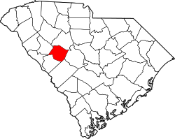 | |
| Unincorporated communities | ||
| Ghost towns | ||
| Footnotes | ‡This populated place also has portions in an adjacent county or counties | |
| International | |
|---|---|
| National | |
Explore the world

United states
New York

Japan
Tokyo

Singapore
Singapore
